Elevate Your Listings with Drone Photography Real Estate: The Ultimate Guide for NYC Agents
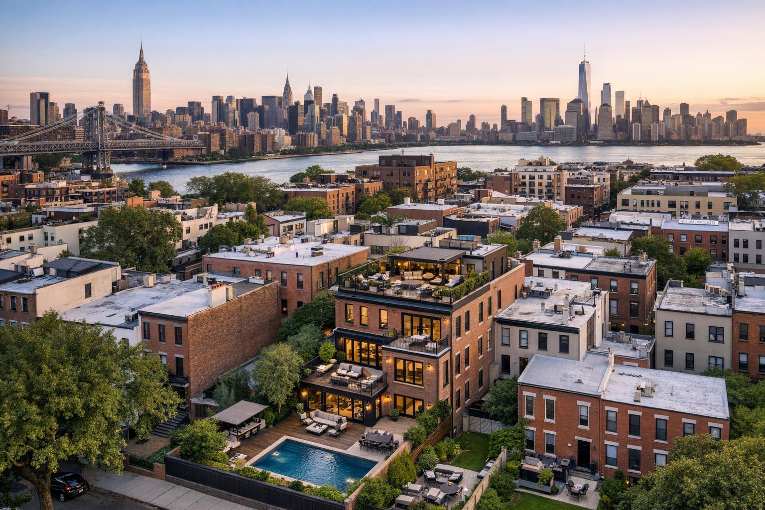
Drone photography captures a corner apartment building with a rooftop garden, providing a detailed view of the surrounding streets and parked cars.
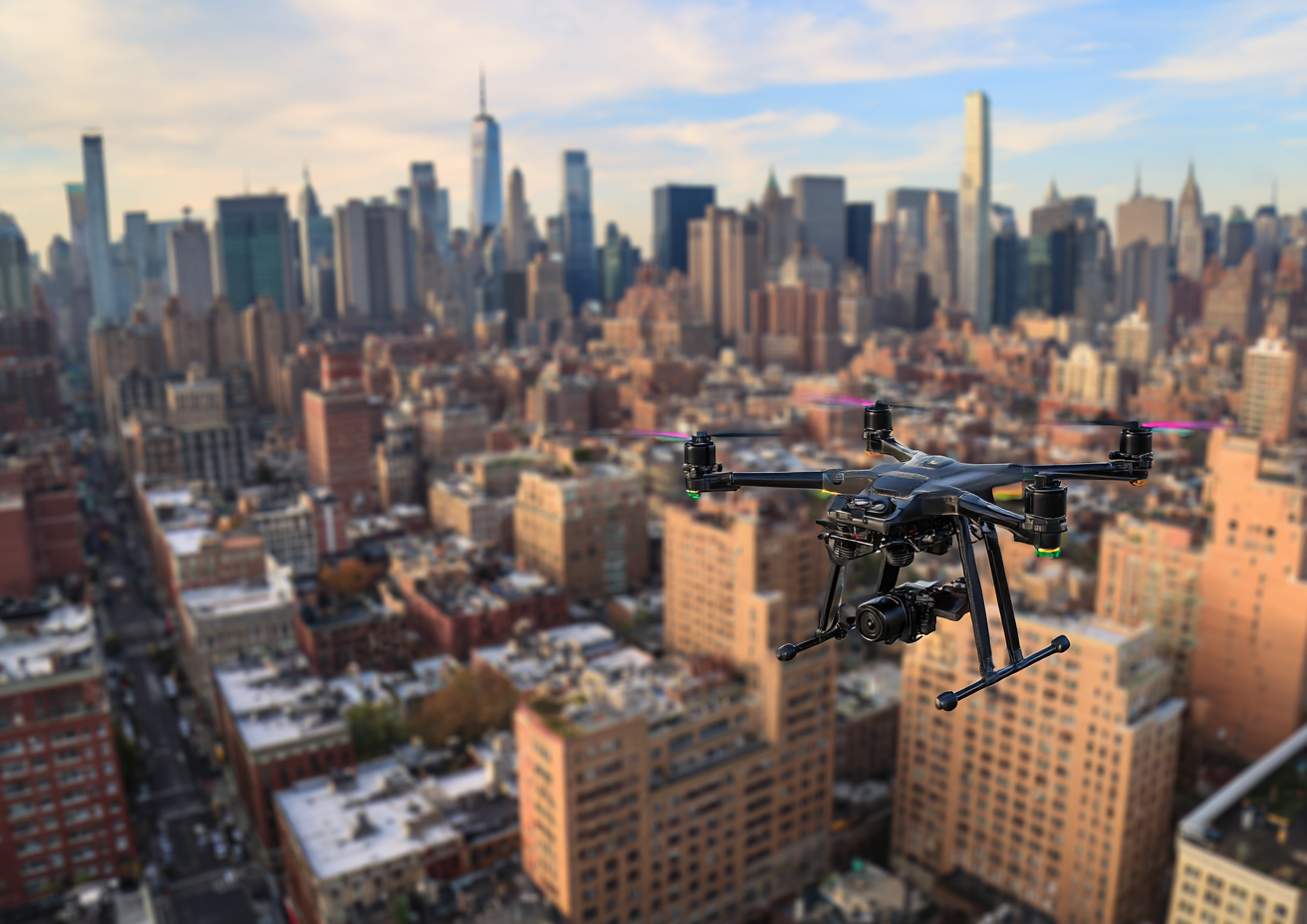
Drone Photography Real Estate: Elevate Your NYC Listings with RealtaSnap
Getting noticed in real estate photography in NYC takes more than a crisp living room shot. Drone photography real estate is the secret sauce savvy agents use to make their listings shine from above—and finally snag that all-important buyer’s attention. In this post, you’ll discover exactly how aerial real estate photography solves stubborn marketing challenges, why visuals matter for every property type, and how RealtaSnap’s drone services deliver game-changing results—fast.
The Challenge: Capturing Exteriors, Scale, and Location Isn’t Easy
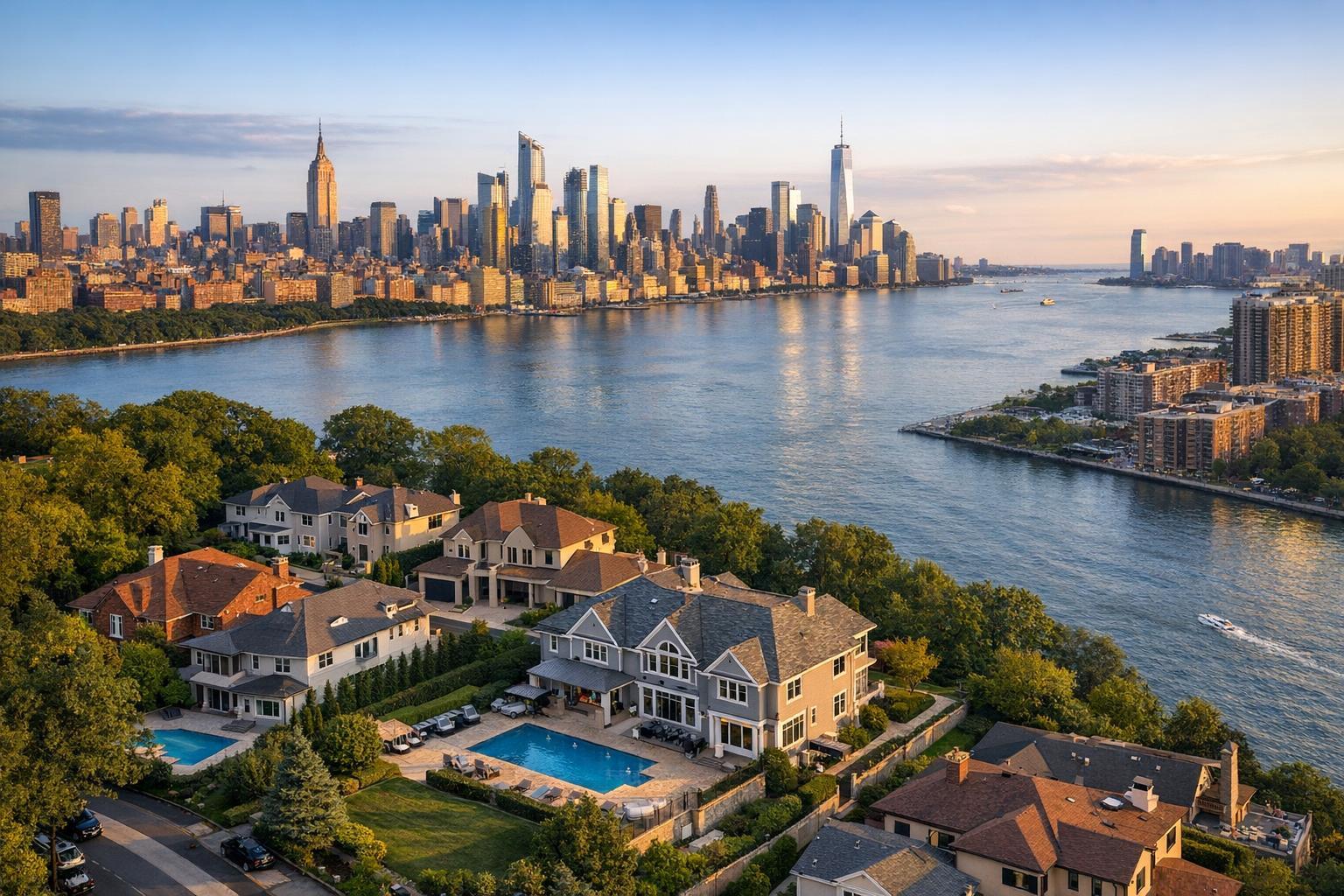
Let’s be honest—traditional listing photos can leave a lot on the cutting room floor. How do you capture that sweeping 25th-floor city view, a rooftop oasis, or the irresistible curb appeal of a brownstone from street level?
Agents across NYC and New Jersey know the pain:
- You want potential buyers to see the full scope of the property—lot size, garden, outdoor patio, proximity to parks, and the wow-factor skyline.
- Standard ground-level shots can flatten a property’s appeal, making it harder to stand out among hundreds of online listings.
- Especially in crowded urban environments, conveying location and neighborhood context is nearly impossible with just interior or exterior photography.
- At the end of the day, you’re left wondering: How do I actually show off my listing’s scale and sell the lifestyle it offers?
That frustration is real, but here’s the good news—it’s totally fixable.
How RealtaSnap’s Aerial Photography Solves the Real Estate Listing Puzzle
Enter RealtaSnap—NYC’s go-to for premium aerial real estate photography and drone videography that turns “hard to market” listings into must-see properties. We blend cutting-edge FAA-certified drone technology, in-house editing expertise, and lightning-fast delivery to give your listings a bird’s-eye advantage.
We offer three flexible drone packages designed to scale with your needs:
- 10 Aerial Photos: $209—perfect for exteriors, rooftops, gardens, and neighborhood context.
- 1-Minute 4K Drone Video: $229—cinematic, stabilized video tours for social, MLS, or custom listing websites.
- Photo & Video Combo: $299—our most popular bundle, letting you showcase location, lot lines, outdoor spaces, and the surrounding cityscape in one shot.
And you won’t wait around. Every set of drone photos and video is professionally edited in-house and delivered to your RealtaSnap dashboard within 24 hours, ready to share on any platform. Need everything seamless? Every shoot includes a free, custom listing website.
Want to see how drone photography NYC-style can set your listings apart? Book your aerial session in under three minutes here.
Top Benefits of Drone Photography for Real Estate
- Highlight outdoor spaces, rooftops, and building amenities in one impressive shot
- Instantly demonstrate property scale, boundaries, and prime location to buyers
- Grab attention on StreetEasy, Zillow, and social—scroll-stopping visuals sell
- Showcase neighborhood context: parks, public transit, destination hotspots
- Offer buyers an immersive, cinematic view that static interiors can’t match
- Fast, fully-edited results—go live with better visuals in 24 hours
Why RealtaSnap Beats Typical Aerial Real Estate Photography Providers
Anyone can fly a drone—but not everyone delivers the same results. Here’s what sets RealtaSnap apart for NYC agents who don’t want to gamble on a big listing:
HDR Images Are Always Included:
Forget surprise upgrade charges. Every aerial photo is enhanced with multi-exposure HDR blending for color-accurate, detail-rich final images that pop, inside and out.
FAA-Certified Drone Pilots:
Safety—and legal compliance—matter in a city like NYC and throughout New Jersey. Our drone operators are fully FAA-certified, expertly navigating local regulations and airspace to keep you protected and fully insured.
Fastest Turnaround, Every Time:
No more chasing down files or waiting days for edits. All visuals are delivered digitally via your dashboard and email in less than 24 hours, so you’re always ready to launch a new listing, host an open house, or update a social campaign.
Easy Booking, Easy Access:
Schedule, download, and share your drone photos (and all your real estate media) in just a few clicks—from your phone, tablet, or desktop. No confusing portals or missing files.
All-Inclusive Packages, No Upsells:
Transparent pricing is our model; aerials start at $209 and there are never hidden fees for edits or delivery.
Ready for a real marketing edge? You can compare all RealtaSnap’s services here and pick the perfect package for your property type, from iconic skyscrapers to newly renovated walkups.
Conclusion & Next Steps: Book Your Drone Photography Real Estate Session Today
Imagine your next listing—featured at the top of search results, dazzling buyers with a true sense of space and story. With RealtaSnap’s panoramic aerial real estate photography and drone video tours, that result isn’t just possible—it’s standard. And because we believe premium visuals should be accessible to every NYC and NJ agent, our FAA-certified team delivers HDR-enhanced drone content with next-day turnaround and zero platform headaches.
Stop letting your property’s best angles go unseen. Stand out, sell faster, and give every listing the edge it deserves.
Ready to capture your listing from above? Click here to book your RealtaSnap drone shoot now.
All prices and information are subject to change. Information is deemed reliable but not guaranteed.
Frequently Asked Questions
Is real estate drone photography legal in NYC and NJ?
It's easy to worry about legal issues, but every RealtaSnap drone session is piloted by an FAA-certified operator who understands local airspace and permits—so you’re always covered.
What happens if the weather is bad on my scheduled shoot day?
Inclement weather can certainly cause concern, but RealtaSnap monitors conditions and will reschedule for the soonest available clear day at no extra fee, ensuring you get beautiful results.
How fast do I receive my edited drone photos and video?
Waiting for content is frustrating, but with RealtaSnap, all drone visuals are expertly edited and delivered within 24 hours of your session—letting you go live faster than ever.