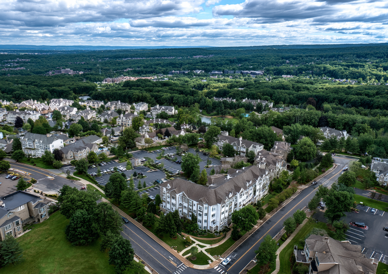
The Lay of the Land: Why Drone Photography is Essential for NJ Land Sales
Real estate drone photography in NJ captures a scenic landscape featuring residential areas, lush greenery, and small lakes under a partly cloudy sky.
Real Estate Drone Photography in NJ: The Game-Changer for Marketing Vacant Land
Are you struggling to attract attention to your NJ land listing? In today's competitive market, real estate drone photography in NJ is more than just a buzzword—it's your must-have tool for closing deals on vacant properties. This post will walk you through why aerial visuals are the secret weapon for land listings, how they reveal every angle buyers care about, and why RealtaSnap is your go-to partner for showcasing New Jersey properties with show-stopping aerials. Plus, you'll discover service details, transparent pricing, and answers to top agent questions on marketing NJ lots with aerials.
The Problem with Selling Vacant Land Without Drone Photography
Let’s be real—selling land in New Jersey isn’t for the faint of heart. You’re not offering gleaming kitchens or luxury finishes. You're selling potential, and that’s hard for buyers to visualize with ordinary photos. Standard ground-level shots just can’t capture the full story. The result? Your listing sits, overlooked, while buyers scroll right past.
Without real estate drone photography in NJ, it’s nearly impossible to communicate property boundaries, topography, access roads, and those critical nearby amenities. Details like proximity to utility lines, lakes or highways get lost. Static, street-level images can’t deliver the context or scale that investors, builders, and homebuyers crave. And let’s not forget—when you’re marketing NJ lots with aerials, you instantly stand out in a crowded market.
But here’s the kicker: buyers are looking for land with an eye toward development, subdivision, or long-term investment. They need the full picture—literally. If you can’t deliver a comprehensive, high-level view, you’re leaving serious money on the table.
How RealtaSnap’s Drone Photography Elevates Your Land Listing
This is where RealtaSnap steps in. Our team lives and breathes drone photography for vacant land in NJ. We understand that a raw parcel isn’t just dirt—it’s an opportunity that needs strong visual storytelling. And helping agents get the ball rolling (fast!) is what we do best.
What’s in the RealtaSnap package for land listings?
- 10 Aerial Photos: $209
- 1-Minute 4K Drone Video: $229
- Photo & Video Combo Package: $299
Every set is shot by FAA-certified pilots, using industry-leading equipment. Our in-house team edits and quality-controls every detail—from color balance to boundary overlays—to ensure each image is not only accurate but compelling. You get MLS-ready media plus mobile-optimized versions, accessible from any device.
But the real magic? We deliver your finished visuals in just 24 hours. Book online in under three minutes, then watch your RealtaSnap dashboard light up as soon as your assets are ready.
Here’s how our aerial shots solve the biggest pain points for New Jersey land agents:
1. Showcase Your Boundaries with Precision
Whether your lot is flat, sloped, or irregular, overhead photos can display borders and lot outlines with stunning clarity. Buyers and builders instantly “get” where the property starts and ends.
2. Reveal Valuable Topographic Features
Got a view, gentle hill, or wetland area? Our drone photography makes it easy to showcase elevation, natural resources, and buildable zones. This is crucial for buyers with specific development goals.
3. Prove Location and Access
From onsite roads to nearby interstates and utilities, aerial imagery puts everything into perspective. You can highlight how close your land is to main access points, schools, or transportation—critical info that rarely comes across in standard shots.
4. Context is Everything
Show how your lot sits within a neighborhood, commercial district, or rural expanse. Drone photography for vacant land in NJ delivers a story at a glance—not endless descriptions no one reads.
Key Benefits of Aerial Photography for NJ Land Listings
- Crystal-clear boundary overlays that answer buyer questions on lot size and shape in seconds.
- Elevated views of landscape, tree coverage, and water features—all compelling selling points for development.
- Instant visual proof of road access and utility proximity, letting investors make faster, more confident decisions.
- MLS- and app-ready media formats so your listing looks polished everywhere, from national portals to local marketing blasts.
- Fast, easy scheduling and delivery with a seamless digital workflow—book, review, and share in minutes.
- Professional editing for every image—no upcharges, no hidden tiers.
- Packages starting at just $209, making premium visuals accessible even for lower-priced parcels.
Why RealtaSnap’s Drone Services Are the Best Choice for Marketing NJ Lots
Let’s cut to the chase. Plenty of companies offer drone photography for vacant land in NJ, but only RealtaSnap is designed with NJ real estate agents in mind. Here’s what sets us apart:
Everything Included—No Confusing Upgrades:
HDR imagery, boundary highlights, and speedy editing are always standard—never expensive add-ons. There's no nickel-and-diming, just simple, transparent pricing.
Unmatched Turnaround Time:
Most companies make you wait days. With RealtaSnap, your aerials are delivered within 24 hours—because every day a listing isn’t live is a day lost.
Streamlined Tech, No Hassle:
From booking to file delivery, our process is all-online, device-friendly, and built for busy agents who need to move fast and never chase files.
Trusted By the Best in NJ Real Estate:
Brokerages across New Jersey—from big franchises to boutique land specialists—book RealtaSnap for drone work that gets listings noticed immediately.
In-House Pros, No Contractors:
Your creative work is completed and checked by our own dedicated team. Our FAA-certified drone pilots and editors know the local market. That attention to detail shows up in every shot.
Want to see our aerials in action? Check out the gallery and client resources on our services page.
How to Get Started with RealtaSnap’s Drone Packages
Ready to see what drone photography can do for your NJ listing? Here’s all it takes:
- Head to our booking page—it takes less than three minutes: Schedule your shoot now.
- Choose your drone package—photos, video, or both.
- Tell us about your land, access points, and any special features you want highlighted.
- Relax: RealtaSnap takes care of the rest, from flight planning to final delivery.
All your visuals are delivered in MLS-compliant formats, with support for custom boundary overlays on request. Every shoot also includes a free custom listing website for easy digital sharing—just another RealtaSnap bonus you won’t find elsewhere in NJ.
All prices and information are subject to change. Information is deemed reliable but not guaranteed.
Frequently Asked Questions
I've tried ground-level photos before—won't drone shots just be an expensive extra?
We get it: sparing dollars on a new listing is tempting. But standard photos rarely do vacant land justice. Drone images show off scale, boundaries, and landscape in ways that ground photos simply can’t. And at just $209, our packages often pay for themselves with faster interest and offers.
Isn't drone photography for vacant land in NJ only for high-end listings?
Not at all! Our aerial packages fit every budget, from small investment lots to large acreage. Many agents find that drone shots help lower-priced listings attract serious buyers and command better offers. We believe every NJ listing deserves the best coverage—no matter the price point.
Won’t this take forever to schedule and get the images back?
No way! RealtaSnap’s digital booking system lets you reserve a shoot in minutes, and you’ll receive your fully edited images within 24 hours of your session. We know every day on market counts, so our goal is always to help you go live—fast.
If you’re ready to get noticed and sell land smarter, real estate drone photography in NJ is your competitive edge. Start impressing buyers and winning more listings today with RealtaSnap’s aerial packages—for New Jersey agents who hustle.
Visit www.realtasnap.com to get started or learn more about our complete real estate visual solutions.