Unlocking the Power of Drone Photography for NYC Real Estate Listings
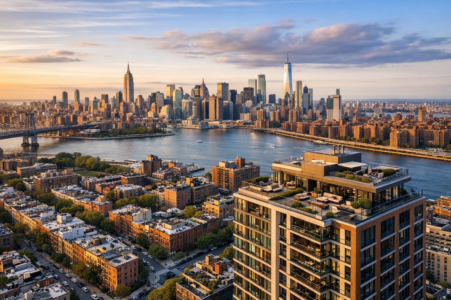
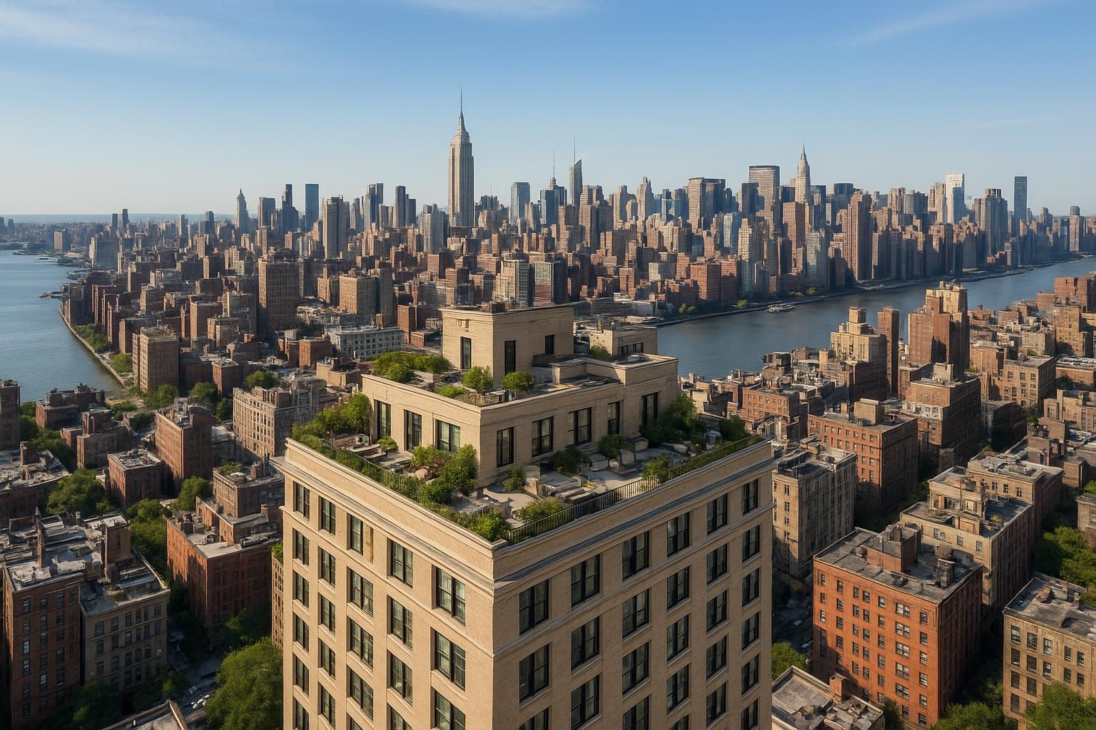
Drone photography in NYC captures a breathtaking view of the skyline with the Empire State Building and a lush rooftop garden in the foreground.
How Drone Photography is Transforming NYC Real Estate Marketing
RealtaSnap is raising the bar for drone photography NYC, pairing elevated visuals with professional real estate photography in NYC to help agents and property owners stand out in an ultra-competitive market. In this post, discover how aerial real estate photography is revolutionizing marketing for both residential and commercial listings, the key trends shaping the industry, and how RealtaSnap makes flawless, high-impact drone photography accessible, legal, and hassle-free for New Yorkers.
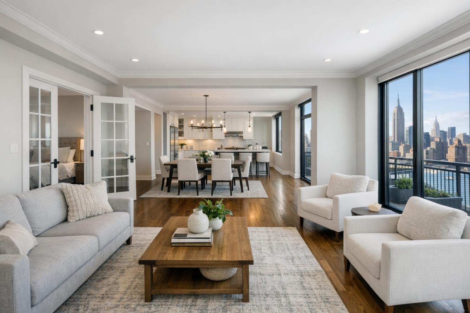
The Problem: Static Listing Photos Fall Short in New York City
The NYC real estate market is arguably the most dynamic and fast-paced in the country. Whether selling a co-op, condo, multifamily building, or commercial space, you face a critical challenge: standing out among hundreds of listings all vying for attention on the city’s top platforms. Traditional ground-level images simply can’t capture the energy of a high-rise view or showcase the full layout of larger properties. When buyers and tenants scroll through dull or repetitive photos, your listing becomes just another address on the block — even if your space is exceptional.
This problem is magnified by NYC’s distinct skyline, urban density, and unique property features that are difficult to illustrate from ground level. Potential buyers want to see panoramic vistas, roof decks, neighborhood context, and visual proof of value. Without engaging visuals, interest drops, traffic slows, and properties can linger on the market longer than necessary.
How RealtaSnap Solves It With High-Impact Drone Photography
RealtaSnap specializes in drone photography for real estate, delivering stunning aerial perspectives that instantly elevate your listings. Our FAA-certified pilots are deeply experienced in navigating the city’s regulatory environment, ensuring every flight is safe and fully compliant with NYC’s strict drone laws. From luxury penthouses with skyline terraces to mixed-use commercial buildings, RealtaSnap gives you the tools to show off everything that makes your property unique.
Pairing high-resolution imagery with rapid 24-hour turnaround, RealtaSnap’s drone services provide not only beautiful photographs but also immersive 4K video tours, interactive property maps, and dynamic marketing assets. Our team handles every technical and legal detail so you get the benefits — and the “wow factor” — without any of the headaches.
To see how easy it is to schedule drone photography or combine ground and aerial packages, visit www.realtasnap.com or explore our full list of NYC real estate media services.
Benefits of RealtaSnap Drone Photography
- FAA-certified drone pilots with deep knowledge of NYC regulations
- Next-day (24-hour) delivery of fully edited aerial photos and videos
- High-resolution images capture true scale, views, and amenities
- Customizable packages for every residential or commercial listing
- Safe, insured, and compliant flights — every session
- 4K aerial video tours boost social media and website engagement
- Seamless add-on with ground-level photography for a full marketing toolkit
- Experience with co-ops, condos, rentals, new developments, and more
- Transparent pricing and easy online booking
- Flexible scheduling, including weekends and evenings
Comparison with Competitors and Traditional Methods
Unlike basic drone enthusiasts or generic vendors, RealtaSnap’s turnkey drone photography NYC services are built for the realities of city listing marketing. Our FAA-certified pilots understand local laws and fly only where and when it’s legal — no surprises or last-minute cancellations. Traditional ground-only photography can’t show off city views, nearby parks, or angles that set your property apart, while online “gig” platforms may leave clients frustrated with delays or inconsistent results.
With RealtaSnap, clients enjoy:
- Faster turnaround: Edited drone photos and video delivered in 24 hours
- Better quality: Pro-grade drones, advanced editing, and knowledgeable pilots
- Superior experience: Personal service, worry-free compliance, and a focus on NYC real estate success
Trends in NYC Drone Photography for Real Estate Marketing
Aerial real estate photography is quickly becoming a staple for high-performing real estate marketing in New York City. Here’s what’s shaping the landscape:
- Rising demand for 4K and cinematic drone videos for digital tours, walkthroughs, and branded content
- Increased use for commercial real estate: Developers and brokers now rely on aerials for site selection, progress updates, and retail leasing
- Integration with 3D tours and floor plans, providing interactive marketing suites for new developments and luxury listings
- More creative storytelling: Agents use drone photography to highlight proximity to parks, waterfronts, landmarks, and transit
Legal and Practical Considerations in NYC Drone Photography
Flying drones in New York City is uniquely challenging. NYC’s tight airspace, proximity to airports, and local legal restrictions make it difficult — and sometimes impossible — for unlicensed operators to capture aerial media legally. Penalties for unauthorized drone flights can be steep, and many “backyard pilots” don’t realize the risks or necessary permits.
When hiring drone photography real estate services in NYC, it’s essential to choose a provider like RealtaSnap, which exclusively utilizes FAA-certified pilots, secures all necessary clearances, and carries comprehensive liability insurance. Flights are planned for safety and compliance, and where legal boundaries exist, alternatives such as telescopic or mast photography can still deliver stunning aerial perspectives.
Conclusion & Call to Action
The right drone photography NYC solution isn’t just about beautiful images — it’s about winning the attention and trust of buyers, tenants, and investors in the city’s crowded real estate marketplace. With RealtaSnap, you’ll unlock the full potential of aerial real estate photography, ensuring your listings get noticed, rise to the top, and close faster.
Ready to see how drone photography can transform your next NYC listing? Explore RealtaSnap’s premium packages and book a session at www.realtasnap.com. Discover how our signature blend of speed, quality, and local expertise turns every building and apartment into a showpiece.
Frequently Asked Questions
1. Isn’t drone photography illegal or risky in New York City?
Many sites face tough airspace rules, but RealtaSnap uses only FAA-certified pilots who ensure safe, legal flights for every job. When aerial photos aren’t possible, we offer equally compelling, compliant alternatives.
2. Will drone photography really make a difference for my property listing?
It’s easy to assume ground photos are “good enough,” but buyers love the unique angles and broader context that only aerial real estate photography provides. RealtaSnap’s images help listings stand out and attract more qualified interest.
3. Does drone real estate photography cost a lot in NYC?
People often worry aerial work is expensive. RealtaSnap offers competitive, transparent pricing and custom packages that fit every listing and budget. All prices and information are subject to change. Information is deemed reliable but not guaranteed.