Why Drone Photography is Revolutionizing Real Estate Marketing in NYC
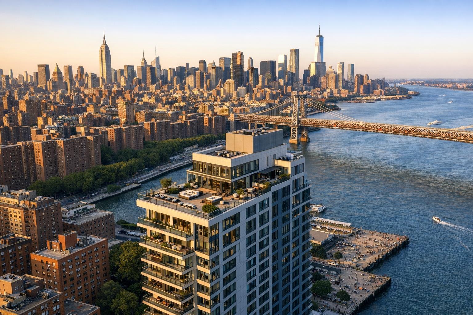
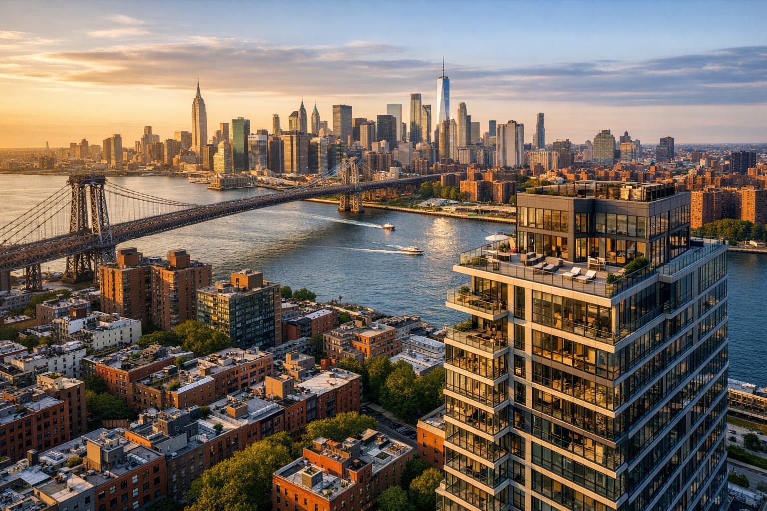
Capturing a breathtaking aerial view of a cityscape featuring a prominent bridge, skyscrapers, and a luxurious riverside apartment building, the image highlights the potential of drone photography in real estate.

Why Drone Photography is Revolutionizing Real Estate Marketing in NYC
The impact of drone photography real estate marketing in New York City is impossible to ignore. Aerial perspective gives property listings something traditional ground-level shots can't: true spatial context within a city defined by its views, density, and architectural variety. For both agents and buyers, seeing where a property sits—how it relates to parks, skyline, outdoor space, or iconic neighborhoods—often reveals what makes that address truly special.
Looking Beyond Street Level: Why NYC Listings Need More
Capturing real estate in NYC presents unique visual challenges. So many standout features are either tucked away from the sidewalk or lost inside a standard window frame:
- Roof decks with panoramic city views
- Peaceful gardens hidden behind historic brownstones
- Terraces that face the skyline or water
- Large lots and outdoor space in the outer boroughs or New Jersey
- Distinctive corner buildings with multifaceted character
Conventional listing photography remains essential for showing off light, interiors, and layout. But it frequently leaves buyers guessing: How private is that yard? What does the terrace actually overlook? How far is the nearest park? With so many critical details invisible from ground level, drone photography steps in to answer these questions visually before a buyer ever sets foot inside.
The Value of Aerial Real Estate Photography: Scale, Context, and Setting
A well-planned drone photo isn’t just a dramatic opener—it’s a shortcut to understanding. Few methods communicate scale and setting so swiftly. For a townhouse, drones reveal the relationship between backyard, deck, and neighboring homes. For a high-rise, they illustrate vertical position and sightlines. And for multifamily or commercial properties, a single shot can display an entire footprint or key access points.
Buyers don’t just want to see what a property looks like—they want to know where it sits, what surrounds it, and how exterior amenities actually connect. Drone photos and videos can make a listing’s context tangible:
- A shot over a Brooklyn brownstone block shows both green space and urban rhythm.
- A Long Island City condo benefits from a sweeping view of the river and skyline.
- Staten Island or New Jersey listings use aerial shots to clarify backyard size and neighborhood positioning.
The right angle can also distinguish private decks or patios from shared spaces—provided the photo accurately depicts reality.
Where Drone Media Adds the Most Listing Value
Not every NYC listing benefits from aerial coverage. Small studios without exterior features are often better served by exceptional interior photos, floor plans, or 3D tours. Drone photos truly shine for properties where the exterior, views, or location are key buyer considerations:
- Homes with roof decks, substantial terraces, or balconies with unique outlooks
- Large yards, pools, gardens, or outdoor kitchens
- Detached homes, estates, or townhouses on generous lots
- Buildings situated on waterfronts, parks, or distinct city vistas
- Listings with striking facades, corner lots, or architectural distinction
- Multifamily, commercial, office, or hospitality properties with meaningful footprints
- Developments where neighborhood context is central to the marketing narrative
Aerial imagery is also valuable for rental or commercial marketing when footprint, access, or nearby amenities impact value.
Drone Video: Bringing Listings to Life
Stills are great for reference. But drone video footage introduces an extra dimension—motion. Short aerial videos help set the scene and tell a story: flying in from above, highlighting architectural forms, drifting toward a rooftop deck, and then transitioning smoothly to ground-level or indoor clips.
This approach is especially effective for listings where the arrival, setting, and exterior spaces need to be experienced in sequence. A one-minute highlight reel can move naturally from neighborhood to building, to outdoor features, and finally inside—building anticipation along the way.
RealtaSnap offers packages that combine drone stills with video, all designed specifically for real estate marketing: high-dynamic-range (HDR) aerial photos with blue-sky replacement if needed, and polished 4K aerial videos.
Learn more about available drone photography and videography services in NYC.
When and How to Use Drone Images in Your Media Plan
A flawless real estate listing isn’t about collecting every possible media format—it’s about answering buyer questions effectively:
- Interior and exterior photos remain the core visual assets.
- Aerial stills are perfect for establishing views, orientation, and scale where context matters.
- Drone videos add movement when showing a property’s approach or outdoor amenities is important.
- Floor plans clarify layout.
- 3D virtual tours offer remote exploration when needed.
If the main value lies in a penthouse deck or landscaped yard, lead with aerials. For classic interiors with limited outdoor space, lean on interior photography and floor plans.
What Makes a NYC Drone Shoot Successful?
A successful aerial shoot in New York City is all about planning and local knowledge. Unlike open suburban environments, NYC presents a patchwork of dense buildings, regulated airspace, unpredictable weather, and essential access logistics.
- FAA Rules: Every drone flight for real estate marketing must comply with FAA Part 107. Certain airspace requires pre-authorization, and not all locations are flyable—even if they seem open.
- Pilot Discretion: Roof access often makes or breaks a project by providing safe, controlled launch points. Agents should confirm access and permissions in advance.
- Permits and Restrictions: If your property is in an area requiring special event or NYPD permits, RealtaSnap does not manage that paperwork—those responsibilities fall to the client and can impact scheduling.
- Weather and Timing: Conditions like wind, rain, or harsh light will affect both flight safety and image quality. Share listing priorities early—if a sunset view or blooming garden is key, plan accordingly.
Drone operations are strictly limited to real estate marketing—survey or façade inspection is outside service boundaries.
Getting Ready for Aerial Coverage
Prepping a listing for a drone shoot means thinking well beyond the front entry. Since aerial photos capture a wider area—including neighboring yards, rooftops, and outdoor spaces—presentation matters.
- Tidy patios, rooftops, and yards
- Remove anything distracting: bins, hoses, tools, bikes
- Ensure that exterior gates and roof doors can be opened during the shoot
- Double-check that building management, doormen, or occupants know about the appointment and any needed access
- Identify specific views or boundaries to prioritize, especially if certain outdoor features are critical to your marketing
A pristine exterior is as important as a clean living room. These small touches mean the property will show its best—especially when seen from above.
Results: Drone Imagery That Tells a Story
Thoughtful drone coverage elevates listings by helping buyers see not just property details, but their broader context—the amenities, settings, and features that make a NYC address desirable. The best aerial images are composed with intention and edited for clarity, not just spectacle. For many buyers, these perspectives spark curiosity, build trust, and provide the clarity needed to move forward confidently.
RealtaSnap Drone Packages and Pricing
RealtaSnap keeps drone photography straightforward with transparent packages:
- 10 aerial HDR photos (with blue-sky replacement if needed): $209
- One-minute 4K drone video: $229
- Combined package (10 photos + video): $299
You can select drone services, add the property address and access information, and book directly online at www.RealtaSnap.com.
Booking is fast and flexible—just 24 hours’ lead time is needed as long as your desired slot is shown on the real-time calendar.
FAQ
Question: Is drone photography feasible for every NYC real estate listing?
Answer: Not always. Each flight depends on FAA regulations, airspace, weather, roof access, and pilot safety assessment. Some properties are within restricted zones or require permits; for those, aerial coverage may be declined if safe operation isn’t possible.
Question: Should I choose drone photos, video, or both for my listing?
Answer: Consider your property’s strongest features. Photos are ideal for capturing overall scale and context for the listing. Aerial video helps tell the property’s story or showcase outdoor spaces and approach. Many agents choose the combined package for multi-platform marketing.
Question: Can RealtaSnap’s drone footage be used for inspections or engineering surveys?
Answer: No. RealtaSnap’s drone services are limited to real estate marketing imagery and are not intended for architectural, engineering, or façade inspection purposes.
Ready to elevate your listing with professional aerial imagery? Get started and book your shoot at www.RealtaSnap.com.