Aerial Advantage: How Drone Photography Elevates NYC Real Estate Listings
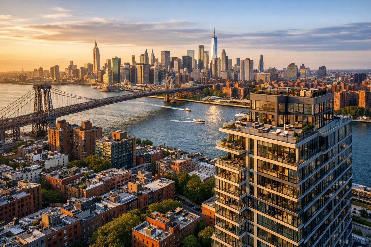
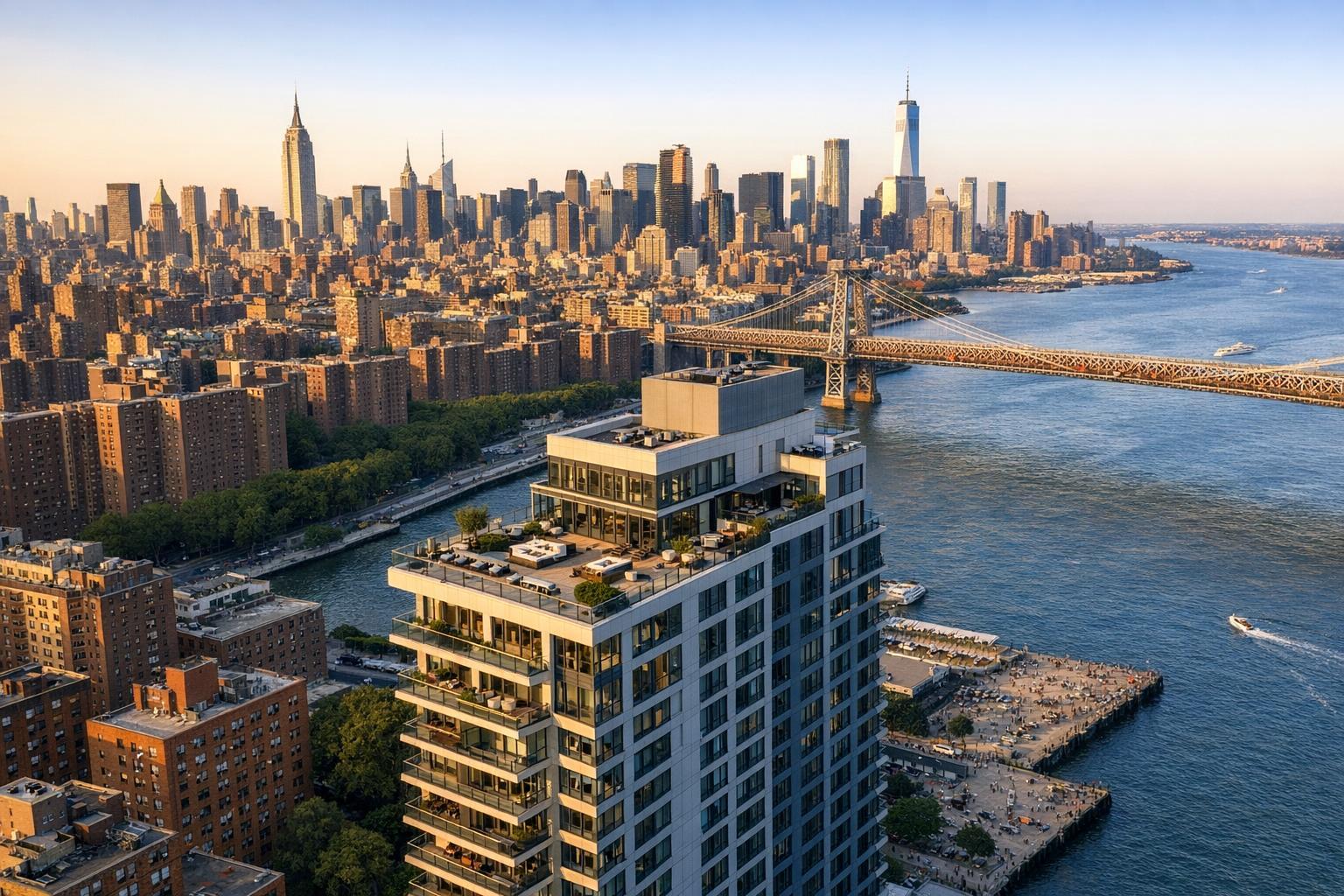
Drone photography captures a breathtaking view of NYC, showcasing skyscrapers along the river with a prominent rooftop pool in the foreground.

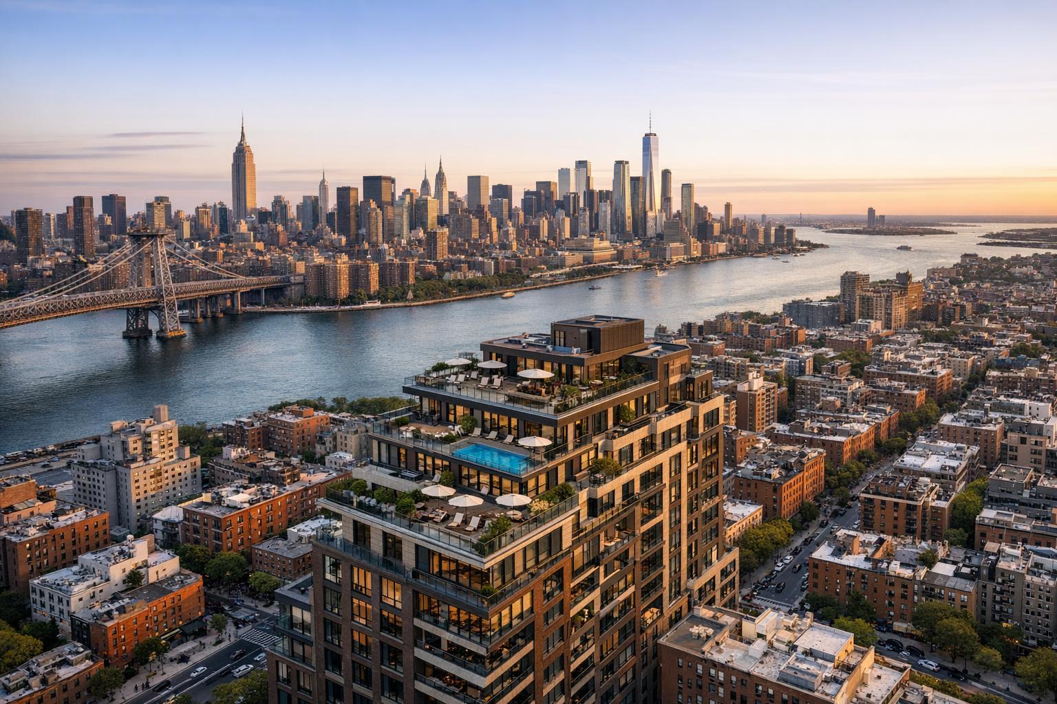
Aerial Advantage: How Drone Photography Elevates NYC Real Estate Listings
Drone photography in NYC has become one of the most powerful ways for sellers, agents, and developers to show buyers “the bigger picture.” While interior photos and walkthrough videos are essential, there’s something unique about aerial real estate photography: it situates a property within its environment, revealing the context that traditional ground-level images miss.
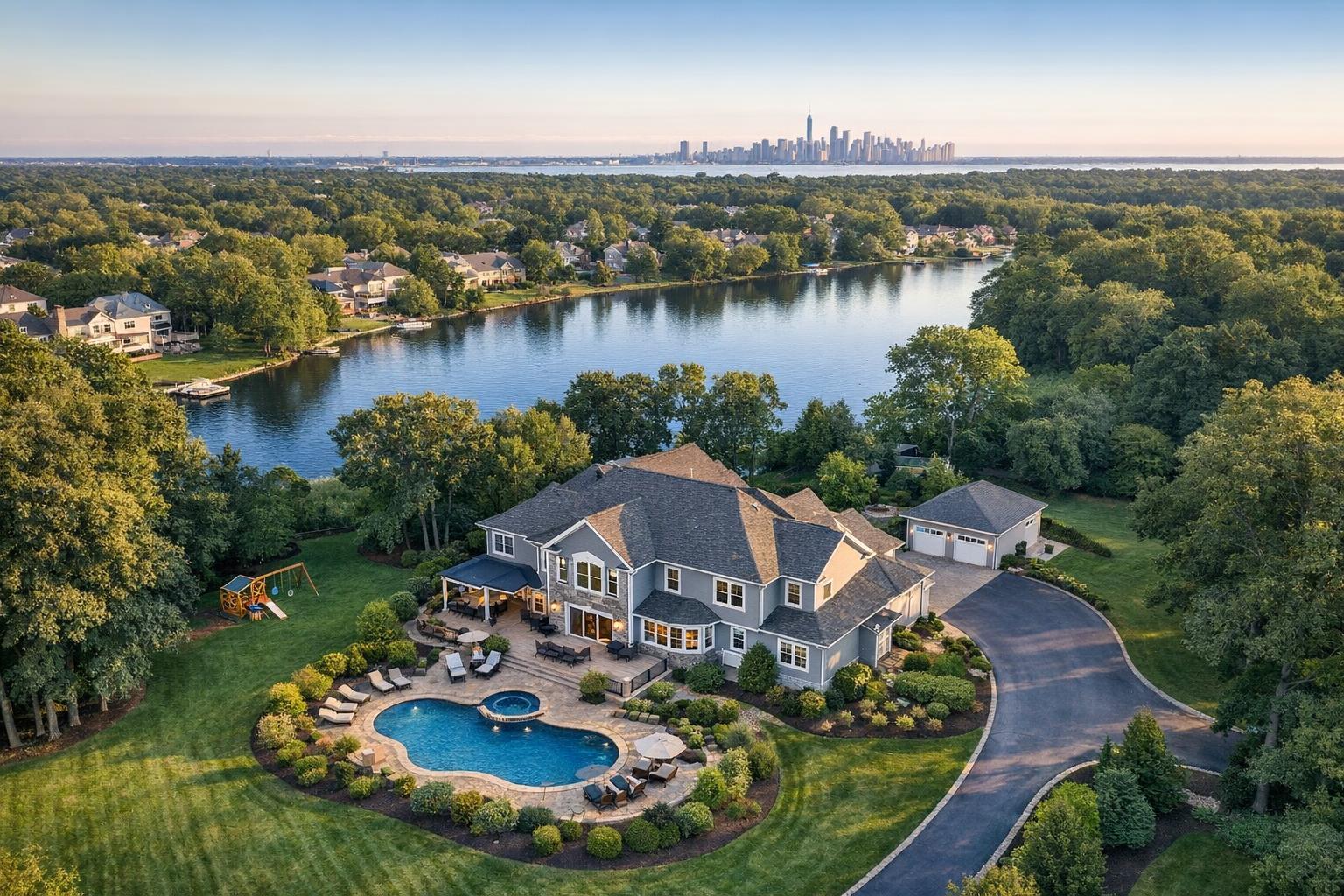
For potential buyers scrolling through listings, that perspective can instantly make a property more understandable and appealing—whether it’s a Brooklyn townhouse tucked between park blocks or a New Jersey home overlooking the water. When used thoughtfully, aerial images do more than just impress: they help people ask not just what a property looks like, but what it feels like to be there.
Seeing More From Above: Why Context Matters
Standard real estate photography is all about highlighting the quality of finishes, the play of light, and those interior details that make each listing unique. Aerial photography, on the other hand, quite literally takes a step back to capture a wider view—one that includes street settings, outdoor spaces, and even the energy of an entire neighborhood.
This city-centric context is especially valuable in and around New York City, where the location often defines the lifestyle. With aerial real estate photography, you can:
- Showcase roof decks, patios, gardens, or pools positioned atop or behind buildings
- Emphasize proximity to parks, waterfronts, or major transit routes
- Reveal the scale of a home’s lot or the relationship of a building to its block
- Highlight architectural lines and design elements only visible from above
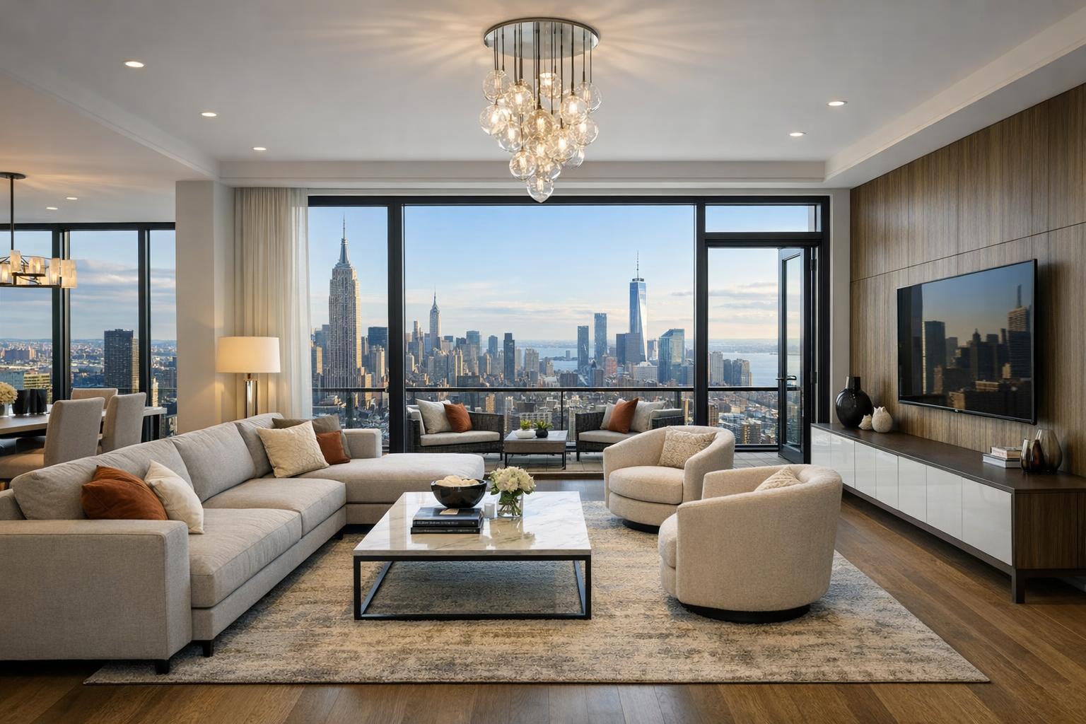
- Frame scenic views and skyline context that add value to the property
Carefully chosen aerial images make listings easier to visualize. For instance, a high, wide shot might display both a lush backyard and nearby green space, while a lower angle might focus on a striking architectural detail or the buzz of the surrounding streetscape.
When Does Aerial Media Make the Biggest Impact?
Not every NYC apartment needs a drone shot—but whenever setting, size, or a one-of-a-kind feature could tip a buyer’s decision, real estate drone services NYC truly shine.
Townhouses & Single-Family Homes
Urban and suburban homes often hold secrets you simply can’t see from the sidewalk. Overhead imagery can spotlight hidden gardens, rear terraces, exterior amenities, and relationships to neighboring buildings—key selling points in both the city and nearby New Jersey markets.
New Developments & Multifamily Buildings
Aerial overviews help establish new construction or larger multifamily listings within their neighborhoods, showing the building’s massing, location, and nearby landmarks. This can be especially useful for highlighting access to waterfronts, parks, or bustling commercial corridors. The best results maintain accuracy: drone images should reflect actual sightlines rather than exaggerate proximity.
Luxury & Design-Centric Properties
Architecturally bold listings benefit from unique vantage points that reveal symmetry, landscape planning, and connections to their site. A drone’s perspective can highlight geometry, openness, or those eye-catching outdoor living spaces that luxury buyers expect.
Commercial & Mixed-Use Sites
Aerial shots are also valuable for commercial real estate, offering key context around traffic flow, parking, neighborhood activity, and corner visibility. These factors often tell more about the opportunity than interiors alone.
Photos, Video—or Both?
How you present a property from above depends on both the listing’s strengths and your marketing plan.
- Still Aerial Images: Highly flexible for MLS galleries, brochures, and social media. The most effective packages focus on clarity and relevance: a concise set of striking HDR drone photos typically works best.
- Aerial Video: Adds cinematic movement and can build a sense of arrival or drama for larger or high-end sites. Video is excellent for showing transitions—like the approach to an entryway, or sweeping from a rooftop toward the skyline.
- Hybrid Packages: For listings that need to capture both still moments and dynamic scenes, combining photos and video ensures buyers get the full picture.
At RealtaSnap, drone photography packages include 10 expertly edited HDR images for $209, while drone video (a one-minute, 4K edit) is available for $229. If you need both, a combined package starts at $299.
Explore RealtaSnap’s drone photo and video options.
Planning for Aerial Media in NYC: Rules, Access, and Reality
It’s one thing to envision dramatic drone shots of Manhattan or the Brooklyn waterfront—it’s another to actually make them happen. NYC airspace requires careful planning and compliance with all applicable FAA Part 107 rules, and every property presents its own logistical puzzle.
- Airspace and Local Restrictions: Not every NYC or New Jersey address is “flyable.” Each location must be evaluated for safety, access, airspace rules, and local regulations. Some sites are simply off-limits, while others may require special authorization.
- Roof Access: In dense urban neighborhoods, secure roof access can make a drone shoot feasible and open up stronger angles for roof decks and exclusive terraces. Be sure to confirm with your building or management if this is possible.
- Weather and Safety: Wind, rain, and visibility affect both image quality and flight safety. A reliable provider will always make the final call in favor of safe operation.
- Permitting: RealtaSnap does not obtain municipal, NYPD, or special event permits. If your project requires additional permitting, it’s your responsibility, and flights may be declined if these are not in place.
A credible drone service will never guarantee aerial marketing for every property before assessing the site firsthand.
How to Prepare for a Drone Shoot
A bit of preparation goes a long way in maximizing the impact of your aerial real estate photography:
- Tidy outdoor spaces—remove bins, equipment, or anything that clutters patios, driveways, or lawns.
- Arrange deck furniture or landscaping so areas look purposeful and photo-ready.
- Secure roof, backyard, or gated access before the appointment.
- Alert your photographer to any nearby construction, cranes, or events that could interfere with the shoot.
- Consider the best time of day for sunlight and shadows on key features.
The aim isn’t to stage an artificial scene, but to make the property’s best outdoor elements clear and enticing in every shot.
Choosing the Right Real Estate Drone Services NYC
When comparing providers, it’s helpful to look beyond dramatic portfolio images and ask practical questions:
- Are aerial stills, video, or both available?
- How is airspace and flight feasibility determined for your specific address?
- What information needs to be provided in advance—roof access, building rules, site contacts?
- How are weather and safety assessments handled?
- Are final images and videos tailored for real estate marketing, not just general visuals?
- What exactly is included in the quoted price (number of photos, video duration)?
- Does the company handle permitting, if needed?
RealtaSnap focuses specifically on real estate marketing media in NYC and New Jersey, providing packages that balance striking visuals with a thorough understanding of local airspace and access realities.
Making the Most of Aerial Media in Your Listing
The strongest aerial images do more than simply show a property from above—they tell a story that buyers can immediately grasp. Before scheduling a drone shoot, ask yourself: What’s the central selling point? Is it outdoor living, privacy, a dramatic setting, architectural features, or proximity to something special? Tailor each aerial angle to reinforce that story and give buyers a reason to explore further.
For tailored advice, convenient scheduling, and a look at available drone packages, visit RealtaSnap’s drone photography and videography page or explore additional services at www.RealtaSnap.com.
FAQ
Question: Is drone photography available for every listing in New York City?
Answer: No. Each site must be individually checked for airspace rules, weather, building access, and local safety. Roof access often helps in urban areas, but if a location cannot be flown safely or legally, aerial photography may not be possible.
Question: Should I choose aerial photos, video, or both for my listing?
Answer: It depends on your goals. Choose drone photos for gallery images or print materials. Opt for video if your marketing would benefit from a cinematic presentation. Many agents find value in a combined package, especially for standout properties.
Question: What permits are required for a drone shoot?
Answer: Standard FAA compliance is required for all flights, but if your location needs a special municipal or NYPD permit, securing that is your responsibility. RealtaSnap does not obtain permits beyond standard FAA approvals and may decline assignments where permits are required but not provided.
Ready to elevate your next listing? Learn more or book a shoot at www.RealtaSnap.com.