Drone Photography in NYC: What Real Estate Listings Need to Know
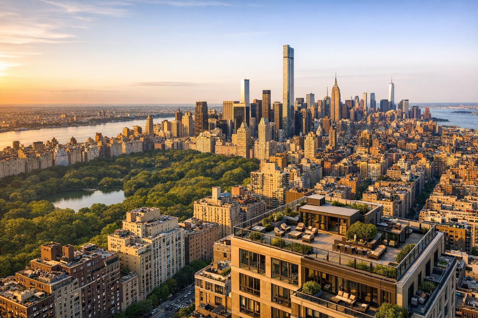
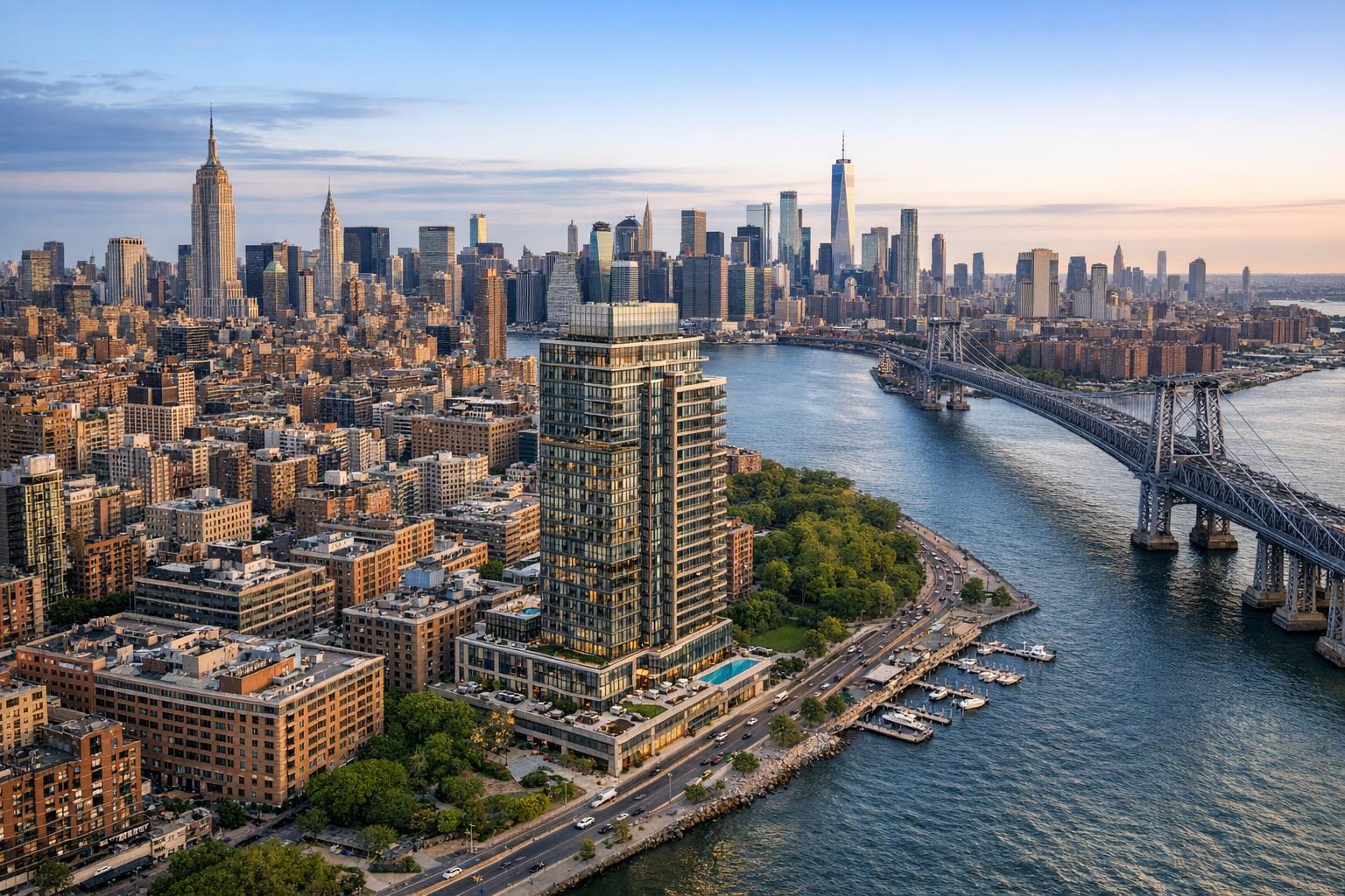
Drone photography captures a stunning aerial view of New York City, showcasing its iconic skyline, bridges, and waterfront.

Drone Photography in NYC: What Real Estate Listings Need to Know
For real estate professionals, drone photography in NYC holds real promise, but it works best when paired with a sensible strategy. Not every listing benefits from an aerial view, and New York City's dense, complex landscape means there’s more to consider than just adding drone images to the marketing plan. This guide will walk you through the types of listings that often benefit from aerial context, the practical limitations of working in NYC (and nearby markets), and what’s involved before you schedule a drone shoot with a trusted provider like RealtaSnap.
Why Consider Aerial Media for a Listing?
Aerial photography gives buyers a sense of story that ground-level shots can’t always deliver. When selected thoughtfully, drone images and video can clarify how a property relates to its surroundings—whether that’s outdoor amenities, architectural scale, neighborhood features, or spectacular views.
The right flyover or elevated angle can answer questions buyers naturally have:
- How large is the backyard, and how private?
- How does a townhouse or brownstone relate to the block?
- What exactly does a rooftop terrace offer, and how are the surrounding views?
- Where is the waterfront in relation to the home?
- Is there development potential for larger lots or commercial properties?
When context is part of the value proposition, aerial coverage can make the story click.
Which NYC Listings Are Best Suited for Drone Imagery?
Not every property justifies the extra effort and planning required for drone photography. In NYC and the surrounding region, aerial media makes the biggest impact in certain scenarios.
Townhouses, Brownstones, and Brooklyn Gems
Homes with charming backyards, landscaped rooftop terraces, or deep lots in Brooklyn often hide their best features from the street. Aerial shots can highlight outdoor living areas, unique rooflines, or the relationship between main and auxiliary structures.
Manhattan Listings with Rooftop Access
Penthouses, private terraces, and high-rises might justify drone work, especially when those amenities are a prime selling point. Flight feasibility, though, depends on access, airspace, weather, and onsite realities. Sometimes, gaining roof access alone determines whether a drone shoot is possible.
Waterfront and View-Focused Properties in New Jersey
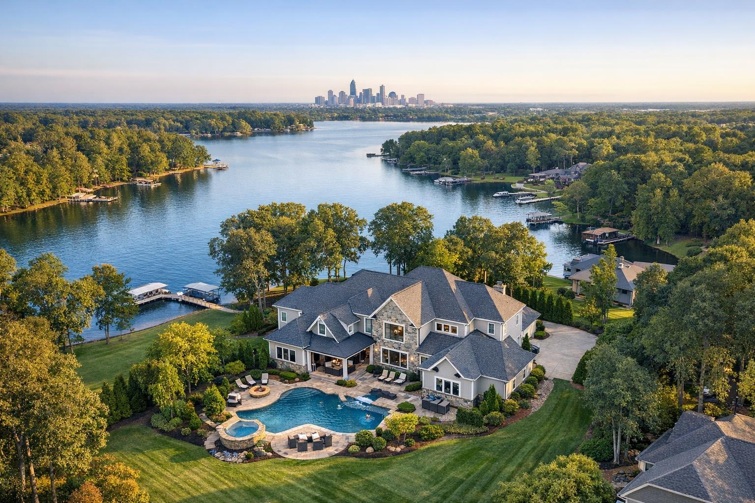
If you’re marketing a home near the Hudson, a lakeside property, or a house with sweeping views, a drone is often the simplest way to show the setting without relying on written descriptions. Large lots, pools, outdoor kitchens, and water access are captured best from above.
Larger Residential, Multifamily, and Commercial Buildings
For new developments, mixed-use buildings, and multi-structure properties, aerial imagery demonstrates building scale, entrances, parking, and site layout for buyers or investors. Drone media is less about romance here and more about clarity.
When Drone Photography Isn't the Right Choice
Aerial images aren't always the answer. Some listings may be better served by polished ground photography and video.
Skip the drone if:
- The property is hemmed in on all sides with no views or outdoor features.
- There are strict airspace or building access limitations you can't overcome.
- There’s no meaningful context or amenity to capture from above.
- Inclement weather or ongoing construction makes safe, compliant flight impossible.
- The listing is a standard apartment with zero exterior amenities.
In other words, don’t add drone just to check a box. Let the listing’s own strengths guide the decision.
Navigating Airspace, Access, and Feasibility in NYC
Flying a drone in New York City is never as simple as booking a service. Each flight is subject to a real feasibility review based on current conditions, FAA Part 107 regulations, airspace overlays, weather, and property-specific factors. Even two buildings on the same street may differ widely in what’s possible.
Airspace and Authorization
NYC airspace is patched with controlled and restricted zones. Some locations can be flown with proper filings and permissions, while others are practically off-limits. Always communicate the full property address early so your provider can research viable options.
Roof and Building Access
For many NYC and Brooklyn properties, access to the roof or private outdoor space makes drone work substantially more feasible. Agents may need to coordinate with owners, managers, or building staff in advance. Confirm:
- Who will grant access on the day of the shoot
- Any special building rules or filming restrictions
- Entry procedures, hours, or sign-in requirements
- Safe staging areas for takeoff and landing
Weather and On-Site Realities
New York’s weather changes quickly, and conditions on site may differ from the forecast. Wind speeds, unforeseen construction, street closures, and local events can all impact whether and how a drone can fly. Flexibility goes a long way—sometimes a backup plan is part of the process.
What to Prepare Before Scheduling a Drone Shoot
A smooth evaluation comes down to clear information up front. Before you try to book aerial media for your listing, gather the details that impact feasibility:
- Complete property address (not just a neighborhood or intersection)
- Listing type (townhouse, brownstone, condo, detached home, large commercial, etc.)
- The specific feature you hope to highlight
- Available exterior access (roof, terrace, yard, or similar)
- Any building requirements, permissions, or rules
- Known issues like construction, access limitations, or street events
- Whether you need still photos, drone video, or a combination
A provider like RealtaSnap reviews each request on a case-by-case basis and will let you know if aerial coverage is truly practical for your property.
RealtaSnap Drone Media Options and Pricing
When aerial coverage is recommended, RealtaSnap’s offerings are tailored to real estate marketing—not engineering, surveying, or inspection. Packages are transparent and up-to-date:
- 10 HDR drone photos: $209 (includes blue sky replacement if needed)
- One-minute 4K drone video: $229
- Combined photo and video package: $299 (includes 10 HDR photos with blue sky replacement and a one-minute 4K video)
Every booking is subject to feasibility based on actual location and conditions, as well as all applicable regulations and safety precautions. You can book, enter your address, add access instructions, and select your preferred service at the RealtaSnap online booking page.
Making the Most of Aerial Media
The question isn’t whether a drone is impressive—it’s whether aerial context adds genuine value to your listing presentation. For a Brooklyn brownstone with a lush rear garden, a Manhattan penthouse terrace, or a New Jersey waterfront home, drone media brings key features to life. If a property’s story is already clear from the ground, there’s no need to force it just for show.
Plan your media package around what helps buyers see, understand, and imagine themselves in the space. That might mean combining:
- Standard interior photography (to show rooms, layout, and finishes)
- Exterior stills (to set curb appeal)
- Aerial shots (to convey outdoor living, scale, or context)
- Video (to highlight movement or view transitions when appropriate)
Ready to Evaluate a Listing?
If you’re considering aerial real estate photography for an upcoming NYC or New Jersey listing, the process starts with a conversation and the right address. RealtaSnap can walk you through what’s possible for your specific property, based on everything from airspace to weather and building logistics.
You can explore current drone media options and book online, or head to www.RealtaSnap.com for broader information about listing media services.
FAQ
Question: Can drone photography be guaranteed for NYC real estate?
Answer: No. Drone flights are always subject to location, FAA rules, airspace, weather, access, and the pilot's assessment. Selecting drone services starts the planning process, but an actual flight depends on feasibility for each property.
Question: Is roof access required for a drone shoot in Manhattan or Brooklyn?
Answer: Not always, but having rooftop or outdoor access often makes aerial coverage much more practical in dense urban neighborhoods. If it’s possible, confirm who will provide access and any building rules before the shoot.
Question: Should I choose drone photos, video, or both for my listing?
Answer: Photos work best when you need a clear, single-image story—like showing lot size, outdoor amenities, or context. Video makes sense if the property's movement (like walking from patio to pool or ascending to a skyline view) helps buyers understand its value. Some listings benefit from both.
If you’re weighing drone media for your next listing, we’d be happy to help you assess what makes sense. Visit www.RealtaSnap.com for more.