Drone Photography in NYC: When It Makes Sense for a Real Estate Listing
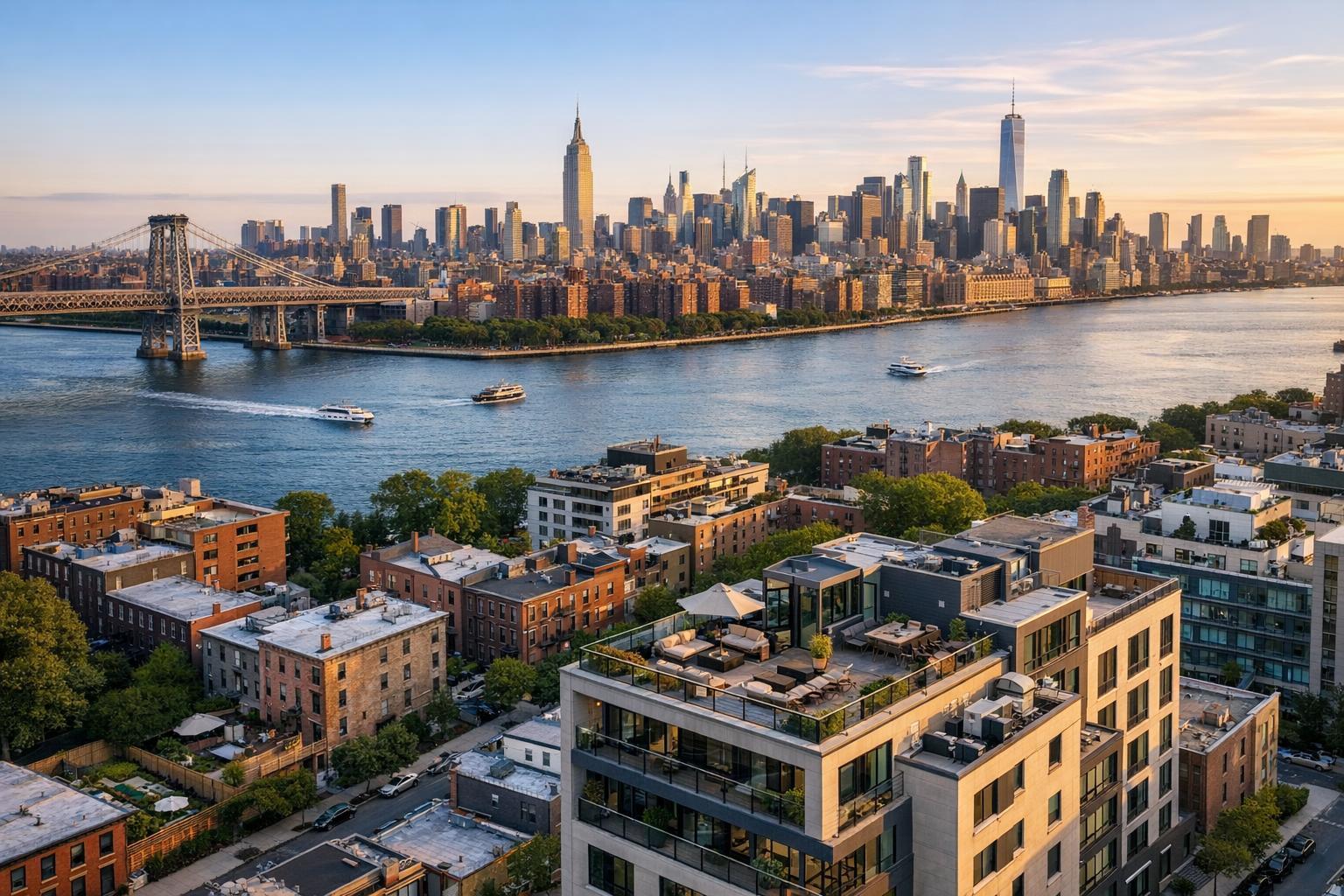
Drone photography of NYC captures a stunning view of the skyline at sunset, with the river and bridge in the foreground.

Drone Photography in NYC: When It Makes Sense for a Real Estate Listing
Drone photography in NYC is a tempting upgrade for many real estate listings, but in such a dense and regulated city, it’s not automatically the best—or even an available—choice for every address. There’s an important distinction between wanting a dramatic aerial view and knowing when it genuinely adds to a property’s marketing story. In New York City, balancing what’s visually useful, what buyers care about, and what’s actually feasible is the key to using aerial media effectively.
Why Aerial Media is Sometimes the Right Move
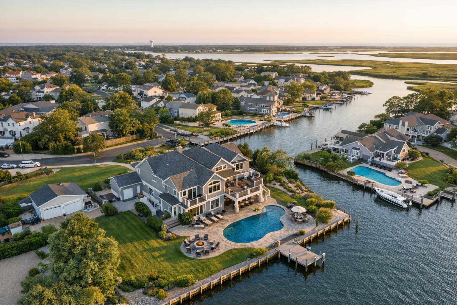
Aerial real estate photography does something ground-level shots can’t: it puts a property into context. In NYC, where location is as much of a selling point as interior finishes, an overhead image can show the relationship between a building and its outdoor spaces, water, skyline, or surrounding blocks.
Stills or video from above are especially strong when a listing has:
- A private roof deck or landscaped terrace
- Proximity to a park, the waterfront, or open space
- Distinctive architecture that’s tough to capture from the street
- Large grounds, a corner lot, or extra separation from neighbors
- A unique skyline view or a story about neighborhood context
For many listings, one or two elevated images might be all that’s needed. Others might shine brightest with both aerial photos and a concise aerial video that leads into interior footage.
Listings That Truly Benefit from Drone Photography
Not every NYC property actually needs an aerial perspective. Drone shots are most impactful when they help answer a question a serious buyer or tenant would ask—“What’s the real deal with that roof deck?” or “How is this building set in relation to the river and the skyline?”
Private Outdoor Spaces
In a city where outdoor living is a premier feature, drone imagery makes it clear just how large or special a terrace or rooftop is—especially compared to a tight, ground-level shot. If rooftop access is available, it’s worth confirming the space is tidy and everything is secured before scheduling an aerial shoot.
Waterfront and Open Spaces
If a listing boasts direct access to a marina, park, or open water, aerial perspectives highlight what makes that location unique. For best results, the photo should clearly show how the property’s position relates to those features—not just a generic skyline or distant waterfront.
Standout Architecture and Larger Sites
Drone stills clarify rooflines, interior courtyards, and the true footprint of properties where street access is limited or other buildings block a full view. A Brooklyn brownstone on a distinctive block, a detached house, or a new development with memorable lines all gain clarity from the sky.
Skyline Views and Setting
It’s tempting to replace window views with a sweeping aerial, but potential buyers still want to see the actual outlook they’d enjoy from the home. Use drone imagery to provide context, then ground-level shots or video to capture the lived-in view.
Commercial and Multi-Unit Listings
For buildings with large footprints, extensive grounds, or significant parking and loading areas, aerial visuals can help viewers quickly grasp the property’s scale, site layout, and access points.
The Realities of Flying Drones in New York City
New York is not a one-size-fits-all environment for aerial media. Each borough blends dense development, tightly controlled airspace, countless launch considerations, and local rules. That’s why every address must be reviewed individually—sometimes properties right next door to each other may have different flying restrictions, building access issues, or safety considerations.
Feasibility for real estate drone photography in NYC depends on several factors, including:
- Airspace restrictions and FAA rules
- Local regulations and possible permit requirements
- Weather, wind, visibility, and day-of conditions
- The presence of people, traffic, or activity
- Space to operate the drone safely
- Roof or exterior access and building management cooperation
- Pilot’s judgment and safety protocols
Some listings may not be flyable, and that doesn’t reflect poorly on the property. It’s simply part of responsible drone operation in an urban landscape.
Roof Access: The Unsung Hero of Drone Shoots
Getting to the roof can be a game changer for aerial feasibility. Rooftop launches provide clearer sightlines, safer takeoffs, and a better vantage for rooftop amenities or skyline relationships. It’s still important to check for building rules, construction, or other factors that could affect access. If you have rooftop access secured in advance, let your media team know—it makes planning far easier.
Choosing the Right Type of Drone Coverage
Every listing tells a different story, so deciding between aerial photos, video, or both comes down to what’s visually important.
- Aerial stills are usually perfect when one or two frames clearly communicate location context—your terrace in relation to the building, a private roof deck, or that prime spot near the park.
- Aerial video is best if showing movement clarifies the story, such as a slow approach to the building or a reveal of the horizon as the camera rises above the roof. Short aerial clips pair well with on-site listing videos, but should always support the overall flow and not distract from the core of the property.
- Both formats work especially well for standout properties with multiple exterior strengths or architectural details.
For compact apartments without exterior perks, standard interior photography and video are often the smarter focus.
Is Drone Media Worth Exploring for Your Listing?
Before requesting drone coverage, ask yourself:
- What exterior feature or setting truly needs aerial context?
- Can the story be told from the street, windows, or existing outdoor access?
- Is there roof or terrace access?
- Would a single aerial photo suffice, or does a short video add value?
- Does the building’s architecture or skyline relationship strengthen with a bird’s-eye view?
- Are there special access instructions, building rules, or local restrictions to share ahead of time?
- If a drone flight can’t happen, what ground-based visuals will serve as Plan B?
This approach keeps drone use focused and intentional, not a default add-on for every listing in Manhattan, Brooklyn, Queens, the Bronx, or Staten Island.
Planning Drone Shoots With RealtaSnap
RealtaSnap offers aerial photography, video, or a combined approach for properties across NYC and New Jersey. Because flight feasibility is determined case by case, it helps to share property details up front—address, access notes, outdoor features, and any building management instructions. Early details about rooftop access, terraces, or waterfront locations help our team determine if a drone flight is appropriate under current rules and conditions.
Assignment feasibility depends on factors like FAA rules, weather, safety, and any permits required. RealtaSnap does not handle municipal, NYPD, or special event permitting beyond standard FAA authorization, so clients should be prepared to secure those if needed. Bookings are easily handled online, where you can provide essential shoot notes for faster assessment.
For more about aerial real estate media services or to start planning a shoot, see RealtaSnap drone photography and video for NYC listings.
Let the Property Guide the Media Plan
In New York City, drone imagery is best thought of as a strategic tool—not a standard feature for every listing. The smartest aerial work starts with the exterior story you need to tell, then takes into account all practical considerations around safety, access, regulations, and weather. If your next listing has an exterior feature that deserves a wider perspective, RealtaSnap is ready to help you figure out whether drone media is the right call.
Visit www.RealtaSnap.com to discuss what’s possible for your upcoming listing.
FAQ
Question: Can drone photography always be done for NYC listings?
Answer: No. Drone services for real estate are determined case by case. Flight depends on FAA regulations, airspace, weather, safety, property access, local rules, and pilot judgment. Some locations are simply not flyable.
Question: I’m listing a Manhattan apartment without a private terrace or roof. Is drone photography still helpful?
Answer: Sometimes. Aerial shots can provide helpful context if there’s something unique about the building exterior or its setting. For many apartments, interior photos and video will do a better job telling the listing’s story.
Question: What should I prepare before requesting aerial media?
Answer: Share the property address, details about roof or exterior access, any building management instructions, and the exterior feature you want to highlight. These details make it easier to assess what’s possible and what media coverage will be most useful.