Elevate Your Listings: The Power of Drone Photography for NYC Real Estate
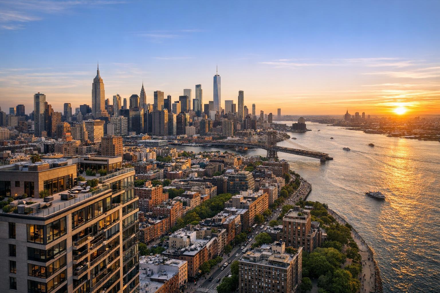
Drone photography captures a stunning aerial view of New York City at sunset, showcasing the skyline and the shimmering river.

Elevate Your NYC Listings: How Drone Photography Changes Real Estate Marketing
Drone photography in NYC real estate is more than a pretty picture—it’s a practical tool for buyers, sellers, and agents who want to communicate what makes a property unique. With so many listings packed close together, standing out isn’t always about interior finishes or room sizes. Sometimes it’s about the context: the private rooftop, the view, or even the way a space sits in its neighborhood. That’s where aerial photography shines.
Why Aerial Imagery Tells a Better Story
Traditional real estate photography gives a sense of space, design, and light. Aerial real estate photography answers entirely different questions:
- What does the building actually include, beyond its walls?
- How do outdoor features, parking, or location set this property apart?
- Where does the property sit within the block, and how does it relate to its neighbors?
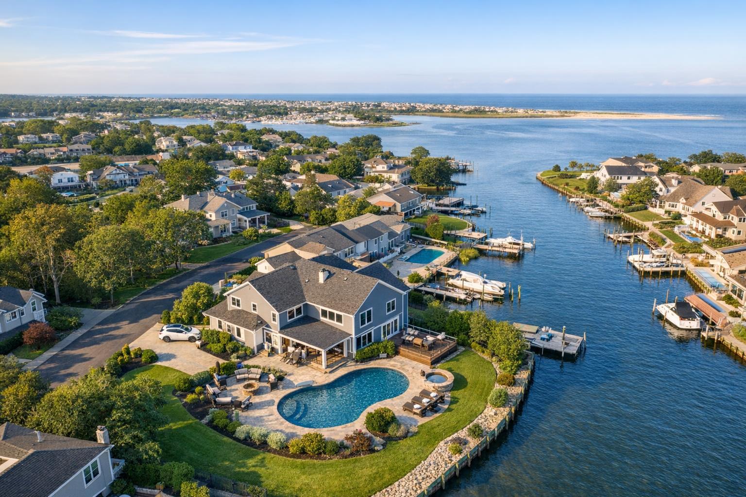
Instead of relying on maps or long descriptions, a single drone image can showcase scale, layout, and setting. For New York City, where every square foot counts and location is everything, those overhead perspectives can quickly convey what buyers most want to know.
Practical Examples from NYC and Beyond
Not every listing needs a drone—plenty are all about interiors. But some spaces practically demand an aerial view:
- A Brooklyn townhouse with a lush backyard or deck, and you want to show how they connect
- Penthouses with rooftop terraces that need to be seen in context with city views
- New developments where showing proximity to transit, parks, or neighboring buildings matters
- Commercial spaces with valuable corner locations, unique access, or visible signage
- Multi-family investments that benefit from visualizing courtyards, parking, or nearby amenities
For these scenarios, drone photography isn’t just dramatic. It makes complex site details simple to grasp.
What Makes a Great Aerial Shot?
It’s easy to enjoy a sweeping skyline view, but the best drone photos are intentional. Ground-level and aerial images should complement each other, building a complete picture for the buyer or tenant.
Good drone media might include:
- Wide shots showing the whole property in its setting
- Lower-level aerials revealing the connection between building and street
- Top-down views to explain lot lines, outdoor amenities, or roof features
- Close looks at architectural details, gardens, or specialty spaces
- Short video flyovers, offering a better sense of access and movement
For a compact NYC home, just one or two targeted aerials may be enough. Larger or more complex sites—think commercial properties in Queens or waterfront homes in New Jersey—often benefit from a mix of shots and brief video.
When Drone Footage Actually Helps (and When It Doesn’t)
A drone can make any property look eye-catching, but there’s a responsibility to represent things honestly. Overly wide shots may isolate a property, and dramatic angles can exaggerate roof terraces or lots. The right approach to aerial real estate photography is about clarity:
- Don’t crop out adjacent buildings or access points
- Show true proportions—don’t mislead about size
- Let outdoor spaces be recognizable and easy to interpret
- Pair aerials with ground-level photography to give a complete picture
The best drone media helps buyers visualize possibilities and feel confident about what’s on offer.
Drone Feasibility: Navigating NYC’s Unique Rules
Drone work in New York City always comes with logistical realities. Flights aren’t possible everywhere, and each request is considered by factors like:
- Airspace and FAA restrictions (near airports, heliports, or specific airspaces)
- Weather and wind conditions
- Safety and visibility around busy streets or neighboring rooftops
- Physical access to outdoor spaces, gardens, or terraces
Even experienced pilots need to make a site-specific assessment. For some NYC addresses, a drone simply isn’t allowed by law or is too risky to operate safely. If drone photography isn’t feasible for a particular listing, professional ground-level exteriors or on-site video can still add meaningful context.
Prepping for a Successful Aerial Shoot
Getting ready for a drone session focuses on tidying up what will be seen from above:
- Move vehicles or trash bins out of driveways and curbside spaces
- Straighten up patio furniture and remove loose items
- Confirm access to rooftop, deck, yard, or any locked outdoor amenities
- For commercial sites, highlight entrances, signage, loading zones, or parking
Clear communication about property features ensures that both ground and aerial photographers can capture what’s most important.
Coordinating Aerial and Traditional Media
A striking aerial isn’t a replacement for interior shots or 3D tours. Instead, it’s a piece of a balanced marketing approach:
- Eye-level photography shows detail, mood, and finishes
- Drone imagery gives critical context and visual interest
- On-site video ties the story together with movement and transitions
- Floor plans or 3D virtual tours help viewers understand space and flow
Not every property needs the entire suite. Small apartments may shine with strong interiors, but homes or commercial sites with outdoor perks or special locations should consider aerial media as part of the package.
Choosing a Drone Photography Provider in NYC
If you’re exploring drone photography services for NYC real estate, it helps to ask thoughtful questions:
- What specific features should the drone showcase?
- Does the property’s location support a safe, legal flight?
- Will the package include photos, video, or both?
- What on-site coordination is necessary for safe and complete coverage?
- How will drone shots fit into your overall listing strategy?
- Is there a plan in place if weather or airspace restrictions rule out a flight?
RealtaSnap provides drone photography, video, or photo-plus-video options in NYC and New Jersey, depending on what’s feasible for your site. Drone service availability always depends on address, airspace, and safety. You can see more about their aerial offerings here.
Pricing Snapshot
RealtaSnap’s drone media is designed to be straightforward and transparent:
- Drone Photography: 10 HDR photos, $209
- Drone Video: 1-minute final 4K video, $229
- Photo + Video Bundle: Both services, $299
Each job is scheduled for one hour and includes blue sky replacement (if needed). All pricing details and booking options are available directly at the RealtaSnap website.
Should You Use Drone Media for Your Next Listing?
For many NYC and New Jersey properties, an aerial perspective highlights value that buyers can’t see from the street. Features like roof decks, private gardens, or strategic locations become clear in a way that interior-only photos can’t replicate. But drone services are most powerful when thoughtfully integrated with other listing media, and when local limitations are taken into account.
Curious whether drone coverage fits your property or want to know if your site is flyable? RealtaSnap is happy to walk you through what’s possible and suggest a tailored plan.
FAQ
Question: Do all NYC listings need drone photography?
Answer: Not every property requires aerial coverage. Drone media is most valuable when you want to highlight exterior features, outdoor amenities, or location context that standard photography can’t show.
Question: Can I use drone services for a Manhattan address?
Answer: Sometimes—flights in Manhattan depend on airspace, weather, safety, and on-site access. Dense areas often have more restrictions. Each request is evaluated individually for feasibility.
Question: What’s included in RealtaSnap’s drone packages?
Answer: You can choose drone photos, drone video, or a bundle that includes both. Each shoot runs about an hour and is subject to local flight regulations and safety considerations. Full pricing and details are always available at www.RealtaSnap.com.
If you have an upcoming listing and want to explore the possibilities of drone media, visit www.RealtaSnap.com.