Why Drone Photography NJ is Transforming Real Estate Listings in 2024
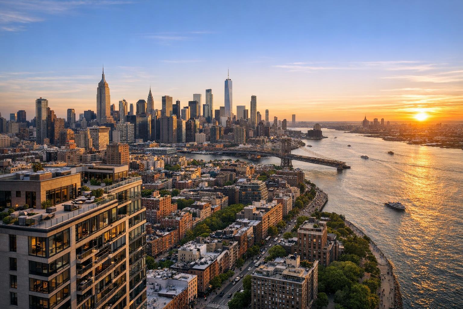
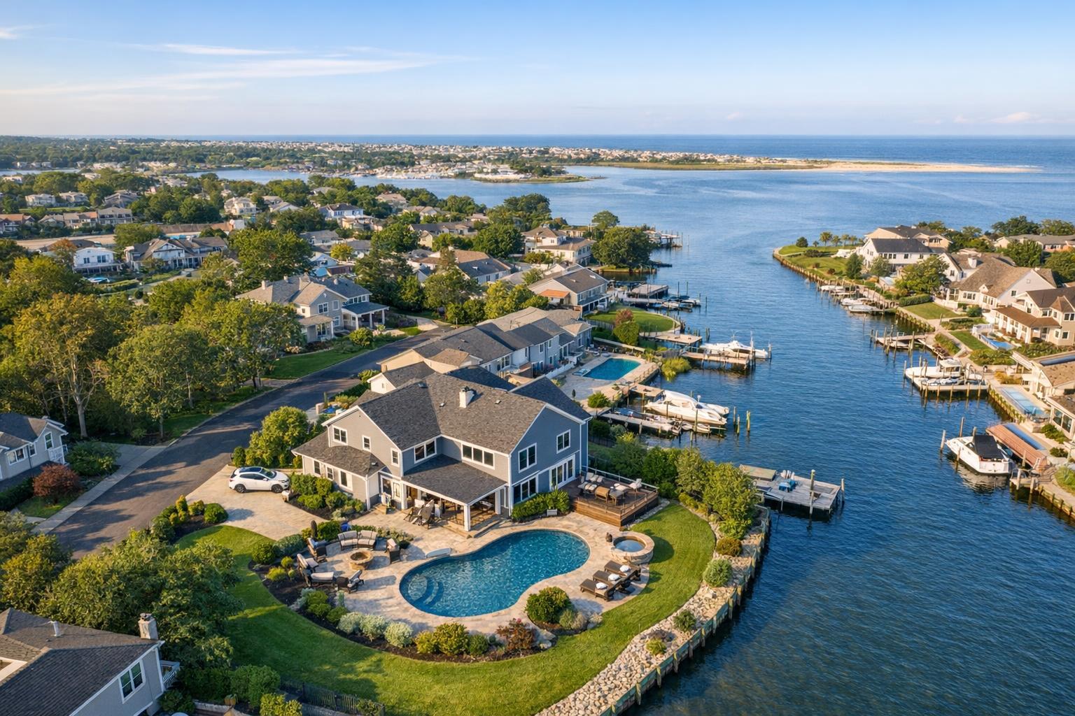
Drone photography NJ showcases a scenic view of a waterfront neighborhood with luxurious homes, private docks, and a swimming pool.

Why Drone Photography NJ is Transforming Real Estate Listings in 2024
Drone photography in NJ is rapidly changing the way real estate professionals present listings, offering a vantage point that traditional ground-level images simply can’t match. In a market as diverse as New Jersey, aerial real estate photography is more than a trend — it’s become an essential tool for highlighting property settings, showing off lot size and outdoor amenities, and helping buyers contextualize what makes a home or commercial location special.
Beyond the Street View: Why Aerial Photography Matters
Most buyers are introduced to a property through carefully staged interior and exterior photographs. But what happens when a traditional photo can’t show how the backyard flows from the kitchen, the proximity to scenic water, or the real scale of commercial parking? That’s where drone photography real estate coverage delivers.
Aerial images do more than just provide eye-catching overhead shots. They help buyers see:
- Lot layout, boundaries, and the relationship between the property and key features
- How amenities like pools, patios, or outdoor kitchens are integrated into the space
- The extent of tree cover or mature landscaping
- The connection to water, parks, golf courses, or downtown streets
- Easy access to main roads, transit, or neighborhood landmarks
This wider context is hard to capture from the ground. Using a mix of interior, exterior, and aerial images allows agents to tell a more complete property story, setting clear expectations for buyers before they set foot on-site.
The Jersey Perspective: What Makes Drone Media Especially Useful Here
New Jersey’s real estate landscape is varied, with suburban neighborhoods, waterfront properties, estate homes, and commercial sites often tucked close together. Each type comes with its own visual priorities.
- Suburban yards and outdoor living: Many buyers are searching for generous outdoor spaces — not just square footage, but how patios, vegetable gardens, and lawns flow together. Aerial photography makes it easy to understand the setup at a glance.
- Waterfront and Shore homes: When access to the bay, river, or ocean is a selling point, a drone can show the direct link from backyard to shoreline, the path to a private dock, or the view orientation from the deck.
- Large homes and new builds: Estate properties, new construction, or residences with distinctive architecture benefit from angles that showcase the full footprint, rooflines, and relationship to open space.
- Retail and commercial properties: Commercial listings often need to show parking lots, loading areas, and street access. Wide, elevated images clarify scale and connectivity in a way surveys or plans cannot.
Effective Drone Media: More Than Just a Pretty Picture
Not every drone shot adds value. A focused, property-specific approach works best, with images that answer a clear question:
- Does the home’s position on the lot stand out?
- Are outdoor amenities truly a selling point?
- Would a broader neighborhood view help buyers understand the setting?
The best aerial collections typically include:
- A front elevated image showing curb appeal and lot positioning
- Rear or side angles for backyards or patios
- Wide context shots capturing water, parks, or neighborhood features
- Targeted views emphasizing landscaping, rooflines, or key architectural details
Height and composition are crucial. Too high, and the property disappears. Too low, and you lose the big-picture context. Effective drone photography balances context with clarity and keeps the property as the central subject.
Getting the Most from Aerial Content
Aerial media works best when it’s part of an overall listing strategy rather than a generic add-on. Consider what a potential buyer needs to understand, then plan the images or video to answer those points.
Agents can use drone images and video to:
- Lead with an aerial when the setting is a prime selling feature
- Mix aerials with traditional photos to add visual depth to a listing
- Use short drone video clips as intro or transition moments in property videos
- Highlight amenities or location context in social media and marketing campaigns
- Share broader perspectives in broker presentations, property websites, or emails
It’s worth noting: drone visuals are most powerful when paired with professional ground-level photography, which remains essential for capturing interior spaces, finishes, and the feel of daily life inside the home.
For those interested in seeing how stills and aerial media can work together, you can review examples of real estate photography services for New Jersey.
Preparing Your Property for Drone Photography
Preparation impacts aerial results just as much as interiors. Before the appointment:
- Remove vehicles from driveways and clear away bins, toys, or maintenance items
- Straighten and stage patio furniture, open umbrellas if appropriate
- Clean up pool areas and surrounding landscaping
- Mow the lawn and tidy up outdoor plantings or fallen leaves
- Identify special features like docks, roof decks, or rear access to guide the shoot
Letting the production team know what matters most — whether it’s a water view, outdoor kitchen, or commercial site entrance — will help shape the session.
When is Drone Usage Feasible?
Drone operations involve more variables than a handheld camera. Flying a drone for real estate must comply with FAA regulations, airspace restrictions, current weather, available site access, and pilot discretion. Not every listing will be a candidate for aerial coverage. Dense neighborhoods or nearby airports may limit flights, and special permits outside standard FAA requirements are the client’s responsibility. Feasibility is determined one address at a time.
If you’re considering aerial media for a property, early communication about location and any known airspace limitations is recommended.
Choosing the Right Media Package
The needs of each listing are different. Some benefit from a gallery of still aerial photos, while others call for a walk-through video that’s anchored by sweeping exterior clips.
RealtaSnap offers several drone media packages, all tailored specifically for real estate marketing:
- Drone photography: 10 HDR professionally edited images, including blue-sky replacement, for $209
- Drone video: 1-minute final 4K aerial video, professionally edited, for $229
- Photo + video combo: 10 HDR images and a 1-minute 4K video, bundled for $299
Still photos are often ideal when you want to emphasize lot characteristics, outdoor amenities, or general scale. Video is especially valuable for listings where the approach, flow, or dramatic reveal adds to the story of the property.
Aerial media can also be paired with traditional ground-level photos for a full spectrum of listing content. Explore options and sample media on www.RealtaSnap.com.
Is Drone Media Right For Every Listing?
Not every property benefits equally from an aerial perspective. Drone services are most valuable when they help answer a buyer’s likely questions or reveal features that wouldn’t be obvious from ground-level images. Properties that tend to benefit most include:
- Homes with large, unique, or especially scenic lots
- Properties near water, beaches, or marinas
- Listings with extensive outdoor amenities: pools, terraces, outdoor kitchens
- Houses with distinctive architectural scale or rooflines
- Commercial sites needing to show access, parking, or footprint
If the view from above clarifies what makes a property special, then aerial real estate photography can be a key part of the listing. In other cases, strong ground-level photos may be the smarter investment.
Bringing Properties to Life Online
In a fast-moving real estate market, buyers have little patience for listings that leave questions unanswered. A well-planned mix of interior, exterior, and aerial media helps turn curiosity into real interest, showing a property’s story with clarity and context.
If you have questions about whether aerial images are a good fit, or you’re ready to book, you’re welcome to reach out or view service details and examples at www.RealtaSnap.com.
FAQ
Question: Does every New Jersey real estate listing need drone photography?
Answer: No, drone images are most helpful for properties where an aerial view highlights outdoor features, location context, or lot characteristics. Listings with minimal exterior appeal may benefit more from strong ground-level photography.
Question: Can you fly a drone on any property in New Jersey?
Answer: Not necessarily. Factors like FAA airspace rules, weather, site safety, and local restrictions all influence feasibility, and flights are evaluated on a case-by-case basis. Authorization or permitting may be needed in some locations.
Question: Should I choose drone photos, video, or both for my listing?
Answer: It depends on how you plan to market the property. Photos are excellent for galleries and property sites, while video adds value when movement, flow, or setting are important to the story. Many agents opt for both when aerial context is a key feature of the listing.
If you have an upcoming property and want to learn more about aerial media, we’d be happy to help. See services, pricing, and sample work at www.RealtaSnap.com.