How Drone Photography Elevates NYC Real Estate Listings
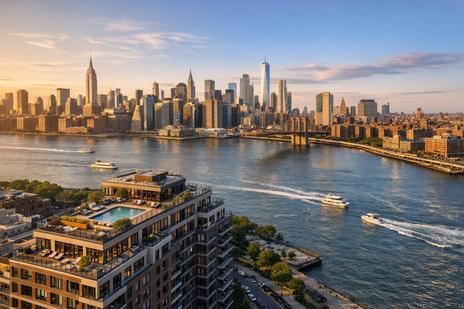
Drone photography captures a vibrant NYC skyline at sunset, with a prominent view of the river, buildings, and boats.

How Drone Photography Elevates NYC Real Estate Listings
Drone photography in NYC offers something that ordinary ground-level images often can’t: a fuller story for every listing. Whether you’re an agent, broker, or property owner, aerial real estate photography brings a distinct advantage, showing a property’s location, exterior features, and unique neighborhood context in a way that grabs attention and helps listings resonate.
Let’s talk about how drone photography reshapes real estate marketing in New York City, where it works best, and how to prepare for a successful shoot.
Why Aerial Real Estate Photography Stands Out
With so much happening at street level in New York, it’s easy for the bigger picture to get lost. Standard interior photos highlight finishes, light, and layout, while classic exterior shots catch the entrance and immediate curb appeal. Drone images add the missing layer—they place the property in context.
A thoughtful aerial view can communicate at a glance:
- The relationship between rooftop spaces, gardens, and terraces
- Architectural style and building scale impossible to capture from the ground
- Proximity to parks, water, transit, or high-profile streets
- How a building sits within its block or development
- Outdoor amenities—pool, parking, patios, or shared grounds
- Sweeping views or signature skyline moments
This is especially valuable in NYC, where the backdrop is often as significant as the building itself. Consider a Brooklyn townhouse with a private garden or a penthouse brimming with terrace space and skyline views. Aerial images let viewers immediately grasp what makes the listing unique.
When Drone Photography Makes Sense
Not every real estate marketing campaign requires a drone. But for properties with meaningful exterior elements or a setting that’s part of the appeal, aerial media can become a key selling tool. Some great opportunities for drone photography include:
- Townhouses and brownstones: Show off a full roofline, back garden, or the connection between outdoor and indoor spaces.
- Penthouses and apartments with terraces: Capture how outdoor areas blend with skyline or waterfront views.
- Waterfront and view-oriented listings: Help buyers see nearby parks, marinas, and open vistas—no imagination required.
- Commercial, multifamily, or development sites: Communicate the scale of a building and highlight access points, parking, and the surrounding neighborhood.
- Suburban and New Jersey homes: Larger lots, unique outdoor amenities, and quiet streetscapes are clearer from above.
Properties in dense blocks or areas with a strong sense of place gain most from this approach. Aerial photos should always serve the story of the property—images just showing rooftops with little context add less value.
Navigating the NYC Drone Landscape
Shooting aerial real estate photography in New York City comes with its own set of challenges. Rules around airspace, nearby airports, local restrictions, pedestrian safety, and weather all play a part. Not every address is flyable. That’s why conversations about aerial coverage should start early, especially for listings near airports, event venues, or busy streets.
Sometimes, roof access is necessary to safely launch or get the ideal angle—especially with high-rise properties. Without it, some drone shots simply won’t be practical. Everything has to comply with FAA Part 107 regulations and any local requirements, and flight plans are confirmed case by case.
When in doubt, a professional operator will review every address for feasibility before confirming the shoot. Setting expectations up front avoids surprises.
Tips for a Smooth Aerial Shoot
Getting the best results from drone photography is usually about a little advance planning. Here’s how to prepare:
- Arrange access ahead of time: If you need roof, terrace, parking, or other secured exterior access for key shots, confirm permissions, keys, or elevator use before the appointment.
- Tidy up outdoor areas: Remove items like trash bins, hoses, delivery boxes, or cars that can distract from the images.
- Think about sun and shadows: Light changes throughout the day, and tall buildings in NYC cast long shadows. Choose times that showcase your property’s best angles.
- Prioritize what matters: Let the main features guide which drone shots to request—terraces, gardens, neighboring parks, or even a dramatic skyline.
Remember, aerial images should complement your listing’s main gallery, not overload it with redundant angles.
Photo, Video, or Both?
How you use aerial media depends on the listing’s needs and your marketing plan.
- Photos work best for gallery images, websites, brochures, and social media—giving viewers time to study details like landscaping, rooftop decks, or neighboring landmarks.
- Video helps show movement and scale, making it a good fit for high-impact stories (think: sweeping approaches, panoramic reveals, or transitions from block to building).
RealtaSnap offers drone photo packages (such as 10-image HDR sets), a one-minute 4K video option, as well as combined packages if you want both stills and video as part of your listing presentation. You’ll also get practical features like optional blue-sky replacements for those overcast days. To explore specific aerial media options, visit the RealtaSnap drone services page.
What to Look For in a Drone Provider
Not all aerial photography is equal, and not every operator is set up for real estate work. When considering a provider, ask about:
- FAA Part 107 licensing and airspace vetting
- Prior experience with real estate, not just general aerial footage
- Understanding of site-specific safety and flight challenges
- Clear difference between the types of deliverables (stills, video, or both)
- Policies on roof, terrace, or special-access points
- How weather and access affect scheduling
- Commitment to marketing-ready media (not inspection or survey photos)
A reputable provider will confirm that a flight is both permitted and practical before booking.
How to Book Drone Photography in NYC or New Jersey
For most real estate professionals, it’s easiest to plan aerial media at the same time as your standard listing shoot. This gives everyone a chance to set up access, prioritize features, and avoid juggling two separate appointments.
At RealtaSnap, you can schedule drone photography on the same platform as your regular photoshoot. Just choose your services, enter the listing address, add access details or special notes (like roof access or required shots), and pick a time that works for you from the calendar. Payment is handled online, and availability is always confirmed before anything is finalized. Learn more or start scheduling at RealtaSnap’s online booking page.
RealtaSnap provides drone photography services across all five boroughs of New York City, statewide in New Jersey, and with limited availability in Westchester County and some Upstate New York locations. Each address is reviewed for feasibility based on location, weather, safety, and local restrictions.
Putting Your Listing in Context
For listings with a compelling exterior story—maybe it’s a view, garden, roof deck, or prime location—drone photography can help prospective buyers or tenants not just see, but understand the property. When ground-level photos fall short or the setting is hard to explain, the right aerial image can make all the difference.
If you’re preparing a new NYC or New Jersey listing and think the location or outdoor features are worth showing from above, consider adding drone photography to your marketing plan. RealtaSnap’s online booking and specialist support make it simple to get started.
We’d love the opportunity to help with your next listing. Learn more at www.RealtaSnap.com.
FAQ
Question: Is drone photography possible at every NYC property?
Answer: Not always. Each site is reviewed for airspace restrictions, safety, access, and weather. Some locations need special permissions or just aren’t suitable for drone flights.
Question: Do I always need roof access for a drone shoot?
Answer: Not necessarily, but roof or terrace access can improve feasibility—especially for high-rises or buildings where street-level launches aren’t possible.
Question: What does it cost to add drone media to my listing?
Answer: RealtaSnap’s drone packages start at $209 for a 10-photo HDR set, $229 for a one-minute 4K drone video, and $299 for a combined photo and video package. All pricing is subject to on-site and flight feasibility.