How Drone Photography Is Transforming NYC Real Estate Marketing
Drone photography captures a sprawling view of New York City's skyline with rows of red-brick buildings in the foreground.

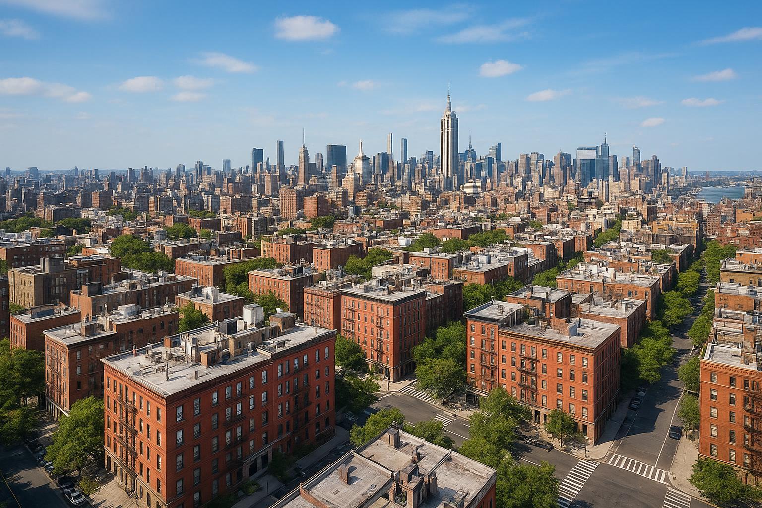
Drone Photography NYC: Transforming Real Estate Media With Aerial Photography In New York City
Introduction
In today’s ultra-competitive market for real estate photography in NYC, drone photography NYC is redefining what’s possible for real estate media. As immersive visual storytelling becomes the standard, savvy agents and property marketers are turning to aerial photography New York City professionals to elevate their listings—and their results. This blog explores how the right drone strategies unlock stunning visual appeal, deeper buyer engagement, and fresh ways to showcase both properties and their surrounding neighborhoods. You’ll also gain insight into recent trends, essential compliance considerations, and how pros like RealtaSnap make a pivotal difference in New York City’s fast-moving market.
The Problem
Urban real estate listings face unique challenges—limited ground-level access, tight competition, and, too often, visuals that just don’t stand out in crowded online feeds. Standard photos capture interiors nicely, but struggle to communicate a sense of scale, outdoor amenities, or the true appeal of a building’s architecture and setting. And with buyers increasingly shopping online and wanting “the full picture,” missing these details means missing potential buyers.
What’s more, the NYC skyline, intricate neighborhoods, and surrounding amenities are part of what sells city properties—yet most listings fail to show how a property fits into its broader community. This leaves agents fighting for attention with visuals that simply can’t compete.
How RealtaSnap Solves It
RealtaSnap leverages cutting-edge drone photography and real estate media to capture perspectives that traditional photography simply can’t. Every one of our aerial photography New York City images reveals not just the property, but its neighborhood, vistas, and real-life context. Whether it’s a modern high-rise, a classic brownstone, or a unique mixed-use space, RealtaSnap helps listings reach new heights—both literally and figuratively.
With expert drone pilots and creative visual storytellers, RealtaSnap’s workflow is built for NYC’s specific challenges: rooftop access, tightly packed blocks, and fast turnarounds. Our approach blends advanced aerial imaging, compliance-first flight planning, and post-production polish to deliver photos and video that make your listings memorable.
Getting started is simple. Just select from our a la carte or bundle packages (including drone photo, video, or both), and count on fully edited results—delivered within 24 hours. You can review our drone service details and samples, or jump straight to scheduling at https://www.realtasnap.com/drone-photography-videography-nyc【20:2†RealtaSnap_URL_List_MASTER.docx】.
Benefits of Choosing RealtaSnap
- Expert drone pilots fully compliant with NYC airspace regulations
- Stunning 4K HDR aerial photos and videos that give buyers a sense of place
- 24-hour turnaround on all edited drone content
- Blue sky and retouching options for flawless visuals
- Simple, transparent pricing: $209 for 10 HDR photos, $229 for 1-minute 4K video, or $299 for both*
- Ability to showcase nearby amenities, outdoor spaces, and neighborhood appeal
- Feasibility checks for rooftop access or restricted airspace areas
- Seamless integration with all other RealtaSnap real estate media offerings
- Fast, intuitive online scheduling with real-time availability
- Dedicated support ready to address unique NYC logistical needs
*All prices and information are subject to change. Information is deemed reliable but not guaranteed. See our full rate sheet for details.【20:1†RealtaSnap_Rate_Sheet_MASTER.docx】
Comparison With Competitors And Traditional Providers
Unlike many drone photographers who struggle to navigate NYC’s strict regulations and cluttered urban environments, RealtaSnap’s local experience means you won’t waste time with failed flights or unapproved pilots. Our team understands FAA Part 107 requirements, airspace permitting, and the practicalities of flying in the city’s controlled or restricted airspaces. With RealtaSnap:
- You get expert pilots willing and able to secure correct authorizations when possible.
- Your timeline isn’t delayed; average delivery is within 24 hours.
- Every photo is edited for maximum impact—no generic fly-overs or unretouched images.
- Scheduling is user-friendly, and all logistics (including rooftop coordination) are handled transparently【20:7†RealtaSnap_Service_Execution_Policy_MASTER.docx】.
- Traditional photographers simply can’t match the immersive, high-impact results of aerial listings in NYC.
Trends, Best Practices, And Compliance Essentials
Trends in NYC Real Estate Drone Photography:
- Interactive aerial videos showing walkability, parks, and cityscape context.
- Neighborhood “fly-throughs” letting buyers see the property and its attractions at once.
- Stacked media strategies—combining floor plans, interior walkthroughs, and drone for a complete marketing package.
- Social cuts and teaser videos optimized for Instagram and TikTok.
Best Practices For Agents:
- Always check drone operator credentials—FAA Part 107-certified only.
- Coordinate building access and, if possible, secure rooftop permissions for better flight feasibility.
- Request sky replacement, color corrections, and post-production polish to maximize listing appeal.
- Use multi-level storytelling: start with wide neighborhood shots, transition to property features, finish with highlight reels for social.
Compliance Considerations:
- All drone operations in NYC must comply with FAA Part 107 rules and local airspace restrictions.
- Some flights (especially in Manhattan) call for advanced airspace authorization—RealtaSnap’s pilots proactively handle this.
- Special permits (beyond standard airspace approval) are the responsibility of property owners; RealtaSnap does not pull NYPD or municipal event permits.
- _Not all buildings or areas are guaranteed flyable, but RealtaSnap will advise and assist in alternative visual solutions if needed._【20:7†RealtaSnap_Service_Execution_Policy_MASTER.docx】
Why RealtaSnap Stands Out
RealtaSnap isn’t just another media vendor—it’s a specialized partner for New York City real estate professionals who need fast, reliable, and eye-catching content. Our images draw buyers in, our price points are clear, and our experts understand every step of working—legally and creatively—in the city’s most competitive neighborhoods.
- Local expertise ensures smoother compliance and logistics every time.
- Lightning-fast turnaround and responsive editing.
- Customized bundles so you only pay for what you need.
Explore more on https://www.realtasnap.com/drone-photography-videography-nyc【20:2†RealtaSnap_URL_List_MASTER.docx】, or browse the full suite of NYC real estate media solutions at https://www.realtasnap.com/real-estate-photography-nyc.
Conclusion & Call to Action
NYC’s real estate market won’t wait—and neither should your listings. Drone photography NYC gives you the visual ammunition to rise above the fray, spark immediate interest, and put every property in its best light. RealtaSnap’s aerial photography New York City services are designed for agents and marketers who expect more: better quality, sharper storytelling, and faster results.
Ready to see your listings from a new angle? Schedule a session today at www.realtasnap.com or dive into our dedicated drone photography services for a complete media upgrade.
Frequently Asked Questions
1. Isn’t drone photography in NYC hard to schedule due to strict regulations?
It can feel overwhelming to navigate city rules, but RealtaSnap handles all required airspace checks and FAA compliance, making booking quick and simple.
2. Are professional drone photos really worth the cost for urban listings?
Some think aerial shots are a luxury, but RealtaSnap’s transparent pricing and multi-photo bundles make the upgrade accessible—and listings prove it drives engagement and higher interest.
3. What if my building or property isn’t in a typical fly zone?
Worried your location may be tricky? RealtaSnap reviews every project’s airspace and access, and if drone flight isn’t feasible, we guide you on top alternative media solutions.
All prices and information are subject to change. Information is deemed reliable but not guaranteed.