How Drone Photography Transforms Real Estate Listings in NYC and NJ
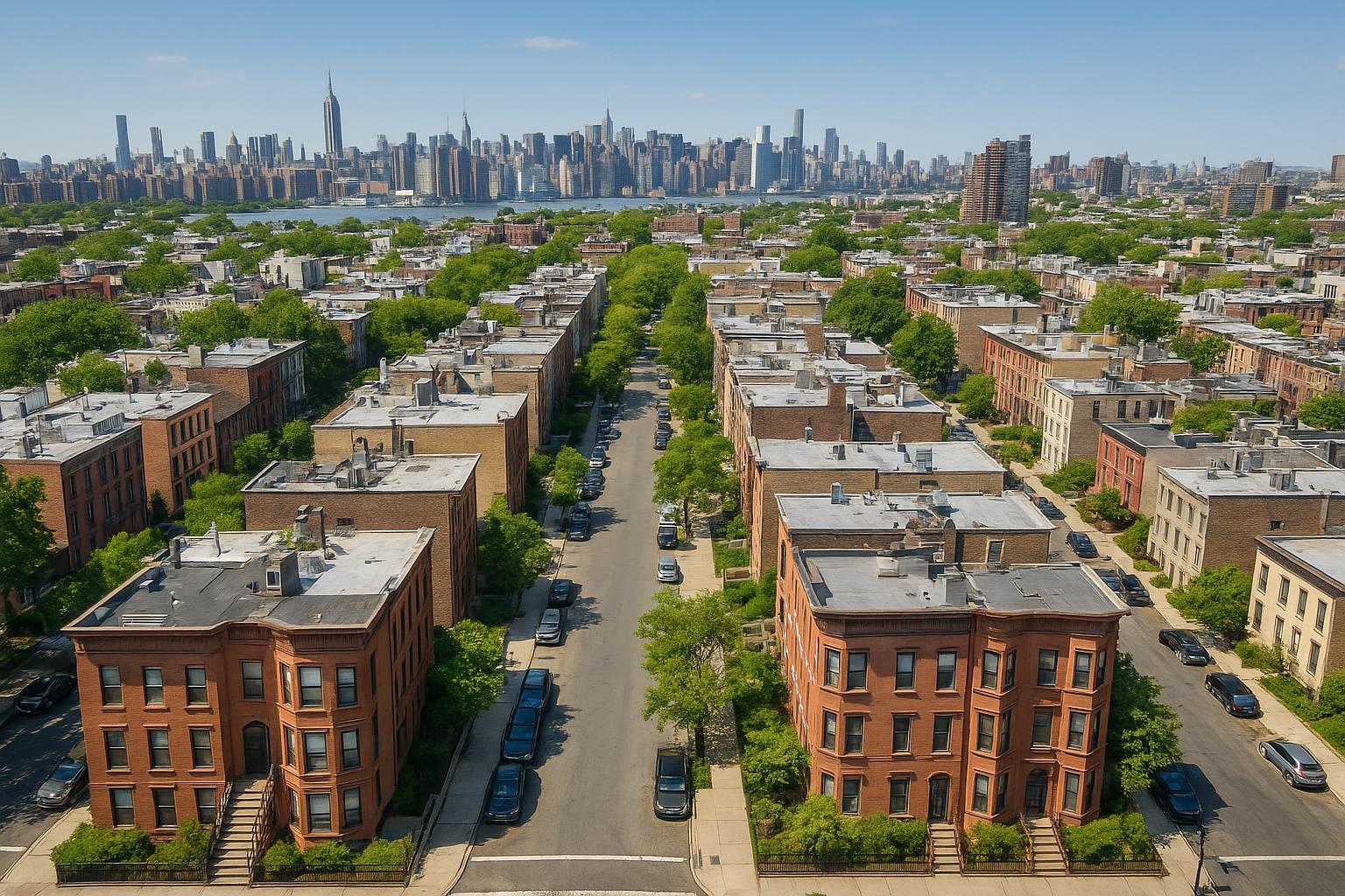
Drone photography captures an aerial view of a residential neighborhood with rows of brownstone buildings and a distant city skyline.

How Drone Photography Is Transforming Real Estate Marketing in NYC and New Jersey
In today’s highly competitive property market, real estate photography in NYC is evolving rapidly, and drone photography real estate is leading the charge. Whether you’re showcasing penthouses in Manhattan or commercial developments across New Jersey, the strategic use of drone photography nyc and aerial real estate photography is giving realtors, developers, and property owners new tools to make their listings stand out.
The Problem: Flat Listings and Limited Perspectives in the Urban Market
Traditional real estate images are often limited to ground views, making it hard for buyers to understand a property’s scale, surroundings, or unique selling features—especially in dense urban environments like NYC or sprawling New Jersey suburbs. This one-dimensional approach can weaken your listing, resulting in lower engagement, fewer showings, and missed opportunities to capture a buyer’s imagination. Commercial and luxury properties in particular lose out on their most salient attributes: location, lot size, and proximity to landmarks or amenities.
How RealtaSnap Solves It: Elevating Listings with Professional Drone Services
RealtaSnap harnesses the power of drone photography real estate to bring a breathtaking new perspective to both residential and commercial properties. We serve all five NYC boroughs and statewide New Jersey, making professional drone imagery and video accessible to brokers, agents, and owners throughout the region【20:13†RealtaSnap_Service_Areas_MASTER.docx】.
Our skilled, FAA-certified pilots combine advanced 4K aerial imaging with a deep understanding of the unique challenges of urban flight. RealtaSnap’s approach to drone photography nyc ensures every project is assessed for safety, regulatory compliance, and optimal creative potential—delivering spectacular, high-impact visuals that set your listings apart. Our services highlight everything from architectural details to property boundaries, nearby parks, business districts, and more—giving buyers a full understanding of scale and setting with every shot.
Drone Photography Options & Transparent Pricing:
- 10 Drone Photos: $209 (1 hour), HDR quality with blue sky replacement
- 1-Minute 4K Drone Video: $229 (1 hour)
- Photo + Video Combo: $299 (1 hour, both media types included)
All prices and information are subject to change. Information is deemed reliable but not guaranteed【20:3†RealtaSnap_Rate_Sheet_MASTER.docx】.
Discover more about our full service menu at RealtaSnap’s drone photography page.
Benefits of Choosing RealtaSnap Drone Photography
- Crisp HDR aerial photos highlight property scale and surroundings
- Helps buyers visualize proximity to amenities and neighborhood features
- Increases clicks, shares, and engagement across listing platforms
- Showcases commercial spaces, retail fronts, rooftop amenities, and parking
- Compliant with all relevant FAA Part 107 regulations for safe, legal operation
- Fast 24-hour turnaround for edited images and videos
- Streamlined online scheduling and upfront, transparent pricing
- Local expertise across NYC and all of New Jersey【20:13†RealtaSnap_Service_Areas_MASTER.docx】
Comparison with Traditional and Competing Services
Unlike basic ground-level shots or DIY drone attempts, RealtaSnap brings rigorous attention to regulatory compliance, safety in dense airspaces, and creative vision uniquely tailored to NYC and New Jersey. Our FAA-certified pilots carefully evaluate every project for feasibility, obtain necessary airspace authorizations, and assess each urban site to maximize outcome and safety—even in complex, controlled areas. RealtaSnap’s faster delivery and client-focused communication create a smooth, worry-free experience from start to finish, making us the top choice for modern real estate marketing【20:5†RealtaSnap_Service_Execution_Policy_MASTER.docx】.
Drone Photography in NYC: Navigating Urban Challenges & FAA Regulations
Operating drones in NYC, Jersey City, and major urban hubs presents unique technical and legal hurdles. The Federal Aviation Administration (FAA) requires all real estate drone pilots hold a current Part 107 certification and adhere to strict rules for flights, especially near airports, in restricted zones, and above certain heights. RealtaSnap’s team of insured, experienced pilots handle regulatory complexities—assessing each property in advance and declining assignments if legal or safety standards cannot be maintained. We do not acquire municipal or NYPD special permits; clients are responsible for any additional permitting beyond FAA requirements as needed【20:5†RealtaSnap_Service_Execution_Policy_MASTER.docx】.
What to Expect from a RealtaSnap Drone Real Estate Shoot
From the moment you book through our website or app, you’ll enjoy a streamlined process:
- Easy online service selection and calendar-based scheduling
- On-site pilot safety assessment and compliance with FAA regulations
- HDR aerial photos and cinematic 4K video
- Fast 24-hour turnaround on fully edited deliverables
- Optional add-ons: virtual twilight, advanced editing, and more
You’ll receive imagery that captures your property’s scale, character, and natural context, giving your listing an emotional and competitive edge.
Ready to see your listings soar? Learn about our full-range drone media and book your next shoot at RealtaSnap’s NYC drone photography page.
Frequently Asked Questions
1. Is drone photography legal in New York City and New Jersey?
It’s common to worry about compliance in urban areas. RealtaSnap’s FAA-certified pilots operate fully within FAA Part 107 guidelines, ensuring all flights are legal and safe for real estate marketing.
2. Are aerial real estate photography services expensive or time-consuming?
Many agents expect high prices and long waits. RealtaSnap offers affordable, transparent pricing and delivers edited drone media within 24 hours for most NYC and NJ listings.
3. Can drone photography work for every property or building?
Some areas do have airspace or permitting restrictions. RealtaSnap evaluates each site for safety, compliance, and feasibility, recommending the best solution—even if a location can’t be flown.
Looking to transform your next New York or New Jersey listing with stunning aerial views? Discover all your options—and get started fast—at RealtaSnap’s homepage【20:2†RealtaSnap_URL_List_MASTER.docx】.