Showcasing Properties from Above: Elevate Listings with Drone Photography NJ
Elevate property listings with stunning aerial views using drone photography NJ, showcasing a beautiful suburban neighborhood.

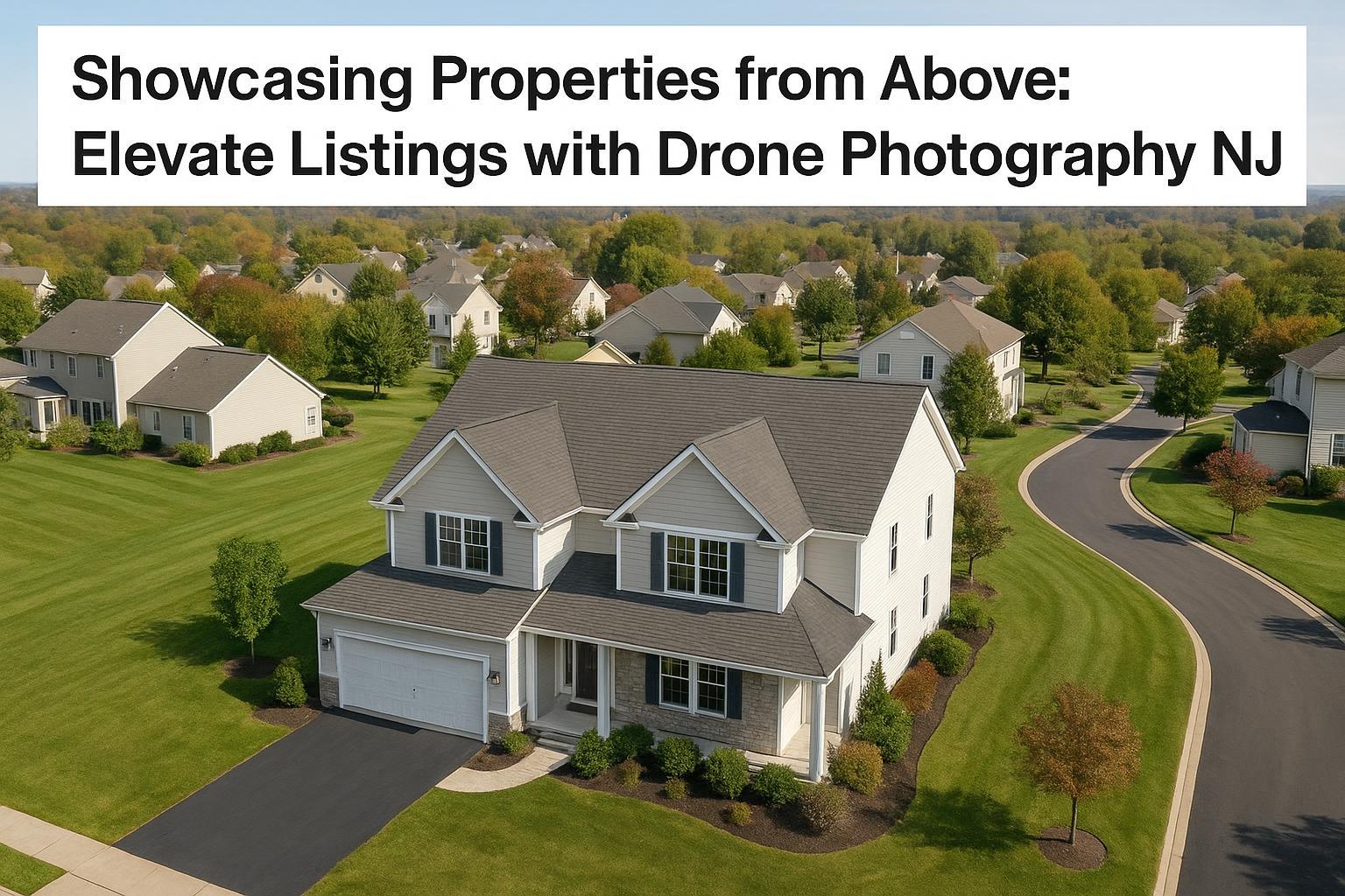
Drone Photography NJ: Transforming Real Estate Marketing with RealtaSnap
Introduction
Drone photography NJ has completely redefined real estate photography in NYC and New Jersey, offering a dramatic new perspective on every listing. Today, agents and sellers who want to make an impact are turning to professional aerial real estate photos for an edge that buyers simply can’t ignore. In this post, you’ll learn how drone photography elevates listing visibility, the specifics of FAA and local regulations, the unique benefits for New Jersey properties, and why RealtaSnap is the top choice for stunning, safe, and fast aerial media.
The Problem: Why Traditional Marketing Falls Short
Surface-level listing photos are everywhere—shots from sidewalks, low angles, or hasty snapshots that never quite capture a property’s true character. In a saturated market, buyers and renters now expect a deeper, more immersive experience. Basic photography often fails to:
- Showcase the full property and surroundings.
- Convey scale, amenities, and location advantages.
- Stand out in crowded online listings.
- Build an emotional connection through stunning perspectives.
Sellers and agents in New Jersey face unique challenges: larger lots, varied landscapes, and a diverse set of architectural styles need to be highlighted accurately and attractively. Standard ground shots simply can’t do justice to sweeping yards, pools, water views, or exclusive communities.
How RealtaSnap Solves It
RealtaSnap specializes in drone photography real estate services, providing high-resolution aerial real estate photos and cinematic videos that transform the way properties are presented. Every shoot is led by Part 107-certified pilots and visual storytelling experts, ensuring legal compliance, safety, and breathtaking results. Whether for single-family homes, luxury estates, or commercial properties, RealtaSnap delivers:
- 4K and HDR drone photos and video for maximum clarity.
- Blue sky replacement and image retouching to guarantee perfect conditions.
- Coverage of both the property and its surroundings, highlighting proximity to parks, beaches, highways, and amenities.
- Marketing-focused edits delivered in as little as 24 hours.
Benefits of Drone Photography with RealtaSnap
- Showcase sweeping landscapes and architectural details in one shot.
- Attract more views on online listings and social media.
- FAA-compliant flights by experienced, insured drone pilots【20:7†RealtaSnap_Service_Execution_Policy_MASTER.docx】.
- Dramatic video and photos, delivered within 24 hours.
- Add-ons like blue sky replacement, clutter removal, and virtual staging.
- Stunning aerial real estate photos for New Jersey's unique market.
- Flexible packages for every size and type of property.
- Transparent, a la carte pricing—no long-term contracts needed【20:0†RealtaSnap_Rate_Sheet_MASTER.docx】.
- Integrated with full real estate photo/video packages for cohesive marketing.
Safety, Compliance, and Regulations You Can Trust
Every real estate drone operation with RealtaSnap follows strict FAA Part 107 guidelines, as well as relevant New Jersey airspace and municipal rules. Key protections include:
- Thorough pre-flight evaluation for safety and airspace restrictions.
- All pilots certifiably licensed and insured.
- Full client transparency if controlled airspace or special permits are required.
- Operations focused solely on real estate marketing—never for architectural surveying or engineering use.
- Roof access and local restrictions are evaluated case by case, keeping both pilots and properties safe.
Comparison: RealtaSnap vs. Traditional & Competing Drone Providers
While other drone photographers may promise fast turnarounds or low prices, RealtaSnap brings a combination of professional experience, visual storytelling, and hands-on real estate knowledge. Here’s where we stand out:
- Faster Delivery: Edited aerial images and videos are returned within 24 hours, not days.
- Superior Quality: Every shoot uses true 4K/HDR camera gear and marketing-driven composition.
- Enhanced Safety: Only fully certified, insured drone pilots, with every flight legally cleared and carefully planned.
- Seamless Experience: Book drone, interior, and video services together—one schedule, one team, one invoice.
- No Hidden Fees: Upfront, transparent pricing for every service, with clear add-on options.
Value and Pricing: Drone Photography Packages
RealtaSnap’s drone offerings are designed for flexibility and value:
- 10 HDR Drone Photos: 1 hour — $209 (includes blue sky replacement)
- 1-Minute 4K Drone Video: 1 hour — $229
- Photo + Video Bundle: 1 hour — $299 (10 HDR photos + 1-min video)
_“All prices and information are subject to change. Information is deemed reliable but not guaranteed.”_【20:1†RealtaSnap_Rate_Sheet_MASTER.docx】
Full pricing and package details are available on the RealtaSnap NJ Drone Photography and NJ real estate photography services pages.
Why RealtaSnap Stands Out
RealtaSnap isn’t just a “drone operator”—it’s your end-to-end real estate media partner for NYC and NJ. Each project is approached with an eye for narrative, using aerial real estate photos alongside professional interiors, 3D virtual tours, and full video production. Speed, safety, and true marketing expertise are always the priority, ensuring your listing is both beautiful and compliant.
Conclusion & Call to Action
Aerial real estate photos are no longer optional—they’re essential for selling faster, impressing buyers, and commanding a premium in the New Jersey real estate market. With RealtaSnap, you get the peace of mind that every flight is safe, every image is striking, and every listing tells the right story. Ready to see your next listing from breathtaking new heights? Explore the full suite of drone photography and videography services at RealtaSnap and transform your marketing today.
Frequently Asked Questions
1. Isn’t drone photography risky or not allowed everywhere?
It’s easy to worry about drone safety or regulations, but RealtaSnap uses only FAA-certified pilots who carefully check each site for legal and airspace clearance. Your listing is always captured safely and professionally.
2. Are professional aerial real estate photos really worth the investment?
Some agents hesitate about cost, but RealtaSnap’s transparent pricing and rapid delivery ensure you always maximize listing impact, attract more qualified buyers, and close faster.
3. What happens if my property is in restricted or controlled airspace?
You might think drone shoots are impossible in these areas, but RealtaSnap reviews each location in advance. If proper authorization is available, we’ll handle the details—if not, we’ll let you know upfront, so there are no surprises【20:7†RealtaSnap_Service_Execution_Policy_MASTER.docx】.
Ready to give your listing the view it deserves? Learn more and book now with RealtaSnap.