Elevate Your Listings: A Complete Guide to Drone Photography in NYC Real Estate
Drone photography captures New York City’s skyline from above a neighborhood with rows of red brick buildings and tree-lined streets.

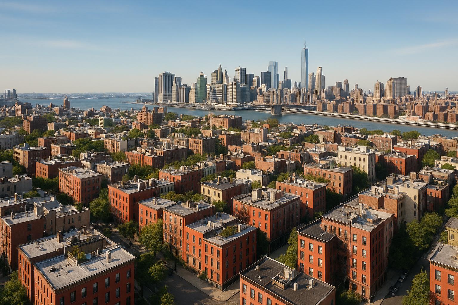
Drone Photography NYC: Elevate Your Real Estate Listings with RealtaSnap
Every exceptional listing starts with bold, captivating visuals—and drone photography NYC is redefining what’s possible in real estate marketing. As the digital-first economy drives buyers and investors to search online, high-flying aerial real estate photography sets your property apart, offering that essential edge for both residential and commercial listings. In this guide, discover how expert drone photography real estate services—including RealtaSnap’s fully compliant, creative solutions—can transform your NYC property’s appeal, maximize your marketing ROI, and ensure total peace of mind.
The Problem: Breaking Through the NYC Real Estate Noise
New York City’s property market is one of the most competitive and visually saturated in the world. With thousands of listings debuting every week, standard photos—no matter how professional—often blend into the background. Tight spaces, sprawling developments, dramatic cityscapes, and luxury penthouses all demand more than traditional ground-level shots.
Without compelling aerial views, key selling points get lost:
- Urban context & neighborhood proximity
- Architecture and lot dimensions
- Amenity layouts—rooftops, pools, and gardens
- Unique viewpoints for high-rise or multi-family complexes
DIY drone attempts, meanwhile, can’t match expert pilots or professional editing, and rarely navigate NYC’s complex regulations safely.
How RealtaSnap Solves It: Elevating Listings with Expert NYC Drone Photography
RealtaSnap leads the way in drone photography NYC for property marketing. Our turnkey aerial services are custom-tailored for residential and commercial listings, delivering expertly composed HDR photos and 4K video that command attention—and drive results.
What makes RealtaSnap the right fit?
- Experienced NYC-based pilots
- Adherence to strict FAA Part 107 guidelines for safe, legal operation
- Editing expertise for compelling blue sky replacement, object removal, and virtual twilight
- Knowledge of local regulations and airspace, reducing risks and delays
- A focus exclusively on real estate marketing—no distractions, just maximum visual impact
Learn more about our services at RealtaSnap Drone Photography NYC.
Benefits of Choosing RealtaSnap for Drone Photography
- Licensed, insured, and compliance-driven operations
- HDR aerials that highlight scale, curb appeal, and setting
- Eye-catching 4K video flyovers and cinematic storytelling
- Rapid turnaround—photos and video delivered in 24 hours
- Easy, transparent pricing with no hidden fees
- Add-on services like virtual twilight and social-ready video cuts
- Coverage across all NYC boroughs and New Jersey
*All prices and information are subject to change. Information is deemed reliable but not guaranteed.*【20:1†RealtaSnap_Rate_Sheet_MASTER.docx】
NYC Regulations & Permitting: What Real Estate Pros Need to Know
Drone photography real estate is highly regulated in New York City. Key points to understand:
- FAA Part 107 certification is mandatory for all commercial flights.
- NYC airspace is heavily restricted—drones cannot launch from public spaces, city parks, or sensitive locations without proper permissions.
- Many areas require air traffic control authorizations, especially in controlled or restricted airspace.
- Roof access is often necessary for safe and legal flights.
- RealtaSnap does not handle municipal, NYPD, or special event permitting; clients must obtain these if required.
- If a project needs special city permits, it may not be feasible—consult with RealtaSnap’s team for pre-project feasibility review.
Our team’s experience navigating these rules means your listing is marketed safely, avoiding legal headaches or service interruptions. We only take on assignments where high-quality results and full compliance are possible【20:5†RealtaSnap_Service_Execution_Policy_MASTER.docx】.
The Creative Edge: Why Aerial Real Estate Photography Stands Out
Classic ground-level shots can’t fully capture architectural drama, outdoor amenities, or commercial assets’ prime locations. Professional aerial real estate photography provides:
- Striking perspectives on high-rises, brownstones, and luxury condos
- Broad context for proximity to landmarks, parks, and transit
- Dramatic “hero” images that earn social shares and media features
- Dynamic video flyovers for immersive virtual tours
Especially in NYC’s dense landscape, a thoughtfully crafted aerial still or motion showcase instantly positions your client’s property as a must-see.
Best Practices: Getting the Most from Your NYC Drone Shoot
- Plan for roof or private outdoor access. Street launch is rarely permitted in NYC.
- Secure necessary permissions in advance. Ask your board, property manager, or landlord, and consult RealtaSnap for feasibility.
- Prioritize golden hour or optimal lighting. Maximize curb appeal and minimize distracting shadows.
- Communicate your marketing goals. Want to showcase landscaping? Cityscape proximity? Let your pilot know.
- Insist on professional editing. Color correction, sky enhancement, and composition are key.
Why Quality Matters: The RealtaSnap Difference
Not all drone visuals are created equal. RealtaSnap’s expert pilots and editors deliver polished, impactful results—never raw, lackluster images. Fast delivery (typically within 24 hours), HDR techniques, and expressive edits mean your listing hits the market with a premium look, fast.
Pricing Snapshot:
- Drone Photos (10 aerial HDR images): $209
- Drone 4K Video (1 minute): $229
- Photo + Video Package (10 images + 1 min video): $299
*All prices and information are subject to change. Information is deemed reliable but not guaranteed.*【20:1†RealtaSnap_Rate_Sheet_MASTER.docx】
See full service details at www.realtasnap.com.
Comparison: RealtaSnap vs. Traditional or Unlicensed Providers
RealtaSnap guarantees:
- Compliance with FAA and NYC regulations (unlicensed pilots risk major fines)
- Higher-quality HDR and 4K content compared to basic drones or phone apps
- Faster turnaround with same-day or next-day delivery
- A seamless client experience—from booking to final file delivery
- No risky shortcuts or hidden costs
Traditional photographers miss out on aerial drama—while most “cheap” drone operators can’t legally operate or edit for real estate excellence.
Ready to Elevate Your NYC Listing?
The best real estate listings in New York City demand a higher vantage point. Take your marketing to new heights with fully compliant, beautifully edited drone photography NYC from RealtaSnap. Whether showcasing a luxury penthouse, a bustling commercial site, or a unique urban home, our aerial services help your listings stand out—and sell faster.
Visit RealtaSnap Drone Photography NYC to get started, or explore all our media solutions at www.realtasnap.com. Let’s make your next listing unforgettable!
Frequently Asked Questions
1. Is using drones for real estate photography legal in NYC?
It’s easy to assume you can fly a drone anywhere in the city, but NYC has strict regulations. RealtaSnap ensures all flights are FAA-compliant and review every location for feasibility, so your project always meets legal requirements.
2. Are drone services more expensive than standard photography?
Many worry that aerial imagery will break the budget, but with RealtaSnap’s clear pricing—starting at $209 for 10 HDR images—there’s an option for every listing. All prices and information are subject to change. Information is deemed reliable but not guaranteed.
3. What if my building doesn’t allow drone flights or the airspace is restricted?
It can be frustrating when access or permitting is an issue. RealtaSnap’s team will review your site in advance to determine feasibility and suggest creative alternatives if standard drone shots aren’t possible for your listing.