How Drone Photography in NYC Elevates Your Real Estate Listings
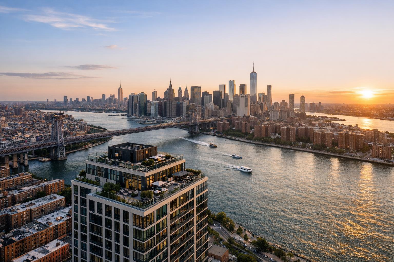
Drone photography captures a breathtaking sunset view of NYC, highlighting the majestic skyline and serene waters below.

How Drone Photography in NYC Is Transforming Real Estate Marketing
If you’re searching for the most effective way to elevate your real estate photography in NYC, drone photography NYC is quickly emerging as a game-changer for agents and property owners alike. Over the past several years, this visually immersive technology—also known as aerial real estate photography—has empowered listings to attract more buyers, stand out online, and sell faster in New York City’s competitive market. In this blog, you’ll discover why drone photography real estate is essential in NYC, how it overcomes unique local challenges, and how RealtaSnap leads as the area’s premier provider.
The Problem: NYC Properties Compete for Attention
In the heart of NYC, the real estate market is crowded with stunning listings, high-rise penthouses, and iconic brownstones. However, with thousands of properties vying for buyer attention daily, traditional ground-level photos often fall short. They struggle to capture a building’s context, the feel of a rooftop terrace, or the vibrancy of a neighborhood. For both residential and commercial real estate, the challenge is clear: conventional photography simply can’t tell the full story or highlight a property’s best features—especially in a stacked city like New York.
Buyers make quick decisions as they scroll through listings, and if a photo fails to instantly impress, the opportunity passes. In a city where “location, location, location” is everything, how can you visually communicate a property’s unique advantages, remarkable views, or dramatic skyline proximity?
How RealtaSnap Solves It: NYC Drone Photography, Done Right
RealtaSnap brings drone photography NYC to a professional, local level—delivering spectacular aerial perspectives for residential and commercial properties. Specializing in drone photography real estate, RealtaSnap creates 4K, HDR aerial images and videos that reveal each property’s story as only an expertly flown drone can.
Our certified drone pilots understand the patchwork of NYC’s airspace rules, helping you navigate strict regulations, obtain rooftop access, and ensure every project remains fully compliant. From SoHo lofts to Queens development sites, RealtaSnap's team provides both creativity and technical know-how for every shoot.
With RealtaSnap, your listings benefit from vibrant, high-resolution aerial real estate photography and video that:
- Instantly capture a property’s setting, scale, and “wow” factor.
- Showcase surrounding attractions, parks, and cityscape backdrops.
- Highlight exclusive amenities—rooftop gardens, pool decks, penthouse terraces, and more.
- Offer dramatic marketing angles that ground-level photos simply can’t achieve.
For more about our aerial services, explore our NYC drone photography & videography page.
Benefits of Choosing RealtaSnap:
- Professional FAA-certified drone pilots—fully NYC-compliant
- 4K and HDR aerial photography and video up to 60 seconds
- Stunning blue sky replacement and crisp edits every time
- Fast 24-hour turnaround on most projects
- No hidden fees—simple, a la carte pricing starting at $209 for 10 HDR photos or $299 for combined photo + video packages
- Rooftop access coordination for challenging locations
- Creative storytelling tailored for each property
- Full range of add-ons—virtual twilight, custom video, object removal, and more
- Friendly, transparent client support
- All prices and information are subject to change. Information is deemed reliable but not guaranteed.
Comparison with Traditional Services
Many traditional real estate photography services rely solely on ground-level shots, missing out on NYC’s breathtaking bird’s-eye perspectives. Some generalist drone vendors may not understand local regulations, lack the rooftop access network, or deliver slower results with less artistic flair.
By contrast, RealtaSnap offers:
- Local market expertise and true compliance for NYC’s complex airspace.
- Faster delivery—fully edited aerial media usually within 24 hours.
- Superior image quality with professional HDR, 4K capture, and optional video.
- Hands-on support, from scheduling to editing—so your listings are never left waiting.
Discover the entire range of our services at RealtaSnap’s website.
NYC Challenges & Regulatory Considerations
No city is as dynamic—or regulated—as New York. Drone operations here require FAA Part 107 certification, thorough airspace research, and sensitivity to controlled, restricted, or protected zones. Practical limitations such as:
- Dense high-rise clusters and narrow urban streets
- Varied rules for private or public building rooftops
- Proximity to airports, heliports, and NYPD operations
- Permitting for special situations (which the client—not RealtaSnap—must handle if needed)
RealtaSnap navigates these hurdles with precision. Our team assesses feasibility on a case-by-case basis. Not every property is “flyable,” but with advance planning and our intricate understanding of the local landscape, we maximize the chances of a flawless shoot.
We focus solely on real estate marketing—not architectural inspections or engineering surveys—ensuring that every project supports your listing’s visual story.
Creative Uses for Drone Media in NYC Real Estate
Aerial real estate photography stretches beyond simple overhead shots. Top uses in NYC include:
- Building fly-through videos for new developments and luxury condos
- Marketing city-view penthouses, terraces, and rooftop lounges
- Illustrating a property’s proximity to parks, waterfronts, and transit lines
- Social media “teaser” trailers with panoramic sweeps
- Highlighting commercial properties, mixed-use buildings, or large footprints
- Documenting construction progress for developers and investors
Our creative team tailors each shoot—whether a single-family colonial in Staten Island or a glass-walled high-rise in Midtown—to enhance its online presence and attract more buyers with visual impact.
Conclusion & Call to Action
In a city where standing out isn’t just an option—it’s a necessity—drone photography NYC offers the competitive edge your listings need. Aerial real estate photography not only captivates buyers but provides context, emotion, and that all-important difference between another “meh” listing and one that sticks in a buyer’s mind.
Ready to transform your NYC property marketing? Choose RealtaSnap for vibrant, compliant, expertly crafted aerial media that sets your listing apart. Elevate your next listing and experience the RealtaSnap difference—learn more or book your drone shoot today.
Frequently Asked Questions
1. Are drones legal for real estate photography in NYC?
Some worry drone flights can’t happen in NYC due to strict rules. While not every location is accessible, RealtaSnap's FAA-certified pilots know how to secure legal airspace authorization and coordinate roof access to capture spectacular aerial photos safely and lawfully.
2. Won’t drone services slow down my listing process?
It’s common to expect delays with specialty services. RealtaSnap delivers fully edited aerial media within 24 hours, ensuring your listing goes to market faster—even when aerial shots are included.
3. Is aerial photography worth the extra investment for smaller properties?
Many assume drone photography only helps luxury or commercial listings. In reality, aerial photos instantly boost any property’s appeal and spotlight location advantages—especially with RealtaSnap’s market-ready packages that fit various budgets.