How Drone Photography is Transforming NYC Real Estate Listings
Drone photography of NYC captures a stunning aerial view of the cityscape with iconic skyscrapers and the Hudson River at sunset.

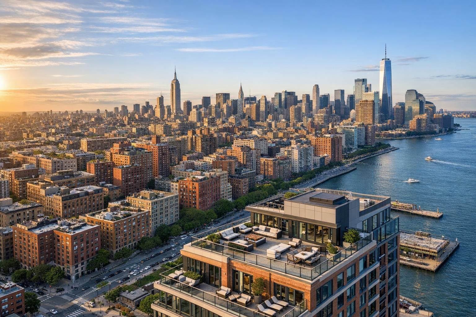
Drone Photography NYC: Elevating Real Estate Listings with RealtaSnap’s Aerial Expertise
Whether you’re marketing a chic Manhattan apartment, a Brooklyn brownstone, or a bustling commercial property, real estate photography in NYC requires a spectacular edge. That’s where drone photography NYC comes in — and how RealtaSnap is redefining property marketing throughout the city with striking aerial images and videos. In this post, we’ll explore how drone and aerial photography NYC are reshaping the way agents and sellers present properties, the core benefits for both residential and commercial spaces, and how RealtaSnap’s offering stands out in a crowded marketplace.
The Problem: Why Traditional Real Estate Photos Are No Longer Enough
The NYC real estate market is one of the most competitive in the world. Prospective renters, buyers, and investors are presented with a constant stream of listings online — meaning your property needs to grab attention instantly. Yet, the biggest challenge is that ground-level photos alone often fail to capture what makes a property truly unique:
- Street views miss rooftop amenities, stunning cityscapes, and private outdoor spaces.
- High-rise and mixed-use buildings lose their sense of scale and neighborhood context.
- Commercial properties struggle to visually demonstrate accessibility, lot size, and proximity to transit or landmarks.
Without advanced visual storytelling, even beautiful spaces can get lost in the crowd. Static images from ground level simply don’t convey the lifestyle, luxury, and dynamism that define NYC real estate today.
How RealtaSnap Solves It: Aerial Perspectives That Sell Stories
RealtaSnap takes drone photography real estate marketing to new heights. Our professional drone pilots leverage top-tier 4K HDR drones to capture images and video that reveal the full scope and setting of your listing.
Every shoot is designed to elevate your property’s profile and emotional appeal, tailored for both residential and commercial clients. Unlike generic drone services or amateur solutions, RealtaSnap’s process is specialized for urban complexity — safely navigating NYC’s airspace, optimizing light and angles, and ensuring regulatory compliance at each step.
Our comprehensive drone packages include:
- 10 HDR aerial photos, professionally edited with sky replacement if needed.
- 1-minute cinematic drone video in crisp 4K resolution.
- Photo + video packages for the most complete visual experience.
- Fast delivery — get your fully edited content in as little as 24 hours.
Combine this with our experience in urban and high-rise environments, and your listing will benefit from the dramatic visual impact only drone photography can provide.
All prices and information are subject to change. Information is deemed reliable but not guaranteed.
Benefits of Choosing RealtaSnap’s Drone Photography
- Stunning aerial perspectives of NYC’s iconic skylines
- HD drone imagery captures roof decks, terraces, and outdoor amenities
- Perfect for residential and commercial listings alike
- Cinematic 4K video tours that drive listing engagement
- FAA Part 107 certified pilots for safety and legal compliance
- Quick turnaround — full edits within 24 hours
- Blue sky replacement for vibrant, eye-catching photos
- Custom solutions for complex urban shoots
- Transparent, a la carte pricing and easy online scheduling
How RealtaSnap Outshines Traditional Photography & Other Providers
While some services offer drone photography as an add-on or afterthought, RealtaSnap specializes in drone photography NYC for real estate — meaning quality, speed, and client experience are at the heart of our approach:
- Faster turnaround: Edited media is delivered within 24 hours, so you can launch listings faster.
- Aerial expertise: We understand the unique demands of NYC airspace, regulations, and property layouts — all crucial for compliance and unbeatable image quality.
- Premium editing: Every image is edited for color, clarity, and sky enhancement, ensuring your property looks its best regardless of the weather.
- Dedicated to marketing (not surveying): Our drone services are tailored exclusively for marketing and visual storytelling, not engineering or inspection work.
Traditional ground-based photography — and even many drone providers — simply can’t capture the scale, beauty, or sense of place that a RealtaSnap aerial shoot delivers.
Regulatory Considerations for Drone Photography in NYC
NYC’s dense urban airspace is subject to multiple layers of regulation. At RealtaSnap, all drone operations follow FAA Part 107 guidelines and local NYC restrictions:
- Airspace checks: Every shoot location is evaluated for FAA and municipal compliance.
- Pilot discretion: Some locations may require additional authorizations or present flight restrictions; roof access can help in dense neighborhoods.
- Permitting: For projects needing special permits (municipal, NYPD, or special events), clients are responsible for securing these in advance.
- Marketing only: RealtaSnap does not perform engineering or survey drone work—only marketing-focused captures.
Not all NYC locations are guaranteed to be flyable; RealtaSnap will always review feasibility on a case-by-case basis, prioritizing safety and compliance so your marketing stays stress-free.
Ready for a New Perspective? See Your Property from the Top Down
Drone photography isn’t an extra — it’s the new standard for top-tier NYC real estate listings. Whether you’re selling a townhouse in Brooklyn, leasing office space downtown, or representing a luxury high-rise in Manhattan, RealtaSnap’s drone and aerial photography NYC services will set your listing apart.
Discover the difference for yourself. Explore RealtaSnap’s drone photography services at www.realtasnap.com/drone-photography-videography-nyc or browse our full range of real estate media solutions at www.realtasnap.com today.
Frequently Asked Questions
1. Isn’t drone photography in NYC too complicated and risky?
It’s true that NYC has strict drone regulations, and safety is crucial. RealtaSnap’s certified pilots handle all regulatory reviews and only fly where it’s safe and permitted — so your aerial media is beautiful and fully compliant.
2. Do I really need drone photos for residential or small listings?
It’s understandable to assume drone services are just for luxury or commercial buildings, but even condos, townhouses, and small businesses greatly benefit from aerial context. RealtaSnap crafts drone packages for every property type, attracting more eyes and higher offers.
3. Is professional drone photography expensive or slow to deliver?
You might think drone imagery takes days or breaks the bank, but with RealtaSnap, fully edited aerial photos start at just $209 and are delivered within 24 hours. It’s efficient, affordable, and always impresses buyers.
Take your next NYC real estate listing to new heights — with RealtaSnap, every property tells a powerful, visually captivating story.