How to Choose Drone Photography Near You for a Real Estate Listing
Captured through drone photography near me, a serene lakeside neighborhood features waterfront homes with docks and lush greenery under a picturesque sky.

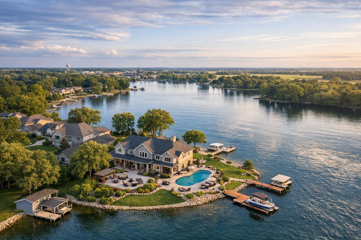
How to Choose Drone Photography Near You for a Real Estate Listing
Searching for drone photography near me is often the first step for agents and property owners looking to give their next listing a boost. But successful aerial media depends on more than just finding a professional in your area. The best results come from providers who know how to evaluate a property’s visual strengths and the neighborhood’s flight realities, from airspace to weather and building access.
Let’s dig into what drone photography and video can accomplish for your listing, where it adds the most value, and how to navigate local realities across New York City and New Jersey.
Why Choose Drone Media for Real Estate?
Aerial photography is about creating a clearer story for your viewers—covering angles and answering questions that ground-level images just can’t touch. Whether it’s showcasing the lot’s true size, highlighting a riverside setting, or revealing the relationship between multiple buildings on a commercial parcel, drone photos and video can provide context, scale, and a more vivid sense of place.
What Drone Photos Can Reveal
- Lot boundaries and shape
- Outdoor amenities like pools, patios, gardens, or docks
- A home’s position relative to water, parks, or golf courses
- Driveways and access roads
- Parking configuration and site approach
- Building footprints and relationship to surroundings
- Architectural features only visible from above
For instance, a suburban New Jersey property with wide setbacks and mature trees shines in a sweeping aerial. A waterfront home in Hoboken or along the shore benefits from a mid-height angle that captures both the structure and the water it faces. In commercial real estate, revealing a building’s footprint and proximity to highways or transit brings important context into the listing.
At the core: Drone images should answer a visual question for buyers that interior or front-exterior shots can’t.
Is Drone Coverage Right for Every Listing?
In short: not always. Drone media works best for listings where exterior features, setting, or property scale are integral to the listing’s story.
Great Candidates for Aerial Media
- Detached homes with notable outdoor features
Especially properties with generous land, landscaped yards, pools, outbuildings, or elaborate driveways. In many New Jersey towns, the ability to show off a full parcel is a huge advantage. - Waterfront estates and shore homes
Waterfront listings gain crucial context from above, showing docks, beaches, or uninterrupted water access—all with the property itself still in focus. - Brownstones and apartment buildings
In Brooklyn and Manhattan, the roofline, proximity to parks, or block configuration may warrant aerial coverage. Not every building allows for safe or legal drone flights, but when it’s feasible, these details can set a listing apart. - Commercial properties and development sites
For retail, industrial, or mixed-use projects, buyers care about more than square footage. Aerials capture parking, roadways, and the site’s commercial context in a single view.
When Ground-Level Media Might Be Enough
If a building is tucked mid-block without outdoor or rooftop amenities, or if dense city surroundings leave no clear takeoff point, standard photography may better serve the listing. Drone flights also face limitations in areas of heavy air traffic, near airports, or within restricted city airspace (especially in Manhattan).
Drone Photography vs. Drone Video: What’s Right for Your Listing?
It’s smart to match your deliverable to your real estate goals:
- Aerial photos are ideal for property galleries, websites, brochures, and materials where viewers need time to study details.
- Aerial video adds movement and scale, revealing approach routes, the flow around buildings, or waterfront edges. This pairs well with broader listing videos that tell a story over time.
- Both can serve listings where the setting deserves in-depth coverage—think homes with stunning grounds, waterfronts, or developments with varied site features.
For a combined approach, RealtaSnap offers a drone package including 10 HDR photos and a one-minute professionally edited video, providing flexibility for both galleries and video tours.
Practical Realities: What Local Drone Providers Should Assess
Proximity alone isn’t enough to guarantee a safe or legal aerial shoot. Real estate drone photography is closely regulated and must be handled on a case-by-case basis.
A reliable local provider will:
- Evaluate airspace—checking for controlled or restricted zones
- Assess weather and changing forecasts for safety
- Look for dedicated takeoff and landing areas
- Determine if roof access is needed (pretty common in NYC)
- Consider nearby airports, heliports, major roads, or events
- Assess pedestrian and vehicle activity at the site
- Respect FAA Part 107 rules, property access, and pilot discretion
In dense city locations, rooftop takeoff can often improve the options, but it doesn’t bypass legal or safety requirements. Approvals from building management may be necessary. Reputable providers will always put safety and compliance before committing to a flight.
Choosing a Drone Photography Provider: What Matters Most?
Not every “drone photographer” is ready for the quirks of real estate marketing. Here are a few traits to look for:
Relevant, Local Work
Ask for samples relating to your exact listing type—Manhattan condo, Brooklyn brownstone, Jersey Shore home, or regional commercial site. The provider’s experience should show an understanding of real estate presentation, not just scenic overheads.
Professional Judgment and Compliance
Listen for a thoughtful approach. If a provider guarantees drone coverage without asking about airspace, address, or building access, that’s a red flag. Experienced drone pilots are transparent about what’s feasible and adjust plans according to airspace, weather, or on-site issues.
Service Transparency
Confirm before booking:
- Number of edited aerial photos
- Video duration and resolution
- Turnaround and delivery method
- Included features (like blue-sky replacement)
- How your media can be used across platforms
If you’re combining interior and drone services, coordinate the shoot so both sets of media tell a coherent visual story.
Getting Ready: How to Prepare a Property for Aerial Capture
Even with drone media, prep matters. Here are a few quick tips:
- Move vehicles from driveways and lots where possible
- Store trash bins, hoses, and outdoor clutter
- Line up and tidy outdoor furniture, especially poolside
- Request or confirm roof access if needed (in urban settings)
- Inform residents or tenants about the schedule
- Call out important views or features for the shoot
For commercial listings, be mindful of parking activity and deliveries. Waterfront homes? Consider the positioning of boats, docks, or landscaping before scheduling the flight.
Local Realities: NYC, New Jersey, and Drone Feasibility
Drone shoots in Manhattan and Brooklyn come with unique hurdles: complex airspace, dense surroundings, limited takeoff zones, and the need for rooftop access. Each address requires an independent review—there are no blanket guarantees.
Suburban and waterfront homes in New Jersey, plus commercial or development properties, tend to be more accessible. Still, legal and safety considerations always come first. Flights are evaluated for each listing, not just by ZIP code.
RealtaSnap: Drone Media for NYC and NJ Listings
RealtaSnap specializes in on-site drone photography and videography—always tailored to the address and local airspace. Every booking is reviewed for feasibility before a shoot is confirmed. Services include drone photo-only, drone video-only, or a combined package, so you only pay for what the listing really needs.
You can see all available options or book your shoot at RealtaSnap’s homepage. The online platform lets you enter the property address, select your desired services, leave access notes, and secure your time slot—all with at least 24 hours’ advance notice.
Bring the Property’s Setting Into Focus
Great aerial media goes beyond eye-catching angles. It helps the buyer or tenant truly understand what’s special about the property—be that outdoor space, water access, unique architecture, or a standout commercial footprint. If you’re weighing whether to add aerials to your next listing, a conversation with an experienced provider (and a review of your address) is a valuable first move.
For Manhattan, Brooklyn, or anywhere throughout New Jersey, RealtaSnap can help you determine if aerial real estate photography fits your goals. Explore your options or book an appointment at www.RealtaSnap.com.
FAQ
Question: Can drone photography be guaranteed for a Manhattan or Brooklyn listing?
Answer: No. Every address in NYC is unique—factors like airspace, rooftop access, neighborhood activity, weather, and pilot judgment always matter. A trustworthy provider will review the property before confirming feasibility.
Question: Is drone media still useful if the property doesn’t have a big yard?
Answer: Yes, in some cases. Rooftop amenities, distinctive architecture, proximity to parks or water, or even the feel of a particular block can make aerials valuable. If the exterior setting isn’t a key selling point, though, ground-level photography may be the better priority.
Question: How far ahead do I need to book a drone shoot with RealtaSnap?
Answer: Standard appointments can be scheduled with at least 24 hours’ notice through RealtaSnap’s online calendar. Include access details and notes relevant to aerial media when booking, so the shoot plan can be reviewed properly.