When Is Drone Photography Worth It for a New Jersey Listing?
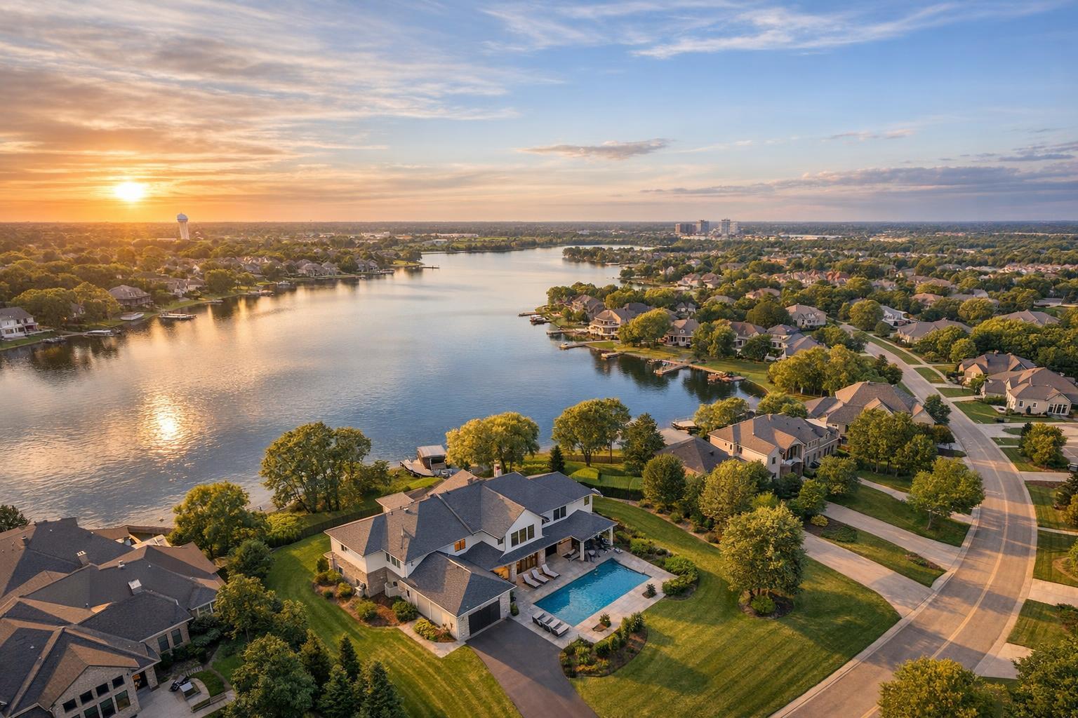
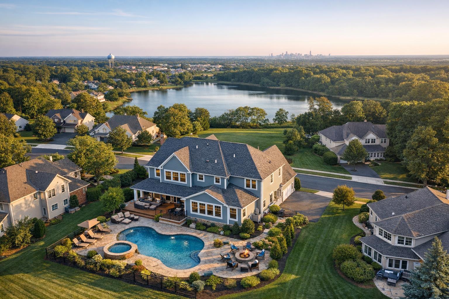
Drone photography in NJ captures a picturesque suburban neighborhood featuring a large house with a pool, surrounded by greenery and a lake in the background.

When Is Drone Photography Worth It for a New Jersey Listing?
Drone photography in NJ can add a unique layer of storytelling to real estate listings, but not every property benefits equally from an aerial point of view. If you’re an agent, broker, or owner considering whether to use a drone for your next New Jersey listing, the real question isn’t whether drones are “impressive”—it’s whether that overhead perspective creates real clarity for a potential buyer. Here’s some practical guidance on when drone photography makes sense, what types of listings gain the most, and what to expect before booking a flight.
Start With the Story the Property Needs to Tell
Every real estate listing highlights a handful of selling points: maybe it’s the backyard, the deck, access to water, or an impressive roofline. Drone photos or video pack the biggest punch when those features can’t be shown well from the ground. An aerial image can quickly capture property boundaries, waterfront settings, or the way multiple outdoor amenities work together.
Before you add drone media, ask yourself:
- Is there a unique aspect of the land, exterior, or setting that is hard to show from eye level?
- Would an aerial photo explain context, location, or layout better than ground images alone?
- Will buyers better understand the property with this added perspective?
If you’re nodding yes to at least some of these, drone photography is likely a good investment.
Properties That Shine With an Aerial Perspective
Large Lots, Deep Yards, and Substantial Land
When the size or configuration of land is part of the selling point—think sprawling estates, homes with wooded acreage, deep rear yards, or detached outbuildings—drone photos instantly clarify scale and layout. These aerials help buyers grasp how the home is situated, where driveways or guesthouses are tucked away, and the actual depth or buffer of the property.
Listings that benefit most often include:
- Properties on multiple acres or with unusually large lots
- Homes featuring long private driveways
- Detached garages, barns, or guest cottages
- Extensive landscaping or gardens
- Corner or irregular parcels that are hard to capture from the street
Waterfront and Shore Listings
In New Jersey, homes on the shore, lakes, or rivers stand out largely because of their relationship to the water. Drones can document proximity to bulkheads, docks, marina access, and beach entrances. This makes it easy to distinguish between a house with just a glimpse of the bay and one that enjoys true waterfront living. Aerials also showcase rooftop decks, pools, and how a house sits within a coastal neighborhood—viewers get a sense of what life on the property would feel like.
Outdoor Amenities That Need a Full Context
Some amenities just make more sense from above. A beautifully designed pool area, tennis or sport court, connected garden spaces, multi-level decks, or firepits often can’t be fully appreciated through standard photos. A drone view puts it all—including how different amenities relate to each other—into one frame.
Ground-level shots are still essential for showing the details of outdoor finishes and design, but aerials add the “big picture” that buyers often want.
Distinctive Architecture and Rooflines
Homes with dramatic exteriors, complex layouts, or custom rooflines—such as historic mansions, contemporary homes, or properties set far from the road—may be tough to capture from any single angle. Drones can highlight wraparound porches, courtyards, multi-wing layouts, or commercial buildings’ parking and access, providing useful visual information not possible from the curb.
Drone media can be especially helpful for:
- Custom homes or estates
- Large commercial sites
- Multifamily footprints
- Buildings with unique roof shapes or exterior features
How New Jersey's Neighborhoods Affect Drone Decisions
New Jersey real estate stretches from dense northern cities to shore towns to sprawling suburbs, so context matters.
Dense North Jersey Areas
Hudson, Bergen, Essex, and other northern counties have closely packed buildings, narrow streets, and lots of overhead wires—not the easiest setup for drone flights. Sometimes, an aerial shot can clarify a rooftop deck or show private outdoor spaces, but flight feasibility here depends on safety, airspace, and many practical details. In very dense locations, strong ground photography is often the better bet.
Suburban Listings
Suburbs offer some of the clearest cases for drone photography. If the house boasts an impressive yard, a pool, or is tucked into a cul-de-sac, an aerial can capture how everything fits together. However, not every suburban home needs it—if there’s little outdoor space or unique exterior features, traditional photos usually do the job.
Shore and Waterfront Homes
At the Jersey Shore, drone photography can offer immediate payoff by showing what makes the property special—water proximity, marina access, and the overall coastal scene. That said, coastal conditions can change quickly. Weather, wind, and temporary restrictions may impact aerial shoots, so flexibility is important.
Commercial and Development Sites
For offices, retail, multifamily, or development parcels, aerial images put building placement, parking, surrounding land, and access routes into perspective. The photos should be straightforward, giving potential buyers or tenants exactly the site context they need without overdoing angles or drama.
When Standard Photography Might Work Better
Not all listings require drone photography, and in some cases, it’ll actually be less effective than a carefully planned set of ground-level images.
Consider skipping aerial media if:
- The property is a condo or apartment with few exterior features
- The building is tightly flanked by others, making the aerial view cluttered or unclear
- The strongest selling points are inside, such as finishes, light, or the interior layout
- Flight is impractical or would mostly show neighboring houses
- The listing needs tight, focused images rather than wide context
For many homes, a smart mix is best: ground-level photos and a few targeted aerials that add genuine value, not repetition. The key is to ensure every image helps viewers understand something important about the property.
What Makes a Drone Flight Possible—Or Not
Real estate drone photography is always site-specific. Even properties that seem perfect for aerials might have restrictions or conditions preventing a flight. Here’s what factors in:
- FAA Part 107 requirements (all drone work must be legal and compliant)
- Airspace classification and needed authorizations
- Local bylaws and temporary restrictions
- Weather and winds on the day of the shoot
- Site safety (obstacles, wires, people, nearby structures)
- Accessibility for takeoff and landing
- Pilot discretion—safety comes first
Some locations are simply “no-go” zones due to airspace or local rules. In these cases, additional municipal or event permits might be required—and those aren’t handled by media providers like RealtaSnap. If you’re unsure about your property’s eligibility, it helps to ask in advance and provide as much site detail as possible.
Planning Aerial Media With Your Listing Shoot
Drone photography works best when coordinated as part of a full listing package. Consider the visual story: what will be shown from inside, at street level, and from above?
If your property needs all three perspectives—say, a shore home with high-end finishes inside, an inviting entry, and a dazzling location near the beach—a coordinated approach delivers the clearest results.
Share these details with your photographer before the shoot:
- Most important exterior features to highlight
- Access details, such as roof entry or gated drives
- Any known restrictions or building rules
- Your main marketing goals (e.g., emphasizing land, water, amenities, or access)
If you’d like to explore integrated listing photography, including aerials when possible, you can review RealtaSnap’s approach and booking options on their homepage.
The Value of Purposeful Aerial Images
Drone photography is a smart addition when a property’s outdoor story is best told from above—particularly for larger lots, waterfront settings, unique exterior amenities, and commercial properties where site context matters. For smaller or more compact listings, well-planned ground photography often communicates space more clearly and efficiently.
At the end of the day, the best listing media is the one that accurately informs and inspires prospective buyers, giving them a true sense of the property from every important angle.
Ready to talk about aerial or on-site listing media for your next New Jersey property? Visit RealtaSnap’s website for more details, or to get started.
FAQ
Question: How many drone images should I include in a New Jersey real estate listing?
Answer: It depends on what you need to communicate. Properties with multiple exterior features—like a large lot, pool, or waterfront—often use several distinct aerial shots. For homes where one overhead image sets the scene, a single view may do the trick. Focus on variety and purpose, not quantity.
Question: Is drone photography possible in dense North Jersey neighborhoods?
Answer: Sometimes, but there are more restrictions. Feasibility depends on location, airspace, weather, safety, local rules, and available takeoff space. In certain spots, ground photos or high vantage points may be more practical.
Question: Does drone photography replace regular exterior photos?
Answer: No. The most effective listings use aerials to supplement—not substitute—core ground-level shots. Standard photos remain essential for showing curb appeal, entry, materials, and the experience of arriving at the property. Use drone images to add context when it helps tell the property’s full story.