Drone Photography Near Me: What to Ask Before Booking for a Property Listing
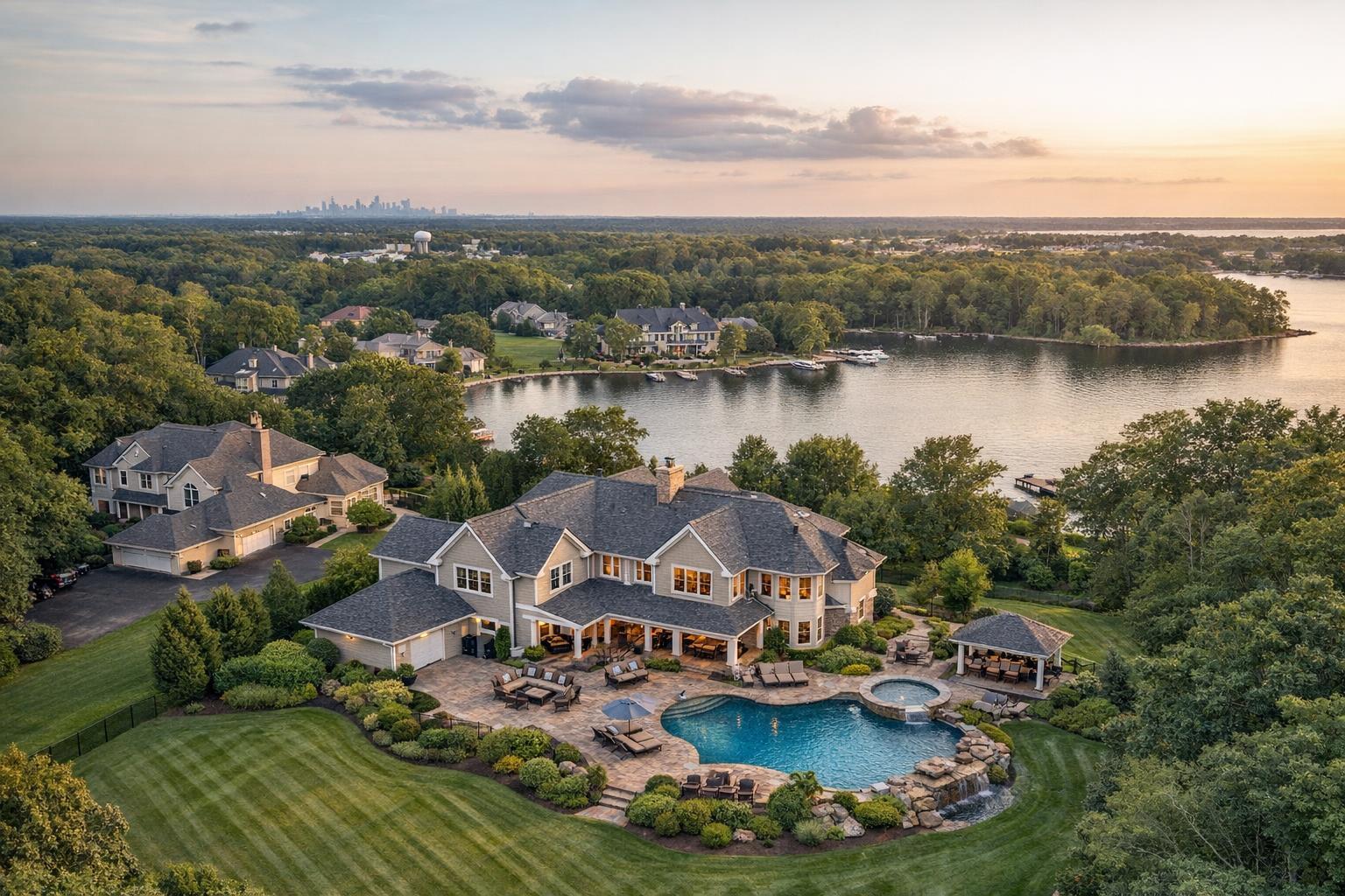
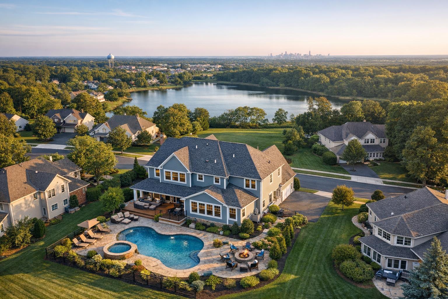
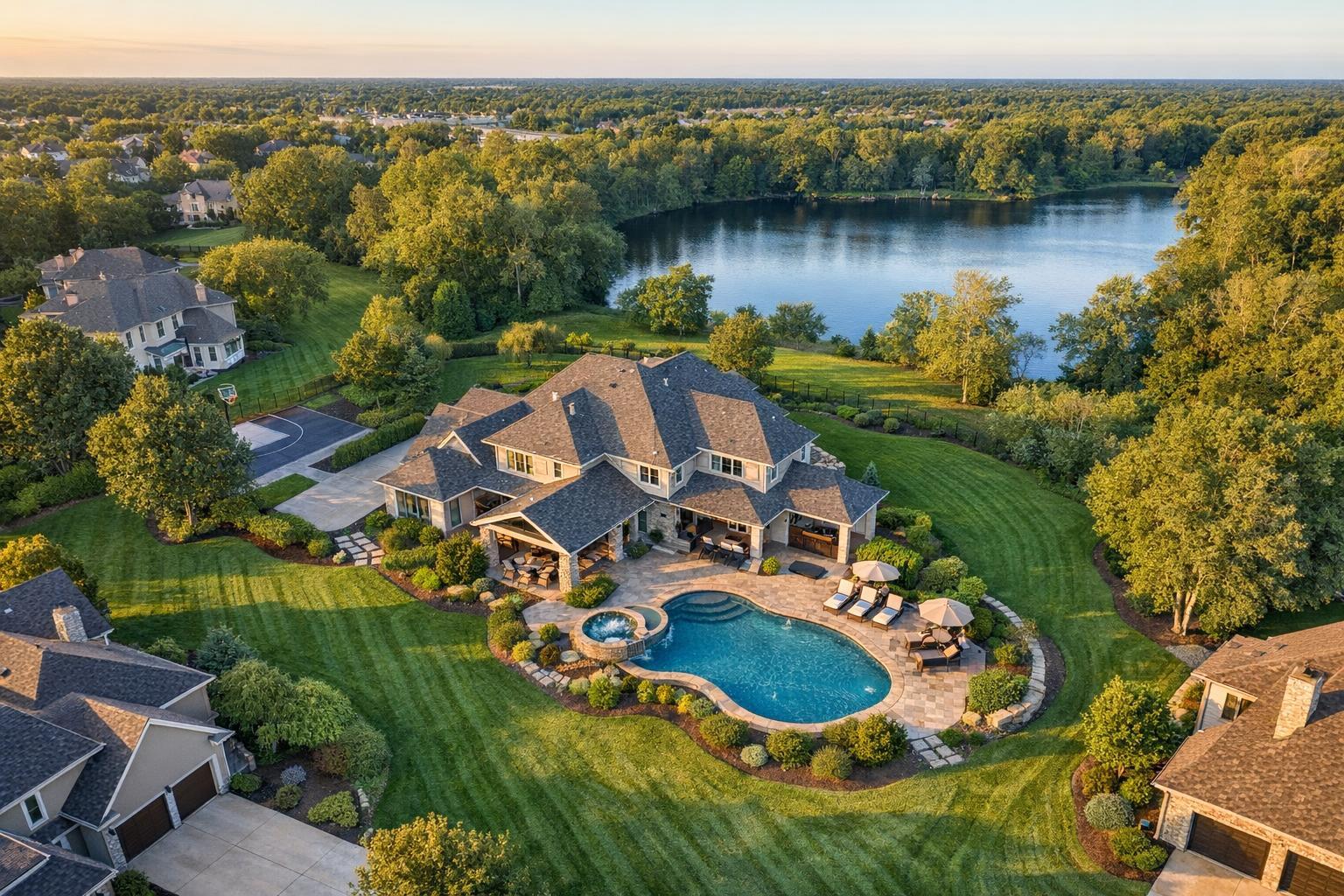
Aerial drone photography captures a luxurious house with a landscaped garden and pool, nestled beside a serene lake, surrounded by lush trees.

Drone Photography Near Me: What to Ask Before Booking for a Property Listing
Looking for drone photography near me often means you have a property with unique features or a great setting that could benefit from an aerial perspective. But before you book, it’s smart to consider if drone media makes sense for your specific address—and what you want the final images or video to show.
Here’s a practical guide for real estate agents, property owners, and developers navigating real estate drone photography in New York City and New Jersey. Use these insights to evaluate if drone services are a good fit and what to ask a provider before you schedule.
When Aerial Photography Adds Value to a Listing
Aerial property photography can do more than capture dramatic views. It’s most useful when the exterior setting or property footprint genuinely adds context a buyer or tenant can’t get from ground-level photos alone. For the right listing, aerial shots can clarify:
- The property’s footprint, boundaries, and lot layout
- Key outdoor amenities like pools, gardens, patios, or guest houses
- How a home sits on its land or relates to water, parks, or open space
- Rooflines, decks, terraces, or unique exterior architecture
- Access points to driveways, garages, or parking lots
- The relationship to nearby roads, transit, or commercial features
Not every property needs drone coverage. Dense city blocks surrounded by taller buildings, listings with limited yard or roof access, or areas with strict airspace restrictions may not be flyable. A solid exterior gallery or views shot from a terrace might be the better choice in those scenarios.
If you’re not sure, start by asking yourself: what story do our photos need to tell? Giving your provider this goal—like showing distance to the waterfront, property scale, or scenic views—makes for a more intentional shoot.
Choosing Photos, Video, or Both
When Aerial Photos Make Sense
Still drone images work well in listing galleries because they’re easy to scan and can deliver key visual information at a glance. Consider stills if you want to highlight:
- The shape and size of the property from above
- Outdoor living spaces or pool areas
- Boundaries and lot lines, especially for land listings
- Street or neighborhood context
A few well-chosen aerial shots are usually more effective than dozens of angles. Aim to answer the questions a buyer or renter would have after seeing the ground-level photos.
Why and When to Choose Drone Video
Aerial video brings movement and scale to a listing—think smooth flyovers revealing a backyard oasis or a wide pass that puts a development site in context. Video works best when integrated into a professionally edited listing film or social media clip. If movement, approach, or showing transitions between spaces matters to your story, consider adding video.
If you only want a couple of exterior context shots, stick with photos. If the property’s setting, scale, and architectural feel are central to the listing, combining photography with video delivers a more complete result.
Questions to Ask Your Drone Provider
Booking real estate drone photography isn’t as simple as finding someone local. To get what you need—and avoid surprises—ask these questions before you commit:
Is this address actually flyable?
In NYC and surrounding urban areas, airspace restrictions, FAA regulations, and local rules can limit where drones are allowed. Give the provider the exact address. Factors like proximity to airports or heliports, nearby events, building density, and available launch spots all matter. No reputable provider will promise a flight without reviewing these details in advance.
What kind of on-site access will be needed?
Access can be a bigger hurdle than you’d think—especially in dense areas like Manhattan or parts of Brooklyn. Roof access, a private yard, or a driveway can make a big difference. Before booking, clarify:
- Is there a safe place to launch the drone?
- Who can unlock the roof, terrace, yard, or parking area if needed?
- Will you need advance building approval?
- Are there gates, security desks, or elevator procedures to factor in?
- Is the space available at the booked time?
Even with roof access, other conditions may limit the shoot. Always check logistics before confirming drone coverage to a client.
What do I actually get in the final package?
Don’t settle for vague drone “packages.” Ask:
- How many aerial photos are included?
- Are the photos edited for a clean, listing-ready look?
- Is video included—and if so, how long is the finished cut?
- Will I get horizontal, vertical, or both formats?
- Can video be combined with other on-site filming?
- Are there priority features you should highlight?
At RealtaSnap, standard drone options are transparent: 10 HDR aerial photos for $209, 60 seconds of finished 4K drone video for $229, or a combined package for $299. Review the deliverables so you know exactly what you’ll get.
How is weather handled?
Weather can shut down a drone shoot—wind, rain, low visibility, or unpredictable conditions aren’t just inconvenient, they can make flights unsafe or illegal. A professional provider will base decisions on safety, not just the appointment window. It’s also smart to have a plan if only drone coverage is affected but other services (like photos or video indoors) can proceed.
Does the provider specialize in real estate listings?
It’s worth asking—flying a drone is only part of the equation. For real estate, it’s important your provider understands how to create images that are clear and helpful for buyers. The best shots aren’t always the flashiest; often, a wide image that helps orient the viewer is more useful than a movie-style angle.
Look for someone who can discuss:
- What makes a listing gallery effective
- How to showcase exterior features clearly
- How to fit aerial footage into a cohesive video or listing package
- The practical constraints of working at real-world NYC and NJ properties
Local Realities: NYC vs. New Jersey
There’s a big difference between flying a drone in suburban New Jersey and dense areas like Manhattan, Brooklyn, or Jersey City. In NJ suburbs, open space and private land make it relatively straightforward to capture dramatic exterior images. In New York City, sidewalks, building density, neighboring structures, and strict airspace rules all come into play.
Roof access can make or break a drone shoot in the city, but even then, nothing is guaranteed until a professional reviews the specific situation. That’s why working with a provider who understands NYC and NJ property logistics is valuable.
RealtaSnap handles drone media for properties in New York City (all boroughs) and statewide New Jersey, always evaluating each property address for feasibility, safety, and compliance.
Preparing Your Property for an Aerial Shoot
You can help the process run smoothly by sharing more than just the address when booking. Useful details include:
- Property type and size (single-family, condo, commercial, land, etc.)
- Whether the site is vacant, occupied, under construction, or in active use
- Notes about access (who can open gates, unlock the roof, assist on-site)
- Features you’d like to capture (pool, terrace, acreage, parking, water access)
- Known building rules or upcoming events
- If drone media needs to match up with photography or video during the same session
If you’re preparing a residential property, take a few extra minutes before the appointment to tidy outdoor spaces, move cars out of driveway shots if possible, and ensure any needed access is arranged.
Understand the Limits Before Promising Aerial Coverage
It’s tempting to market breathtaking drone shots before you know if a location is actually flyable. A more realistic approach is to treat drone photography as a potential asset—pending address review and approval.
Not every address can be captured by drone. Restrictions may come from FAA rules, local ordinances, severe weather, safety limitations, access barriers, or pilot judgement. At RealtaSnap, all drone projects are handled case by case. Additional permits (beyond standard FAA authorization) are the client’s responsibility if required, and some assignments may be declined.
Drone services from RealtaSnap are strictly for marketing purposes—not for inspections, engineering, or architectural analysis.
Booking Aerial Real Estate Media with RealtaSnap
For properties in NYC and New Jersey, RealtaSnap offers on-site aerial real estate media when the location and circumstances support it. Booking is simple: just go to the scheduling page, enter your address, choose drone photo, drone video, or a combined option, and add any specific notes about the property or features to prioritize.
The calendar shows available time slots—appointments require at least 24 hours’ notice. Payment is completed upon booking. If you’re planning comprehensive coverage, drone services can be paired with property photography or listing video for a seamless marketing package.
Aerial media is most compelling when it shows buyers what they can’t see from the ground. If your property’s land, amenities, views, or context deserve that wider look, share your details early and let us review the feasibility. To get started, visit www.RealtaSnap.com.
FAQ
Question: How much does real estate drone photography cost with RealtaSnap?
Answer: Drone photography is $209 for 10 HDR aerial photos. Drone video is $229 for a finished 60-second 4K cut. If you’d like both, the combined package is $299. Each address still needs a feasibility review before the shoot.
Question: Can you fly a drone over any NYC property?
Answer: Not all locations allow for drone flights. Every address is evaluated for restrictions related to airspace, local rules, weather, access, and safety. In dense areas like Manhattan and Brooklyn, roof access improves the chances but doesn’t guarantee approval.
Question: Should I book drone photos or video for my listing?
Answer: Choose aerial photos when you want clear context shots for your listing gallery—like showing lot lines, amenities, or surrounding scenery. Add video if you want to highlight movement through a property or give a broader sense of scale. Many agents find a combination gives the most complete presentation.
Ready to see if aerial media makes sense for your property? Visit www.RealtaSnap.com to book or learn more.