When Is Drone Photography Worth It for a Real Estate Listing?
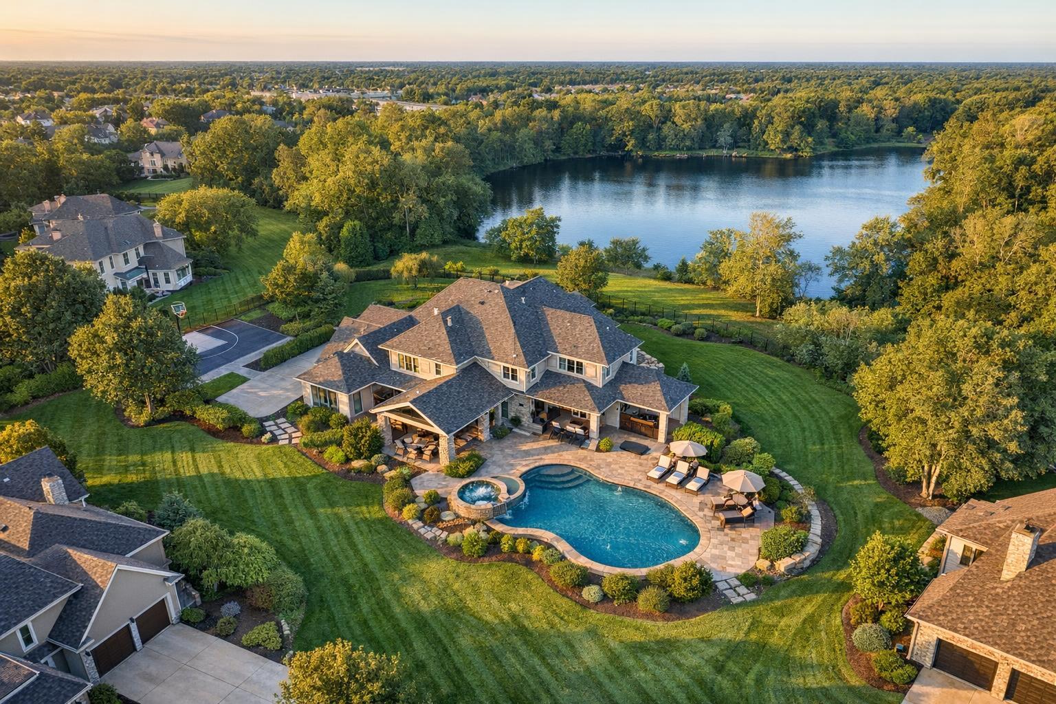
Drone photography captures a sprawling estate with a luxurious pool overlooking a serene lake and lush green landscape, ideal for real estate showcasing.

When Is Drone Photography Worth It for a Real Estate Listing?
Drone photography real estate can be a tremendous asset when an aerial perspective clarifies details that simply don’t come across from ground-level photos. Whether you’re showcasing the expanse of a property, unique outdoor features, or the relationship between a building and its environment, aerial media sometimes tells the story in a way nothing else can.
But is it always necessary? Not every listing benefits from drone coverage. Let’s break down when drone photography adds genuine value for NYC and New Jersey properties, how to weigh its practical benefits, and what to expect when integrating aerial content into your marketing plan.
What Drone Imagery Adds—and When It Truly Matters
Ground-level photography plays an essential role in real estate marketing. It gives potential buyers or tenants a look at architectural features, the quality of landscaping, and a sense of curb appeal. Drone photography, on the other hand, is about context: it shows how a property fits into its surroundings and why that matters.
Here are situations where aerial real estate photography provides clear advantages:
- Revealing lot size and layout, especially when the property sits on a large, irregular, or waterfront lot
- Highlighting outdoor amenities like pools, courtyards, patios, gardens, or expansive driveways
- Illustrating the proximity of a property to water, parks, or major access points
- Showing roof decks, terraces, or the wider view from elevated spaces
- Making it easy to understand parking access or the flow of commercial sites
For instance, a wooded New Jersey estate with a long driveway and a detached garage simply looks more compelling—and easier to grasp—in a single elevated shot. A multifamily building near key transit or amenities can use an aerial still to convey location better than any written description.
Where Aerial Media Is Especially Effective
Larger Homes and Estates
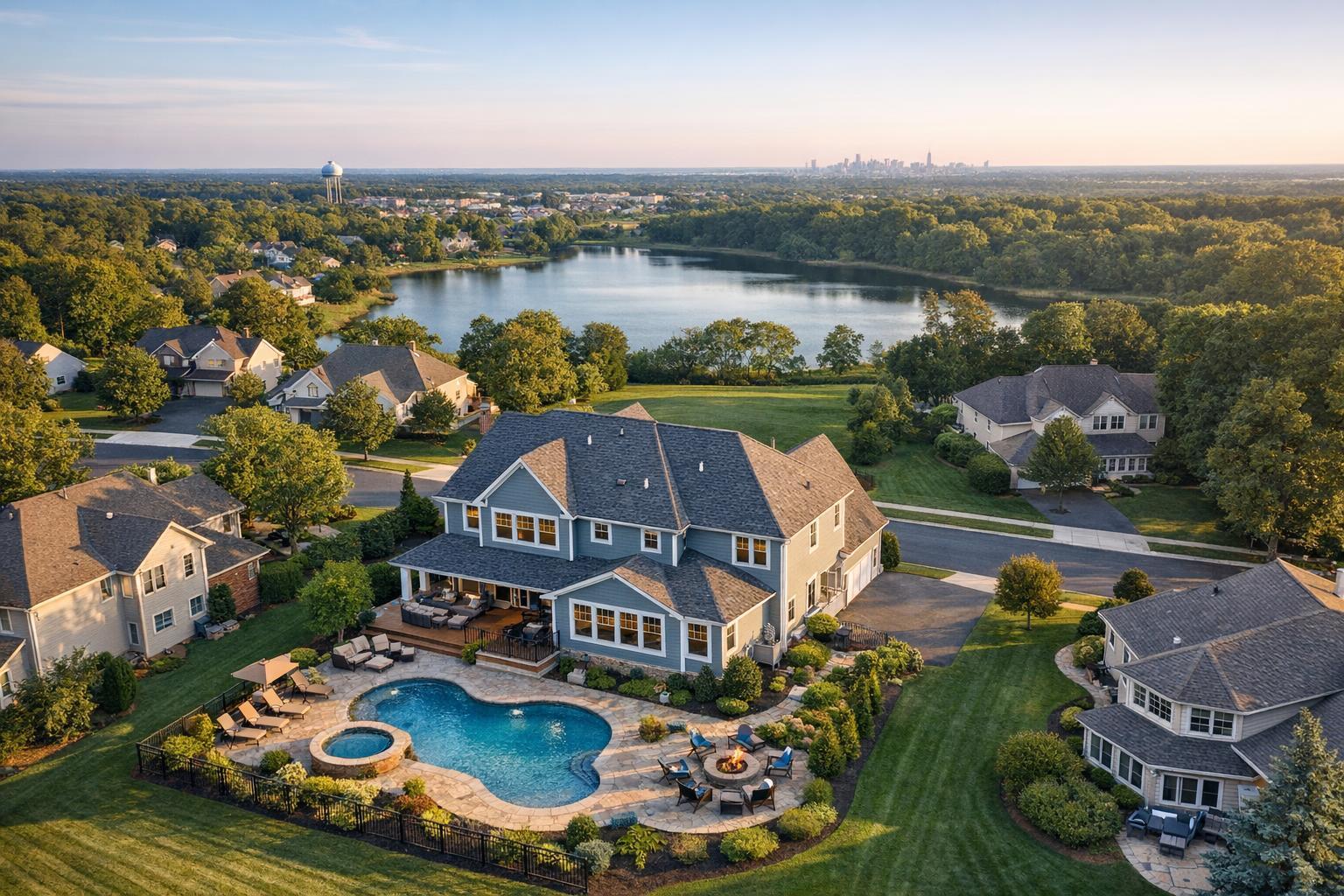
Suburban listings, properties with generous outdoor space, or homes on wide lots benefit the most. In a single frame, buyers see how the house relates to the land, where the backyard sits, the placement of pools or patios, and what sets this site apart.
Ideal situations include:
- Multiple structures or guesthouses on a lot
- Expansive gardens, play areas, or entertaining spaces
- Gated entrances and long driveways
- Properties with mature landscaping or wooded buffers
Waterfront and View Properties
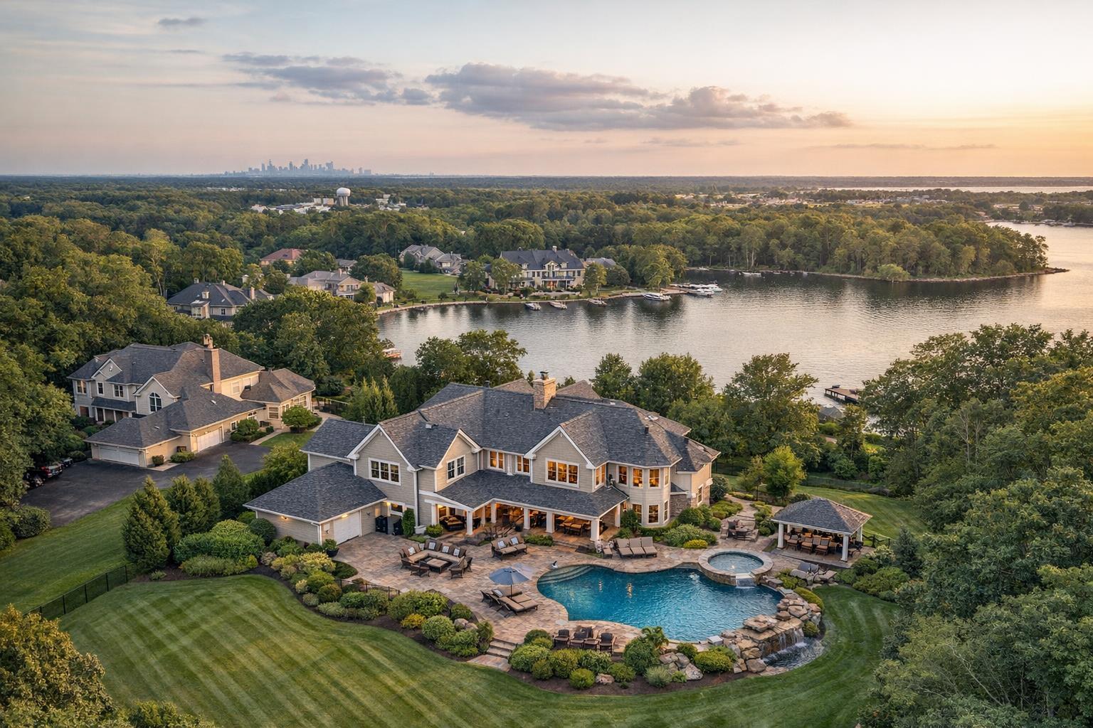
If private docks, shoreline frontage, or sweeping water views are among a property’s main selling points, aerial images can show buyers not just the features themselves, but the relationship between the home and the surrounding landscape.
Urban Properties With a Twist
Not every city address benefits from drone footage. A high-rise unit without private outdoor space may not require it. But in New York City, a penthouse with a wraparound terrace, a brownstone with a roof deck, or a building with dramatic architecture sometimes deserves a bird’s eye view—if the location and airspace make flying practical.
Commercial, Multifamily, and Development Sites
In commercial real estate drone photography, showing site boundaries, parking lots, access roads, loading zones, and the relationship to surrounding properties can help buyers or tenants make informed decisions before they visit in person.
When Standard Photography Might Be Enough
There are plenty of circumstances where the basics capture everything a buyer needs to know:
- The listing is an apartment within a larger complex, and outdoor context adds little value
- All the property’s best features are indoors
- Neighboring buildings are so close that aerial separation is impossible
- Airspace, weather, or access limitations rule out safe aerial operation
For many condos, compact townhomes, or interior-focused spaces, polished ground-level images—interiors, entrance, amenity spaces, and private patios—carry the most weight.
If you’re not sure which approach to use, a good question to ask: “Would seeing this property from above answer a real question a buyer might have?” If the answer is yes, aerials may help. If not, stick with strong conventional photography.
Understanding the Difference: Stills Versus Video
Both drone stills and drone video have their place in real estate marketing, but they solve different problems.
- Aerial stills are perfect for listing galleries, print, and websites. Buyers can closely study how a pool, garden, or building sits on the land, or how rooftop views line up with the skyline.
- Drone video allows for movement: it might sweep upward over a backyard, move toward a waterfront, or pan from a driveway down to street access. These clips often shine as part of a broader listing video or standalone short features for social media.
With RealtaSnap, aerial packages begin at $209 for ten HDR photos, $229 for a one-minute 4K video, and $299 for a package that includes both ten photos and a one-minute video. Choosing between stills and motion comes down to how you plan to tell the listing’s story and whether movement would clarify a unique selling point.
Market-Specific Practicalities: NYC and New Jersey
Aerial real estate photography is governed by more than creativity. Especially in New York City and urban parts of New Jersey, airspace rules, building heights, available launch areas, and municipal restrictions come into play.
In Manhattan and core Brooklyn:
- Many rooftops and terraces require special consideration; permitted, safe operations aren’t possible at every address
- Each shoot requires a fresh review of airspace, access, and permitting needs
Across New Jersey:
- Suburban and waterfront areas usually offer more open space
- Local conditions—including trees, power lines, access, and local airport proximity—still require careful planning
Ultimately, drone feasibility is not guaranteed. Every site must be reviewed individually, and no professional operator will promise aerials without confirming safety and permission.
You can find a detailed overview of RealtaSnap’s NYC and New Jersey drone services—including coverage area and options—on the drone services NYC & NJ page.
What Makes a Flight Possible (or Not)
Several factors go into the practical decision to fly:
- FAA rules, including Part 107 licensing and local authorizations
- Temporary or site-specific restrictions
- Wind, rain, and overall weather conditions
- Obstacles like wires, trees, buildings, or construction
- Safe takeoff and landing locations
- Physical and management access to the property
A responsible aerial workflow means never guaranteeing a drone shoot before these aspects are reviewed. Some municipal or event permits, when required, are a client responsibility and may put certain projects out of reach.
Coordination and Preparation Tips
If you decide drone content would add value, consider it an on-site service that requires the same access and preparation as any other photo or video shoot.
Some ways to prepare:
- Clear driveways, patios, and outdoor amenities
- Confirm access to rooftops, gates, or common outdoor spaces
- Inform building or property management about planned drone work
- Schedule with an eye for the best sun direction and minimal shadows
Including drone coverage early in your planning makes it much simpler for your media team to coordinate with standard photography or video appointments.
Deciding If Drone is Right for Your Listing
Ask these three questions:
- Is there an important feature that isn’t clear from ground-level images? For example, does the property have acreage, a roof deck, water access, or a complex site plan?
- Would context from above help buyers or tenants understand value? Think about things like proximity to amenities, the distance to the water, or the scale of parking and access for a commercial space.
- Is a safe, legal drone flight feasible for this address? No amount of planning will help if airspace or local restrictions make drone work impossible.
If you answer “yes” to the first two and can confirm the third, aerial real estate photography may be a smart investment.
RealtaSnap: Drone Media for NYC and New Jersey Properties
If you’re ready to add aerial stills or video, RealtaSnap provides drone services for qualifying real estate listings across New York City, all boroughs, and statewide New Jersey. Every drone project is carefully reviewed for safety, access, and regulatory compliance before booking. See current service options and check availability at RealtaSnap’s main site.
FAQ
Question: Is drone photography recommended for condos and apartments?
Answer: Sometimes. A unit with a rooftop terrace, water views, or unique outdoor features may benefit from aerial coverage, but for many apartments, especially those with minimal exterior context, standard photography is usually more effective.
Question: Can I request drone images from older listing photos or floor plans?
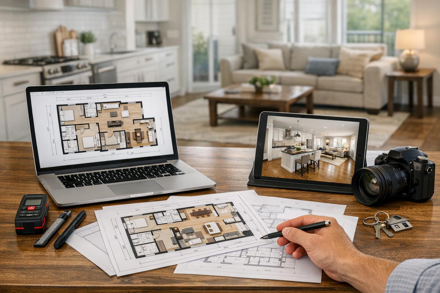
Answer: No. Authentic drone content is always captured on-site and cannot be generated from existing images, floor plans, or architectural renderings.
Question: Are all NYC and New Jersey properties eligible for drone photography?
Answer: Not every property can be safely or legally flown. Factors like airspace, permitting, weather, and property access are reviewed case by case. Some highly urban, crowded, or restricted locations may not allow for aerial shoots, no matter the demand.
If you’re interested in exploring drone photography or have questions about your next listing, we’d love the opportunity to help. Visit www.RealtaSnap.com.