Drone Photography NJ: When Aerial Media Makes Sense for a Real Estate Listing
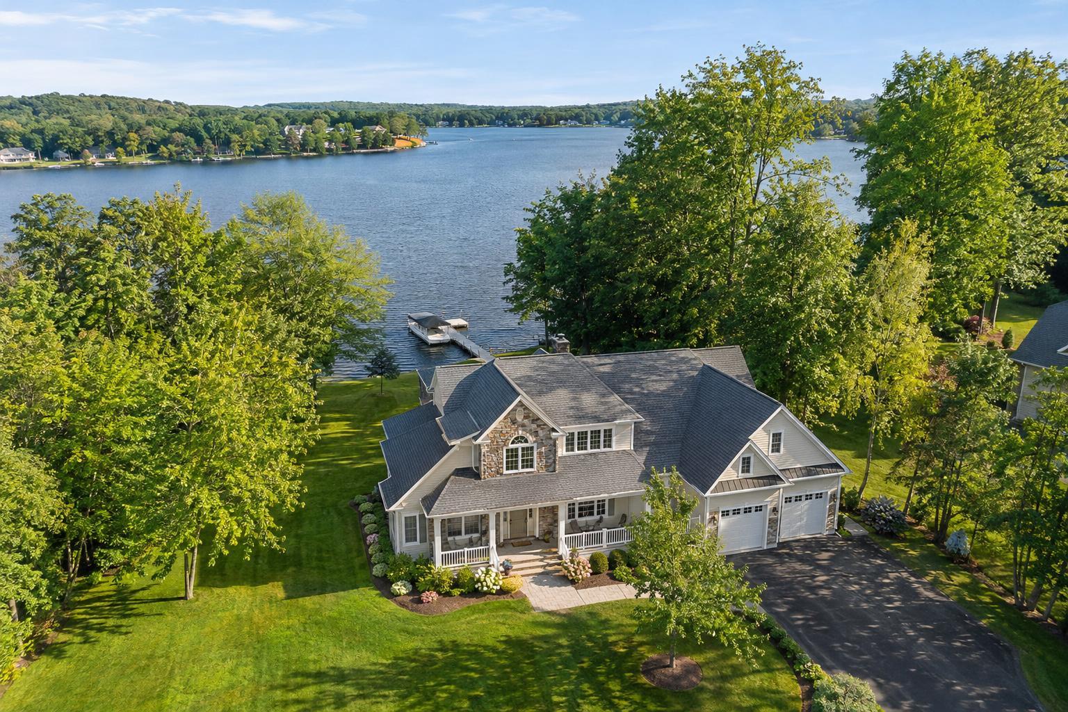
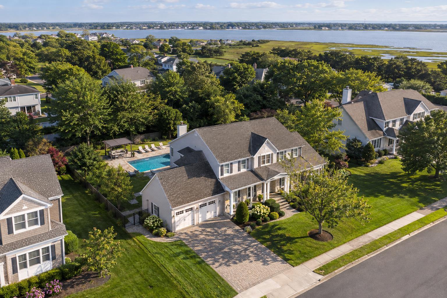
Drone photography in NJ captures a scenic residential neighborhood with houses, lush greenery, and a glimpse of water in the background.

Drone Photography NJ: When to Consider Aerial Media for Your Real Estate Listing
For many listings, drone photography in NJ has become a sought-after way to reveal details and context that regular ground-level photos simply miss. From the air, a single shot can highlight much more than just the roof—a drone can instantly show where a property sits on its lot, the proximity to water or parkland, and how exterior amenities fit into the broader landscape.
But as much as it's become a buzzword, aerial real estate photography isn't automatically the right answer for every New Jersey property. Deciding if your listing will truly benefit—and how to make the most of an aerial session—takes a closer look at the story you want to tell.
What Drone Imagery Can Reveal
Standard property photography still does the heavy lifting for most listings. It covers interiors, curb appeal, and the everyday "walk-up" view. Where drone photos shine is in their ability to provide perspective—helping buyers understand scale, setting, and connections that aren't obvious from the ground.
Some situations where aerial photos deliver unique value:
- Showing the shape and boundary of a property, especially with larger lots
- Capturing sprawling backyards, landscaped gardens, or pool areas
- Illustrating waterfront access, docks, or nearby marinas
- Revealing views of the ocean, bay, or preserved land
- Highlighting architectural features like extensive rooflines, wings, or courtyards
- Demonstrating proximity to parks, golf courses, beaches, or trails
- Laying out access, parking, and context for commercial parcels
A strong aerial image should answer a question buyers are likely to have as they scroll: How is this home situated? What does “waterfront” really mean for this address? Is there actually a private drive, or just a thin strip off the main road? If the view from above makes the essential exterior story obvious, the drone media is doing its job well.
When Does Drone Photography Make Sense in New Jersey?
New Jersey’s neighborhoods range from tightly packed towns and commuter corridors to open suburbs, beachfront communities, and commercial sites. That variety means there’s no single rule—real estate drone photography brings out the best in some properties, and adds little to others.
- Waterfront and shore homes: Drone photos make it much easier to show exactly how close a home is to the water, whether there’s a dock, or if the views are truly unobstructed. This is especially clear along the Jersey Shore and interior lakes or rivers.
- Spacious suburban lots and estates: Aerial angles showcase scale. If a backyard feels endless, or detached garages, guesthouses, and pool houses are major selling points, a drone perspective brings the whole setting into one frame.
- New developments: Whether it’s a single new-construction home in an established neighborhood or an entire development site, drone photos and video help buyers see how everything fits together—roads, access points, and open phases.
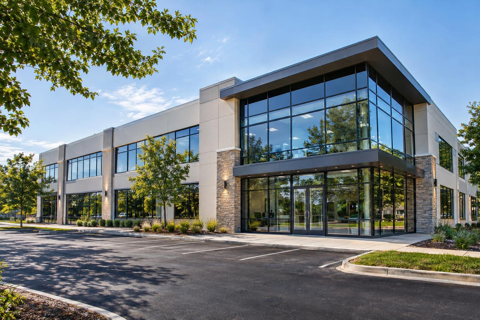
- Commercial listings: For office buildings, retail centers, or parcels marketed for development, an overhead photo is often the only way to communicate lot size, loading/access, and relationship to surrounding businesses or main roads.
- Architecturally unique homes: Designs with dramatic rooflines, multi-level decks, or hillside placements often become easier to explain from the sky than at street level.
When Drone Coverage Isn’t the Right Fit
Not every property benefits from an aerial highlight. Sometimes, a drone image only shows a nondescript roof in a sea of similar houses or introduces visual clutter (power lines, nearby construction) that actually distracts. Drone media may be less useful when:
- Homes sit tightly between similar properties with minimal lot distinction
- The most valuable features are entirely indoors
- Busy roads, utilities, or construction would dominate the aerial view
- Launching a drone isn’t safe or permitted due to local rules or airspace restrictions
In these cases, putting more energy into top-flight interior photos, floor plans, or a well-produced property video may be the smarter allocation.
Making the Decision: What’s the Exterior Story?
A practical approach starts with a few basic questions:
- Does the property’s setting, lot size, or outdoor amenities matter to buyers?
- Is water, an outdoor feature, park, or view a differentiator?
- Would a drone angle show proximity, access, or architectural appeal that’s hard to show from the curb?
- Would aerial video help tell the story, for example, a gradual pan from the driveway to a private dock?
If the answer is yes to more than one, it’s worth discussing aerial options with your media provider.
The Realities of Drone Operations in New Jersey
A successful drone shoot is almost always determined property by property. It isn’t just a matter of owning a drone—legal and practical factors mean some listings simply won’t qualify for aerial media on a particular day.
Key considerations include:
- Airspace and authorization: Some locations—especially near airports or critical infrastructure—require advance FAA authorization or may not be flyable.
- Local restrictions: Beyond federal rules, municipalities or property managers may have their own restrictions or require special permits. RealtaSnap doesn’t pull local or event permits—if one is needed, it’s up to the client.
- Weather and timing: Even with permission, high winds, rain, low clouds, or poor sunlight can make flights unsafe or reduce image quality.
- Safe launch and access: In denser areas, drone operators may need roof or backyard access. Limited space (busy sidewalks, overhead wires) can make safe flying impossible.
If you’re interested in drone coverage for a listing, plan to share the property address up front. This allows your provider to check feasibility before you lock in plans.
How to Prep for a Drone Shoot
A little preparation goes a long way—since drones see more than just the front steps, you want the full exterior to be clean and ready.
- Move cars, trash bins, tools, or other temporary items away from key areas
- Tidy up patios, pool decks, docks, and play spaces
- Secure loose outdoor furniture or umbrellas
- Ensure safe, legal access for the drone pilot: open gates, clear driveways, provide roof access if possible
If there’s a specific outdoor feature you want to emphasize—like extensive rear acreage or a newly built pool—let the team know before the shoot.
What Does Drone Photography NJ Cost?
With RealtaSnap, standard NJ drone photography pricing is clear:
- 10 Drone Photos: $209
- Drone Video: $229 (1 minute, professionally edited)
- Photo & Video Combo: $299 (includes 10 photos and a 1-minute video)
All pricing and package information is available directly during the online booking process. Actual availability and flight feasibility are always confirmed after a review of your address and local conditions.
Booking Aerial Media for Your New Jersey Listing
If your property would benefit from a bird’s-eye view, you can request drone photography and video—along with other listing media—through the streamlined RealtaSnap platform. Enter your address, pick your services, add any unique notes (like special features or specific concerns), and select an available appointment.
For full details on photo, video, and aerial services, visit RealtaSnap’s New Jersey real estate photography page or go straight to www.RealtaSnap.com.
FAQ
Question: Does every New Jersey listing qualify for drone coverage?
Answer: No. Each drone flight depends on FAA rules, local ordinances, weather, access, and pilot discretion. Not all properties are safely or legally flyable on a given day.
Question: What’s the advantage of aerial video versus still photos?
Answer: Still photos offer clear snapshots showing the property’s context and layout. Aerial video provides movement—revealing approaches, transitions, and a sense of how the home connects to its surroundings. Some listings benefit from both formats, but it depends on the visual story you want to tell.
Question: How do I book drone media with RealtaSnap?
Answer: Booking is easy online—just go to www.RealtaSnap.com/schedule, enter the service address, choose your media options, and pick a time. The team will review the address and confirm flight feasibility before the appointment.
If you’re ready to highlight your property from above, we’d be happy to help you plan the right media for your New Jersey listing.
www.RealtaSnap.com