How to Choose Drone Photography Near Me for a Real Estate Listing
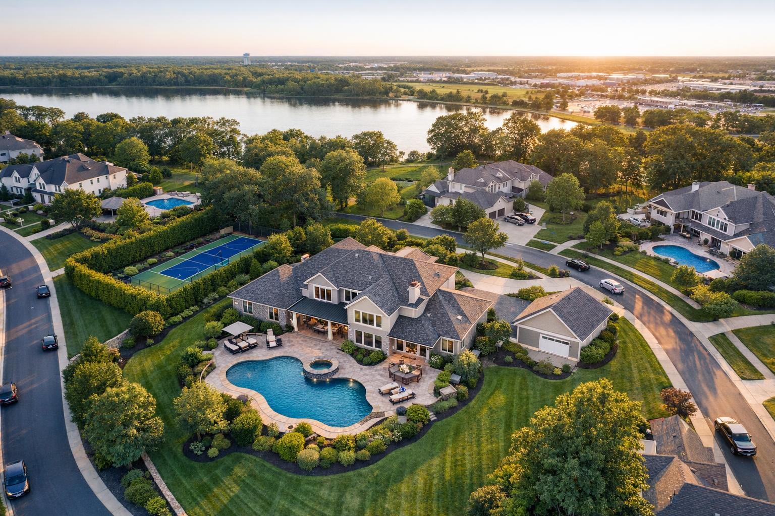
Drone photography near me captures a luxurious neighborhood with large houses, swimming pools, and tennis courts, set against the backdrop of a serene lake and lush greenery.

How to Choose Drone Photography Near Me for a Real Estate Listing
Searching for drone photography near me often means you’re hoping to show off something special about a listing—maybe it’s a rooftop view in Brooklyn, a sprawling backyard along the Jersey Shore, or a commercial site that needs context only an aerial image can provide. But before you book a drone photographer for your next real estate shoot, it’s worth asking: will the aerial perspective actually strengthen my listing, or would standard photography tell the story just as well?
In NYC and New Jersey, the answer depends on the property, its surroundings, and a few real-world logistics. Here’s a clear-eyed look at how to decide if aerial media belongs in your next marketing package, what to ask potential providers, and how to get the most value if you move ahead.
When Does Drone Photography Make Sense for Real Estate?
Not every listing benefits from an overhead view. The best real estate drone photography services showcase something buyers or tenants can’t fully see from the ground—land size, unique architecture, roof amenities, or proximity to water, parks, or other features.
Best-Fit Scenarios for Aerial Photos
Consider adding drone coverage if your listing includes:
- Larger lots or unique property boundaries
- Waterfront access, marina, or beach proximity
- Pools, landscaped yards, tennis courts, or extensive outdoor living space
- Roof decks, terraces, or other elevated features
- Modern or notable architecture with distinctive rooflines or courtyards
- Amenity-driven locations, like golf courses, parks, or major commercial zones
- Commercial buildings, multifamily complexes, campus-style properties, or development parcels
For example, a home along the Jersey Shore might need aerial shots to establish its relationship to the beach, bay, or marina. In North Jersey, oversized lots may call for wide-overhead images to clarify layout and distance from neighbors. For commercial sites, aerials can clearly showcase parking zones and access points.
If, on the other hand, the property is compact, with little exterior space or no remarkable view, aerial images might not add much value. In those cases, sticking with high-quality ground photography is usually the smarter investment.
What Drones Can Show That Regular Photos Miss
Traditional exterior photography does a solid job of highlighting curb appeal, entryways, and outdoor living zones. Where drones make a difference is in putting the whole picture together.
Lot and Layout Context
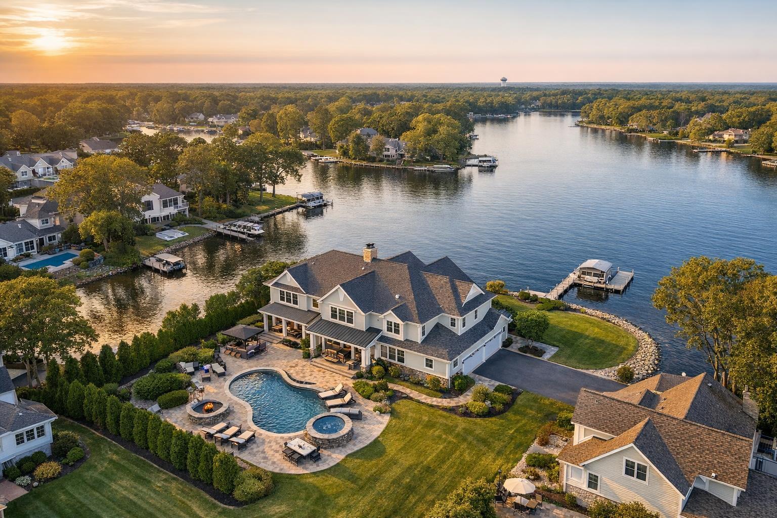
Overhead images answer questions that ground photos can’t—like, how does the house sit on the land? How are the pool, deck, and garden oriented? This is especially useful for irregular lots, multi-structure parcels, or properties with extensive exterior features.
Waterfront and View Relationships
When it comes to waterfront listings, aerial images can show how close a home really is to the shoreline, its dock, or the surrounding landscape. The goal should always be clarity, not exaggeration—a good drone shot helps buyers understand genuine access and views, rather than creating a misleading impression.
Architectural Scale and Form
Some homes just make more sense from above. Contemporary designs, large estates, and buildings with private roof areas or interior courtyards all benefit from an aerial perspective that reveals form, geometry, and spatial relationships otherwise hard to communicate.
Location and Neighborhood Context
Aerial photography can be a powerful tool to show a property’s place within its surroundings, like proximity to open green spaces, major transportation, busy retail centers, or commercial corridors. Choose shots that truly enhance a buyer’s understanding, rather than decorative images that don’t add much substance.
What Makes Drone Shoots in NYC and New Jersey Unique
Selecting real estate drone photography services in this region means dealing with two very different environments.
In New Jersey: Suburban and shore areas offer space to fly. Larger lots, set-back houses, and open commercial parcels often make flight and safe launch zones straightforward. Still, every address needs a safety and feasibility check.
In NYC: Manhattan and Brooklyn can be more complicated. Densely built environments mean more crowds, overhead obstructions, limited outdoor space, and, critically, controlled or restricted airspace. Rooftop access can open up possibilities, but it’s by no means a guarantee. Every urban property is a unique puzzle—and many can only be captured from the ground.
Before You Book: Key Questions to Ask a Drone Provider
The right drone photographer will make the details clear from the start. Here’s what you should confirm before scheduling a flight:
- What will the drone capture? Be specific. Are you showing the lot, the pool, the proximity to a park, a special roofline, or just grabbing “drone shots”? If there’s no real story to tell from the air, rethink the expense.
- Is the address truly flyable? All drone work is subject to FAA rules, variable airspace restrictions, local site conditions, weather, access, and the operator’s judgment. Not all locations are eligible, and discretion is essential—especially in NYC.
- Is there a safe spot to launch and land? A city property with roof access may work; a home with a fenced yard is even easier. Consider traffic, overhead wires, trees, and crowded sidewalks.
- What if the weather doesn’t cooperate? Rain, high winds, or limited visibility may require rescheduling or limiting the shoot. Flexibility is helpful if the exterior setting is key to the listing.
- Are special permits needed? Basic FAA authorization is one thing; municipal, NYPD, or event permits are another. RealtaSnap does not pull special permits, so if one is required beyond standard FAA authorization, it’s the client’s responsibility.
Photos, Video, or Both? Tailoring Your Aerial Media
Choosing between aerial stills and video depends on what you want to convey.
- Aerial photos are ideal for listing galleries—think clear, market-ready images that orient the viewer and highlight important exterior features.
- Aerial video becomes worthwhile when movement tells a better story, like gliding in over a backyard or sweeping toward a waterfront property.
In practice, a handful of thoughtfully planned aerial images usually work harder for your listing than a gallery of similar, high-up shots. Video can add energy and context as long as it’s specifically captured on site, not pieced together from existing stills.
How to Prep a Property for a Drone Shoot
Since the focus is on the exterior, a little preparation goes a long way. Before your shoot:
- Move cars out of driveways or visible parking spaces where possible.
- Remove trash bins, hoses, toys, tools, and any clutter from outdoor spaces.
- Clean up patios, decks, walkways, outdoor furniture, and pool areas.
- Open up the pool if the season allows.
- Arrange outdoor seating so it looks inviting but tidy.
- Handle any quick landscaping fixes, especially if grass and hedges need a trim.
- Make sure access is available to any gates, yards, or rooftops required for the shots.
- Notify residents or tenants about the media team’s arrival.
No need to over-stage or create an unrealistic look—the main objective is to reduce distractions so the property’s best angles stand out.
How to Find and Select Local Drone Photography Services
Whether you’re searching for drone photography near me on Google or asking colleagues for referrals, remember that not every drone operator specializes in real estate marketing. Some focus primarily on construction progress, inspections, or engineering work—those projects have different needs, tools, and rules.
Look for a provider who:
- Understands how drone images complement listing galleries, not just standalone footage
- Knows when aerial imagery is truly helpful and when it isn’t
- Frames properties honestly, without exaggerating size, views, or privacy
- Follows all FAA Part 107 rules and reviews airspace for each project
- Prioritizes safety, site access, and real-world conditions over one-size-fits-all promises
- Navigates logistics particular to NYC, New Jersey, and differentiated by property type
For properties in New York City and throughout New Jersey, RealtaSnap provides drone photography and aerial video services when a flight is possible. Every site is individually reviewed for access, airspace, safety, and weather before a commitment is made.
Should You Choose Aerial? The Property Should Decide
Strong real estate marketing is always led by the strengths of the property itself. Not every listing merits a drone shoot. For the ones that do—those with compelling exteriors, meaningful neighborhood context, and true visual stories from above—purposeful aerial media can help buyers or investors understand what makes the space unique.
If you’d like to talk through options or see if your NYC or New Jersey property is a fit for drone coverage, you can always get started at www.RealtaSnap.com.
FAQ
Question: Is drone photography useful for every real estate listing?
Answer: Not always. Drone photography works best when the property’s setting, architecture, lot size, or proximity to important amenities genuinely add value from an aerial perspective. For small homes with little exterior interest, strong ground-level photos may be the better investment.
Question: Are drones allowed to fly anywhere in NYC?
Answer: No, especially not in dense areas like Manhattan or parts of Brooklyn. Each address must be assessed for airspace, safety, weather, and site access. In some cases, roof access can help, but there are still cases where a flight isn’t possible or advisable.
Question: How do I book a drone shoot with RealtaSnap?
Answer: You can book online at www.RealtaSnap.com/schedule. Enter your property address, select the services you need, and pick an available appointment. Drone coverage is always confirmed after a case-by-case review of the property and its flight conditions.