How to Choose Drone Photography Near Me for a Real Estate Listing
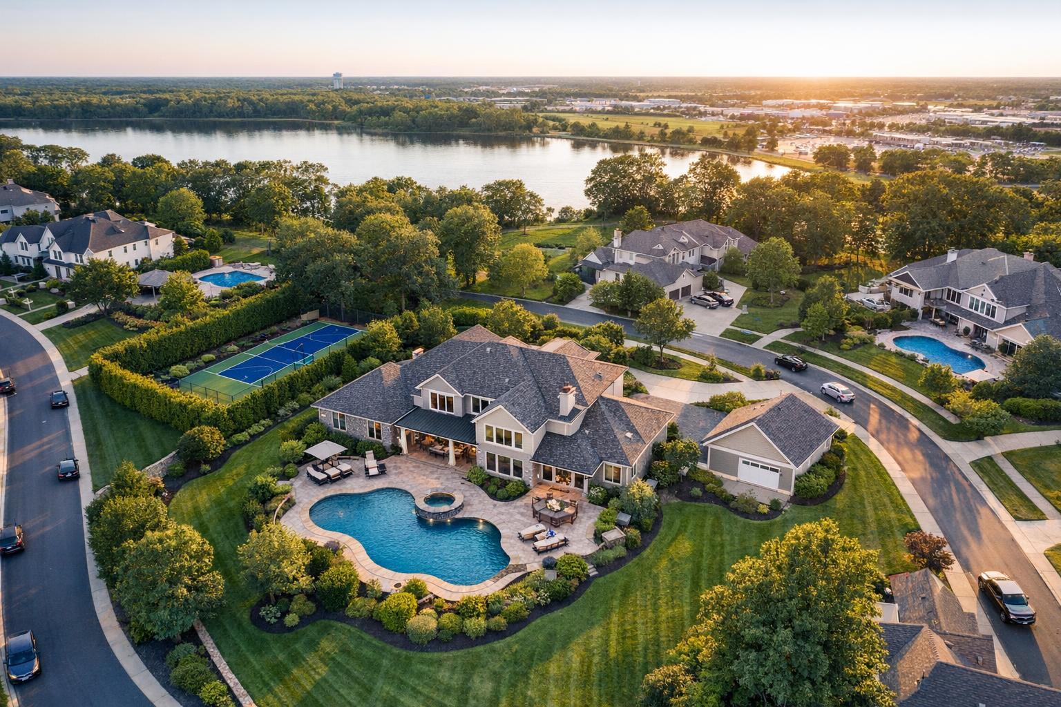
Drone photography near me captures a scenic view of a lakeside neighborhood at sunset, featuring elegant houses, a swimming pool, and lush greenery.

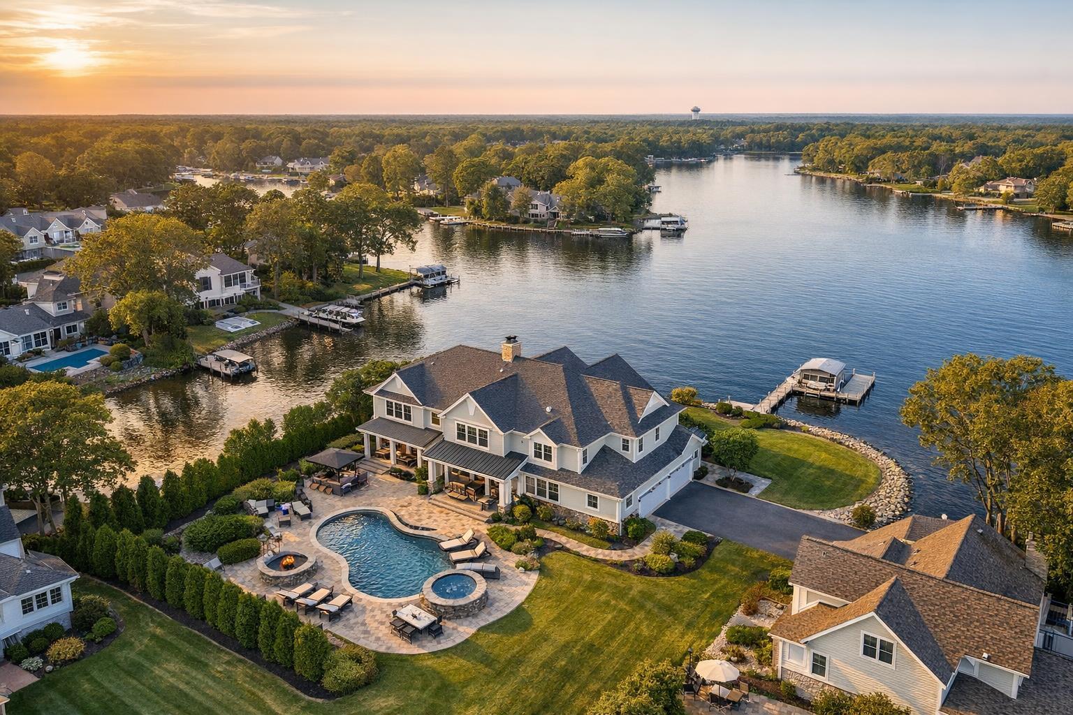
How to Choose Drone Photography Near Me for Real Estate Listings
If you’re searching for drone photography near me for a real estate listing, chances are your property has features best appreciated from above. Whether it’s extra land, rooftop views, or proximity to the water, finding a local provider who understands both the opportunities and the challenges of aerial photography is crucial to getting the shots you need—if those shots are possible in the first place.
In places like New York City and New Jersey, drone photography can offer buyers a different perspective, highlighting lot size, architecture, outdoor amenities, and more. But urban airspace is complicated, and not every listing is a natural fit for aerial coverage. Here’s how to determine if drone media is the right move for your next listing—and what to ask before booking.
When Does Aerial Real Estate Photography Make Sense?
Aerial images can answer questions that ground-level photos can’t. Before you add drone services by default, consider what an overhead view will truly add to your listing. For many residential and commercial properties, drone images help buyers understand the bigger picture:
- How a home sits on its land, with gardens, pools, or long driveways
- Proximity to water—beaches, rivers, marinas
- Rooftop decks, terraces, balconies or unobstructed skyline views
- Distinctive architecture or new construction
- Nearby parks, green spaces, transit, or neighborhood landmarks
- Commercial sites where size, access, or surroundings matter
If the story of your listing revolves around its outdoor space, setting, or unique architectural context, aerial photography can be a powerful tool.
Common Examples
A Brooklyn brownstone with a rooftop, a Jersey Shore property with water access, or a New Jersey estate with sweeping lawns and gardens are strong candidates for drone imagery. On the other hand, a Manhattan condo with no roof access or exterior features may not benefit much from an aerial view.
Where Drone Coverage May Not Add Value
Not every property requires or benefits from drone photography. In some cases, higher angles may not help—and could even distract from what actually matters. Consider skipping or rethinking aerial coverage if:
- The property is hemmed in by identical buildings with little visible land
- There’s no safe or permitted space to launch a drone
- Pedestrian traffic, overhead wires, or dense streets create safety issues
- Indoor features are the property’s main selling points
- Airspace restrictions make drone flight unlikely
- Weather conditions threaten safety or photo quality
- Building management doesn’t allow roof or exterior access
If a drone can’t help clarify setting, scale, outdoor features, or views, your budget may go further with stronger interior photography or listing video instead.
Urban Airspace: Special Considerations for Drone Photography in NYC
Searching for drone photography NYC is often more complex than it sounds. The city is full of airspace restrictions, dense streets, active pedestrian zones, and buildings that may or may not allow rooftop access. Even if a spot looks open on the map, real-world conditions, local regulations, and building policies may prevent a flight from happening.
Before booking drone work for an NYC property, have these details ready:
- Full address
- Exterior features that could allow access (yard, terrace, roof deck)
- Building management or approval requirements
- Known restrictions on access or use of communal areas
- What you want drone media to show (context, views, features)
- Which format you need—photos, video, or both
Providers can only confirm feasibility after reviewing this information. In NYC, flights are handled on a case-by-case basis and often require more advance planning.
Aerial Opportunities in New Jersey
In contrast to NYC’s tight logistics, New Jersey’s more open neighborhoods, larger lots, and more relaxed airspace can offer rich opportunities for drone photography. Single-family homes, waterfront properties, new construction, and commercial properties often benefit from an aerial perspective that simply isn’t possible in a denser city setting.
Even so, planning matters. Things like wind conditions, nearby trees, roads, or neighboring properties can influence both safety and the quality of a drone shoot. It’s always a good idea to discuss specific goals with your provider ahead of time.
How to Compare Local Drone Providers
Not every “drone photographer near me” found in search results is equal. The best providers ask about the property, get clear on feasibility, and communicate what’s actually possible on your timeline and budget. Here’s what to ask:
Compliance and Safety
Commercial drone operators in the U.S. must follow FAA guidelines, including special rules for airspace, weather, and safety. Don’t worry about memorizing aviation law, but do ask:
- Are your flights conducted under FAA Part 107?
- How do you check local airspace and restrictions?
- What happens if a flight isn’t possible on shoot day?
A professional will be upfront about the reality that some flights simply aren’t feasible—and will prioritize safety and compliance over making a sale.
Real Estate Marketing Experience
Knowing how to fly a drone isn’t the same as capturing media tailored for real estate listings. Ask your provider to show examples matching your property type, whether that’s a high-rise, suburban home, or commercial lot. Pay attention to:
- Images that keep the property clear and identifiable
- Angles that make views and scale easy to grasp
- Media that’s polished but accurate, not overly dramatic
- Shots that feel right at home with the rest of your listing package
What Deliverables Are Included?
“Drone photography” might mean stills, video, or both. Make sure you’re clear on what’s covered. For some listings, a few aerial photos are enough, while in other cases you may want video arrows for a listing promo or website banner.
Useful questions:
- Do you offer aerial images, video, or both?
- How will I receive the files?
- Will drone footage be captured as part of an on-site video shoot, if needed?
- Can you prioritize certain features?
- What if weather or site conditions make drone coverage impossible?
If you want to see what drone options are available through RealtaSnap, you can check live scheduling and see standard options directly at RealtaSnap's scheduling page.
Timing, Access, and Preparation
A great drone shoot depends as much on access and timing as it does on weather. Tell your provider about:
- Building access or check-in rules
- Any time-of-day or date restrictions
- Gate codes, elevator, or roof access logistics
- Best times for sunlight, shadows, or avoiding local events
Being upfront helps avoid last-minute surprises.
What "Local" Really Means in Drone Photography
A true local provider brings more than just equipment close to your property. They should understand the realities of operating in that market—from NYC building logistics to suburban property lines to coastal weather in New Jersey. Local expertise means honest evaluations of what’s safe, what’s allowed, and what will genuinely benefit your listing.
You should also expect clear communication and simple booking. At RealtaSnap, real estate media—including aerial photos and video—is scheduled online for New York City, New Jersey, and, on a limited basis, select Westchester and Upstate New York locations. Every drone shoot is evaluated based on airspace, weather, access, safety, and pilot discretion.
Begin your booking directly on the RealtaSnap scheduling page. Enter your property details, select drone options, and include any access notes so feasibility can be reviewed before your appointment.
Coordinate Aerial Media With Your Listing Strategy
Drone content is most effective as one element in a larger property presentation. Use aerial photos and video to show context, scale, or views, but combine them with strong interior photography, floor plans, and (for the right listing) on-site video or virtual staging. The aim is not just a collection of cool angles—but a media package that helps buyers understand what’s special about the property.
A floor plan can clarify a home’s layout, while virtual staging (for empty spaces) can give buyers ideas about how a room might look furnished. Use each medium for what it does best, with aerial media playing a supporting role for properties where setting and scale are selling points.
FAQ
Question: Does every real estate listing benefit from drone photography?
Answer: No, drone media is most impactful for properties with notable outdoor space, unique settings, views, or features best understood from above. Dense urban apartments without exterior access may get little value from aerial shots.
Question: Can I guarantee a drone flight for my listing in NYC or New Jersey?
Answer: Drone feasibility depends on airspace, weather, access, and safety—and is determined site by site. Some flights simply won’t be possible, especially in dense or restricted locations.
Question: What do I need to provide to book a drone shoot?
Answer: Share the full property address, any special features or access details, whether you need photos, video, or both, and any building requirements. More info up front helps your provider give a realistic answer on feasibility and deliver the right media for your listing.
Ready to explore aerial photography for your next listing? Get started, check live availability, or learn more about professional real estate media at www.RealtaSnap.com.