How to Choose Drone Photography Near Me for a Real Estate Listing
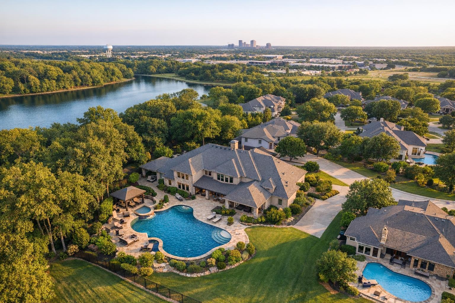
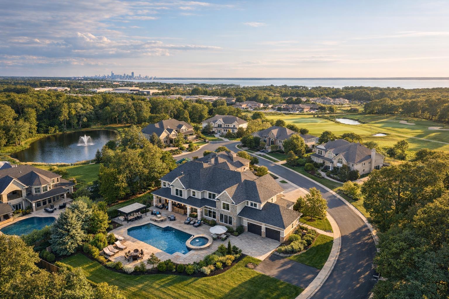
Drone photography captures a picturesque suburban neighborhood with large houses, a pond, and a distant city skyline.

How to Choose Drone Photography Near Me for a Real Estate Listing
Searching for drone photography near me often means you have a property that deserves more than the typical ground-level shot, but is aerial media the right fit—and what should you look for when booking? The decision usually starts with the listing itself, but there’s a lot more to making aerial photography work in practice than simply finding a local drone pilot.
Below, we’ll break down what makes real estate drone photography effective, explain when to invest in aerial shots or video, offer practical tips for vetting providers, and cover some local constraints—especially for listings in New York City and New Jersey.
What Can Aerial Real Estate Photography Actually Show?
Not every property needs an aerial perspective, but for listings with striking settings or hard-to-explain features, drone photography can offer buyers essential context they can’t get any other way.
Well-composed aerial shots can help buyers:
- Understand the relationship between a property and its lot lines, neighboring homes, water, or open land
- Visualize how the yard, driveway, pool, decks, and outdoor areas connect
- Appreciate unique rooflines or architectural features
- See waterfront, park, or trail access clearly without relying on a static map
- Get a sense of a property’s place within a development, streetscape, or neighborhood
For example, if you’re listing a larger New Jersey home with a pool and backyard greenery, a drone photo can tie those pieces together in a way that just isn’t possible from the street or a window. Similarly, for a Jersey Shore or lakefront property, a low-angle aerial view can combine the home and water in one shot, making the setting immediately clear.
It’s less about being “above” and more about answering the natural questions buyers have: Where exactly is this home? What surrounds it? How does the outdoor space add to the appeal?
Which Types of Listings Benefit Most From Drone Coverage?
Aerial photography tends to make the most impact when the landscape is a true selling point. In practice, that usually fits a few broad categories:
- Larger residential properties: Suburban, rural, or estate homes on spacious lots often look incomplete from ground shots. Aerials clarify the footprint, landscaping, and overall scale.
- Waterfront, shore-area, or park-adjacent properties: When buyers care about access or proximity, an aerial perspective puts distance and advantages in context.
- Notable architecture: Unique rooflines, historic layouts, and homes with outbuildings, courtyards, or layered elevations can all be shown off more effectively from above.
- Multifamily, development, or commercial sites: For listings where site layout, parking, access, or neighboring infrastructure matters, drone images can reveal details a floor plan won’t.
- Unique location context: Urban buildings where proximity to transit, local businesses, or amenities is a logistics and value factor—if a legal, safe flight is even possible.
If your property is a compact city condo with no meaningful exterior features, stick with strong interiors, floor plans, and building information. But for homes or buildings with outdoor value, aerial photography is very often worth the consideration.
Photos, Video, or Both? Choosing the Right Aerial Option
Real estate drone services typically offer two distinct deliverables: still photos and video, each serving different purposes.
Aerial Photos
- Easy to add to the property website, listing gallery, brochures, or presentations
- Answer most orientation questions with just a few carefully chosen images
- Best for listings where the goal is to support, not replace, ground photography
Aerial Video
- Use video if movement helps “tell the story,” such as flying in from the street, orbiting a backyard, or sweeping over waterfront
- Particularly strong as part of a full property video, helping buyers see flow and scale
Combined Coverage
- For properties with a lot happening outside, getting both can make sense: stills for the listing and quick reference, video for showpiece moments or social media.
At RealtaSnap, these are offered as flexible packages for NYC and New Jersey—photo-only, video-only, or both, depending on the property and intended marketing use. (You can see current options and pricing on the aerial photography and video page.)
Local Feasibility: What to Know in NYC and New Jersey
Here’s where “drone photography near me” gets truly local. Even if you love the idea of an aerial angle, not every property can be flown safely, legally, or at all.
- In most of New Jersey, open space, suburban layouts, and typical airspace make coverage possible, although flights are still always subject to pilot discretion, FAA rules, weather, and the property’s own access.
- In New York City, especially Manhattan and dense boroughs, the reality is much more complicated. Nearby airports, controlled airspace, crowded rooftops, street congestion, and strict local restrictions can all turn what looks like a straightforward job into something that just isn’t flyable—or requires authorization and a cooperative building management team.
The upshot: feasibility is always address-specific. For urban listings, let your provider know if you have roof access, on-site contacts, or special requirements. Ultimately, even with permissions, the provider and pilot have the final call based on safety, regulations, and practicality.
How to Vet a Real Estate Drone Provider
Choosing the right aerial photographer isn’t just about proximity or price. When researching options, ask these questions to make sure the provider understands the real-world marketing needs of property professionals:
- Portfolio: Look beyond pretty views. Are properties clearly presented, not just scenery? Have they handled homes, buildings, or land similar to yours?
- Deliverables: How many photos are included, and in what format? Is the video a full property edit or a simple “drone clip”? Discuss any special uses (like social media trailers) up front.
- Access and timing: Communicate any complicating logistics—gates, security, driveways, roof access, or ongoing construction—early. Good preparation avoids delays and missed perspectives.
- Weather plan: Drones can’t fly in bad weather or tough winds, so make sure there’s a flexible approach baked into the timeline if you’re on a schedule.
And remember, “near me” means in your real market—NYC and New Jersey pricing, typical real estate formatting, edits to match your listing style. You want a provider who brings both technical drone skill and real estate experience.
Getting the Property Ready for Drone Photos
Helping the aerial team capture the best view means preparing the outdoor spaces—much like you would for interior photography. Here are a few quick prep reminders:
- Park vehicles out of sight if possible
- Put away yard equipment or clutter
- Secure outdoor furniture and trash bins
- Clear pool covers or maintenance gear
- For multifamily or commercial buildings, confirm how the crew will access rooftops, shared courtyards, or parking
If you’re in a building with strict security or management approval needs, loop in the provider as early as you can. Smooth logistics provide better results.
What Sets RealtaSnap Apart
RealtaSnap focuses on clean, market-ready drone photos and video for real estate across NYC, all five boroughs, New Jersey, and select projects in Westchester and Upstate New York (with prior approval). Each photography or video session is evaluated for feasibility based on the address, access, and flight factors—not every property can be flown, but you’ll get clear expectations up front.
Packages include:
- Drone photo (10 edited images), drone video (one-minute 4K video), or both
- Case-by-case review for every property
- Online booking with address, instructions, and payment at checkout
You can always check availability or schedule a session at RealtaSnap’s online booking page.
Let Aerial Media Serve the Listing
At its best, aerial real estate photography answers the questions your ground-level camera can’t—giving buyers a clear view of setting, access, and exterior layout. Before booking, pinpoint which exterior features matter most to your listing. Then share the details with your provider for realistic guidance on what’s possible and practical in your area.
If you’re working in NYC, New Jersey, or nearby and want to discuss whether your property is a good fit for aerials, RealtaSnap is always glad to review the details.
Visit www.RealtaSnap.com to get started.
FAQ
Question: How much does drone photography cost with RealtaSnap?
Answer: Drone photo service is $209 for 10 HDR images. Drone video is $229 for a one-minute 4K final edit. A combined package with photos and video is $299. All sessions are subject to feasibility based on the specific property and conditions.
Question: Are drone flights possible for a Manhattan or Brooklyn listing?
Answer: It depends on the address, airspace, local rules, building access, and safety assessment. Some areas are possible with proper planning and authorization, but not every urban location is flyable. Roof access can help but isn’t a guarantee.
Question: Is drone photography needed for every real estate listing?
Answer: Not necessarily. Aerial coverage is best when the property’s lot, outdoor layout, location, or features can’t be captured well from the ground. For small condos or urban apartments, strong interior photos, floor plans, or a 3D tour are usually more helpful.